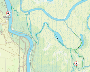
Arrival at Parnka Point – Pelican Campground
It’s been a while since Adelaide Canoe Club (ACC) has car-camped at Parnka Point, so I was keen to visit the area to experience the high water levels (after last visiting here with Matt Eldred in Oct 2021 when we sailed from Parnka Point to Goolwa). This location was a favourite of Eddie Andriessen so I was keen resurrect the Car Camping tradition.
With fingers crossed for some good Autumn weather, I had earlier booked Campsite No 1 at Pelican Campground, providing room for 14 campsites and semi-sheltered protection should the forecast wind and rain arrive. We had a good take-up with Peter McLeod, Mark Loram, Charlie and Marina Walker, Abelardo Pardo, Berny Lohmann and Terry Holder booking for the weekend. I was pretty excited about this trip, as National Parks had advised that there was plenty of water and prolific birdlife in the area, particularly pelicans and ducks.
We all arrived at various times during Friday afternoon and set up camp, keen to get settled before rain arrived. Hopefully not much following the downpour on the drive from Adelaide. Berny saved the day by bringing along his recently purchased gazebo – this made our stay nice and cosy. During our stay we checked out other campsites and agreed 5 and 7 also have potential, particularly when no wind is forecast and with easy access to the water.
Rain overnight which along with the sound of surf made for authentic autumn camping on the Coorong. The forecast 17Kn SW had not appeared on Friday and we were presented with very calm conditions in the morning although an overcast day.
Paddling South Lagoon to Long Island
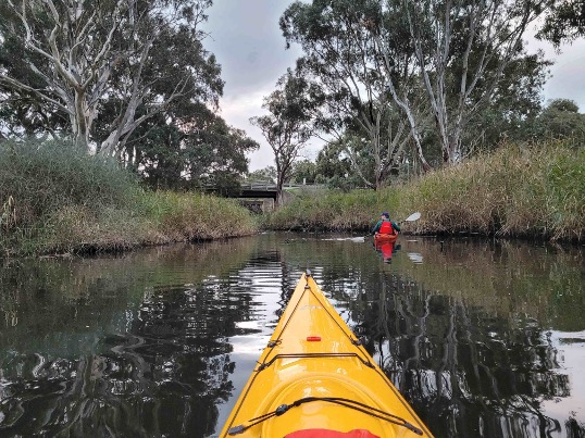
Bit of a slow start after casual breakfast, on water about 9.30am to meet Peter at the Boat Ramp in his plywood Sabre dinghy, Boat No 1461. Slight breeze from the SW had built up, enough for Peter to make headway and practice his tacking. It wasn’t long before the sea kayaks were leading the way down the south lagoon towards Long Island with Peter following.
The aim was to paddle south and explore the cutting at Hack Point and hopefully circumnavigate Cow and Long Island. Sunshine was occasionally breaking through so all looked promising.
We had a short stop at the derelict Coorong Wilderness Lodge. It is still in pretty good condition but could use a refurbishment. Stunning views of the South Lagoon.
We continued paddling south, trying our best to avoid the limestone “bommies” that seemed to pop up when least expected.
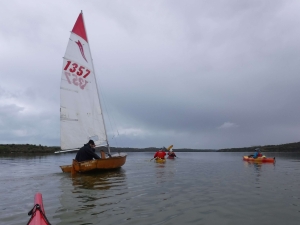
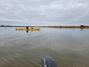
Peter under tow
It was not possible for Peter to stay with the kayaks so we agreed to meet up around Hack Point. The cutting just south was easily navigable so we continued further south along the eastern side of Cow Island. Too cold for a beach stop so we had the occasional on-water snack and refresh. Nice sandy beaches on the eastern side of both Cow and Long Islands: perhaps next trip?
The small channel between Cow and Long Islands also looked navigable, but we continued further south around Long Island, leaving Round and Swan Islands for the future.
Back from Long Island
After rounding Long Island we made our way back towards Hack Point and hopefully Peter and his dinghy. It wasn’t long before Abelardo spotted Peter in one of the small bays opposite Bull Island – apparently becalmed. Abelardo and Charlie went in to investigate and soon had Peter under tow. Once they had re-joined the group Berny also helped out with the tow.
Safely returned to the boat ramp we left Peter to get his dingy loaded up and head back to the campsite.
Still plenty of daylight remaining, so Charlie and Peter decided to explore Bluff Island in the north lagoon while others relaxed at the campsite. I explored the Sandy Beach walk from campsite No 5, further north towards Avocet Campground – birds everywhere!
Lovely evening cooking our meals under the Luci lights from the protection of Berny’s Gazebo. The plan for Sunday was to explore the north lagoon, weather permitting, but probably not The Needles as a 14Kn SW was forecast about 3.30pm.
We must have had a good day’s paddling as most of the group turned in by 8pm.
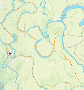
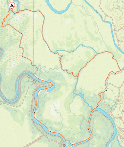
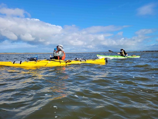
Paddling North Lagoon to Rabbit Island

Sunday Departure – still Perfect
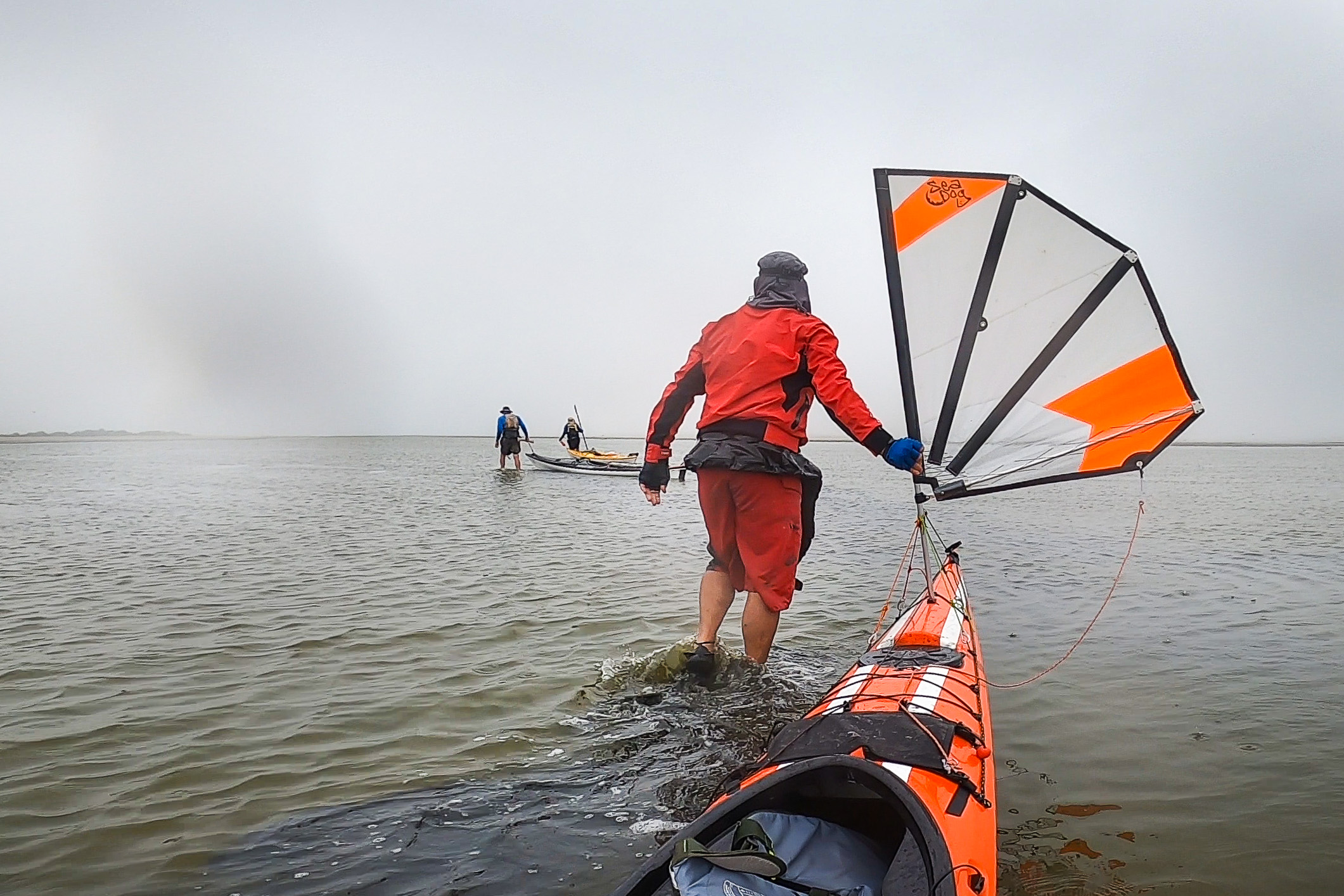
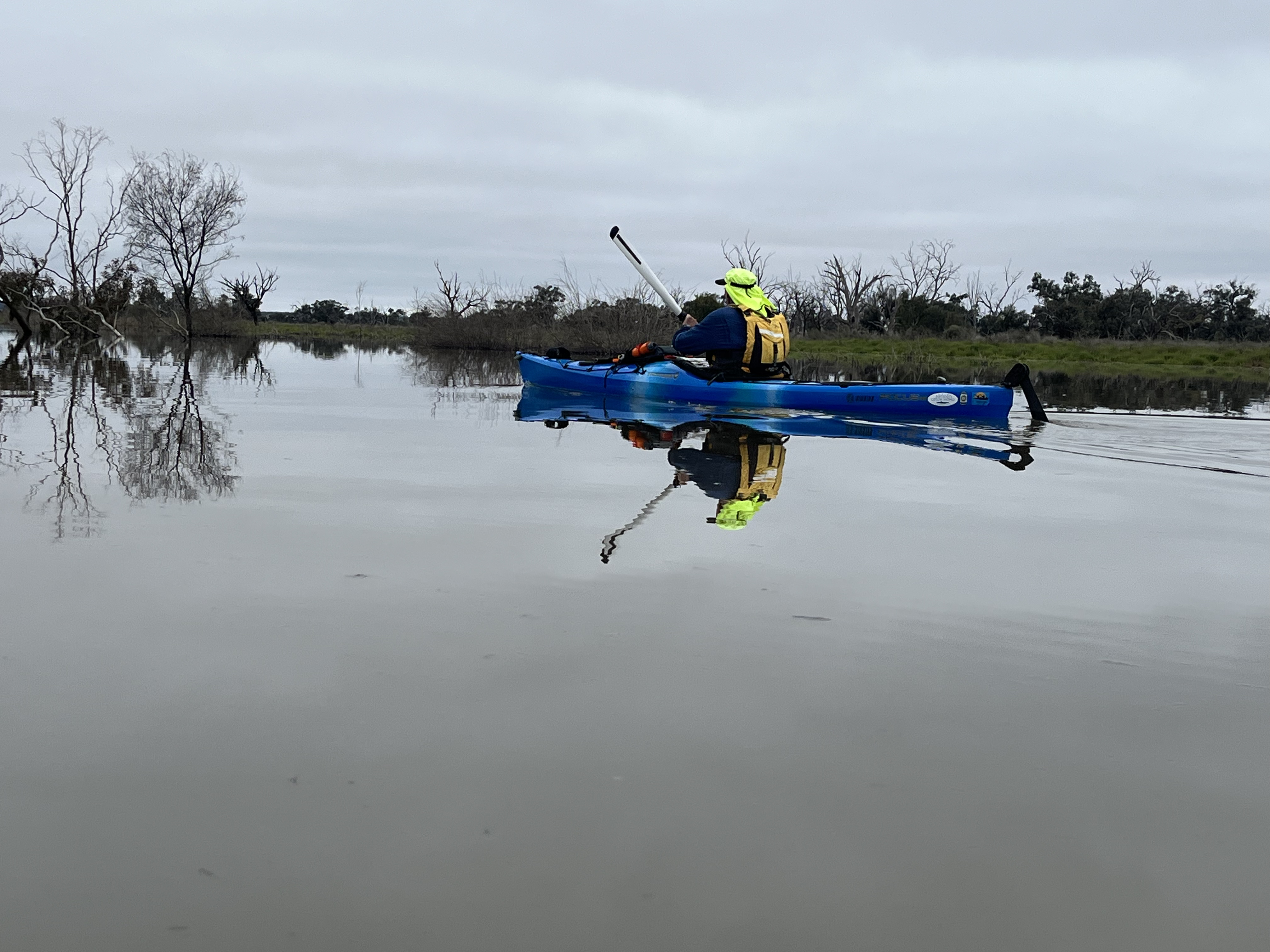
More rain overnight but not as heavy – less water in my tent! On water around 9.30am, having agreed on a more realistic departure time, Peter opting to paddle his kayak this time. We had agreed to explore Bluff and Rabbit Islands following Charlie and Peter’s successful circumnavigation on Saturday. As you can see from the departure picture, the Coorong was like glass with no sign of wind. Winds were forecast to pick up mid-afternoon, so the planned return paddle to The Needles was assigned for another trip.
With the constant sound of breaking waves each night, we were keen to check out the beach, using the Cockle Fishers track just south of Hells Gate. An easy paddle back past the boat ramp to a small beach used to unload vehicles and equipment, and perfect for landing our kayaks.
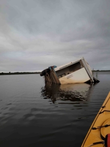
The first interesting encounter we had was the Cockler’s car graveyard adjacent to the track, with only a few that appeared to be in working order. We were soon at the beach with the track only about 500m across the well used dunes. Plenty of cockle signs, either from an old coastline or aboriginal middens. We could see breaking waves almost at horizon level, showing how dangerous the Coorong coastline can be to kayakers attempting circumnavigation.
Back on the water

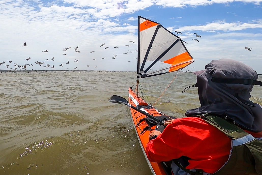
Pelican Squadron
Too chilly standing on the beach, so we were soon back on water and making our way to the eastern side of Bluff Island. We still had the sun breaking through the clouds, only interrupted by several flocks of pelicans flying in formation – stunning, they seemed to go on forever. I have never seen so many pelicans on previous trips and this hopefully sets the trend for future trips.
The pelicans must have attracted the rain, as the clouds released on our kayaks, leaving a nice pattern on the still waters. Not very heavy and it wasn’t long before the sun broke through again.
We could see clear water on the eastern side of Rabbit Island. The sound of cars from the Princess Highway were now audible as we hugged the east side of the Coorong waters. We found our way out of the little bay (thanks to Charlie and Google Maps) on the south of Rabbit Island. We eventually found the shallow channel leading us around the northern end of the island. Plenty of shallow areas with jagged limestone outcrops.
Snake and Needle Islands were now so close and very tempting but not for this trip. The wind had started to pick up. We lifted the pace and sought protection from the south westerly from the lee side of Bluff Island for a short rest before heading back to camp. Timing was perfect as we were about 100m away from shore when the full front arrived.
Return Trip
We had already packed up tents and loaded non-paddling gear so didn’t take long to wash and load kayaks. Then, on our way by 2pm and heading for Meningie Bakery for a hot coffee and debrief.
May not have been perfect weather, but much better than forecast and some very pleasant time on water. We ended up paddling 17Km exploring the south lagoon on Saturday and then 16Km for Sunday’s paddle. Not a bad effort and will definitely repeat this trip.
The Coorong is looking great with a very obvious increase in the bird population. We returned with the promise of some great trips in the next 12 months.
Mark Loram
Click in the maps at the bottom of the page to download the corresponding GPX files.
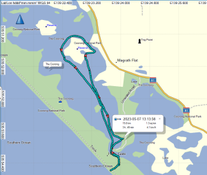
Rabbit Island Paddle Sun 7 May 2023

Long Island Paddle Sat 6 May 2023

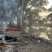
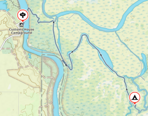
 We arrived at the launching spot near Customs House Houseboats about midday on Saturday. We quickly unloaded the kayaks from the cars and packed, as we were all eager to set off before it got too hot. A short paddle across the river, and then we let the current take us down Suders creek to get to Hypurna Creek. This was not as eventful as it normally is. The big tree which normally blocks the creek seems to have been washed away which made the trip down relatively easy.
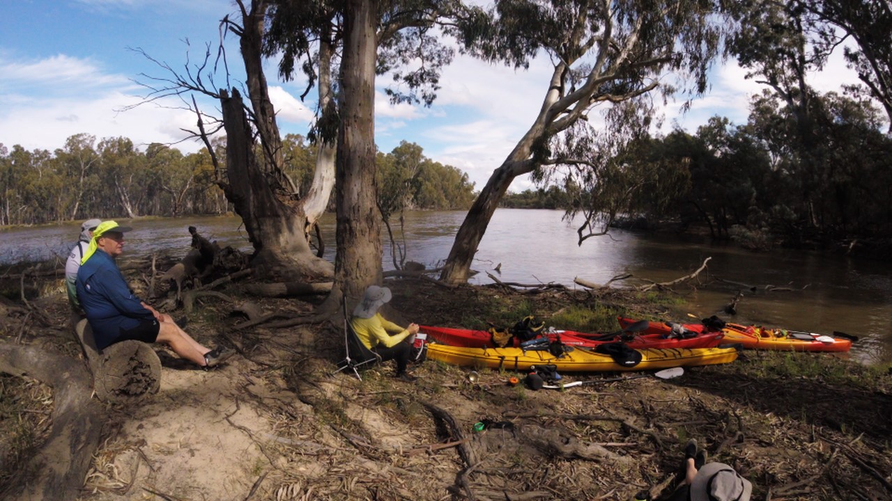
 After finding a suitable campsite we pulled up and set up camp. We soon put up tents, inflated mattresses, assembled tables and chairs. After such effort, we took a cooling swim in the creek, disturbed only by the shrimps nibbling on your feet if you stayed still for too long.
 Luckily Wiperna creek proved to be mostly clear despite being narrower than all the other creeks we had been through. Mostly clear. Right at the end, 100 m from the camp, the creek was completely blocked by a large fallen tree, necessitating people having the climb out of their kayaks, onto the log, drag the kayak over the log, and then climb back in again. Some people opted to skip the last step and just walked back to camp while the kayaks drifted back.
 Next morning we packed up the camp and headed off down Hypurna creek. This time with the current so all the obstacles were a bit easier to manage. We opted to do a short (100m) portage to get back to the Murray rather than try and paddle back up Suders creek. This wasn’t too bad despite the kayaks being loaded. Carry straps and six people per kayak made short work of it. We took the opportunity to have a final swim before setting off to do the final few kilometres to get back to the launching spot.


 Next day we carried on down Toupnein Creek, enjoying the peace and serenity, until it joined the Murray again. Helped by the current again, we sped down the Murray to the exit of the Lindsay River. The day turned out longer than planned. As we bypassed the previous trips campsite to look for a better one, which didn’t turn up for another 6 kms, by which time everyone was more than ready to stop. Total distance for the day was 31 kms.


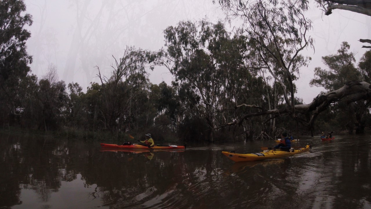
 Day 3 greeted us with lifted fog and a return of southeast winds at 10-15 knots. Despite persistent low water levels and expansive sand flats, the familiar sights of the Coorong’s freshwater soaks, rolling sand dunes, and aqua-colored waters made it a classic experience. A change of plans at Tauwitchere barrage lock. The low water and high winds made crossing into lake Alexandrina not appealing.


")


 at ASC")


