The following text is mostly a transcription of the conversation Hugh and Hugh had in the car, driving back to Adelaide on the morning following the finish of the Massive Murray Paddle in November 2025.
In summary
They trained for the event by doing the Riverland Paddling Marathon in June 2025 and paddling 3-4 times a week, with a focus on Zone 2 training. They felt under prepared going into the race due to not doing enough long-distance paddles but in reality they managed the conditions pretty well after the first day (which was always going to be hard).
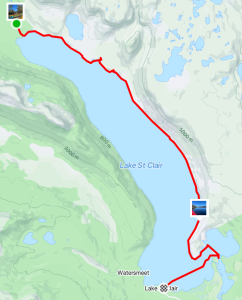
Logistics-wise, they stayed in tents at caravan parks and had a support crew to help with gear. They recommend staying at least two nights at Tocumwal (end of day One , start of day 2), Echuca (end of day 2 start of day 3 ) and Koondrook (the finish point) to minimize travel time.
For food, they used a homemade “goop” made from maltodextrin and fructose, which worked well for energy. They also used commercial muesli bars, lollies, gels and sachets. They drank 2-3 litres of water per day on the water (plus sports drink and coffee).
The race was challenging, with strong winds for the first two days, currents, and changing water conditions. They recommend finding a rhythm and pace and taking advantage of fast water and tailwinds. They also suggest not stopping at checkpoints unless necessary.
For gear, they recommend a stable kayak, a deck bag or camelback for hydration, and a good pair of scissors for cutting Coban for blisters. They also suggest wearing thermals, sunscreen, and a hat, and bringing spare clothes.
They had a positive experience overall and enjoyed the camaraderie and support from other paddlers and spectators. They are considering doing the event again and are looking at different kayak options, such as a Grafton Sports Fusion or an Epic V10.
The full conversation
Training:
(We had both done the Riverland Paddling Marathon in June 2025 (HS did the 200 and HM did the 100) so we had a good base. We had both been paddling 3-4 times a week since then without doing a lot of long-distance work. 2 weeks before the race we did a 100km week with a 5-hour, 40k paddle on the Sunday morning. )
Hugh Mac:
I think concentrating on Zone 2 was an extremely sensible thing to do. I should have added to the Zone 2 a bit more strength in the water training, as it were, not necessarily speed, but the surges, because so much of that race is involving surges, not flat-out sprinting speed, but the ability to pick up your pace and maintain it for a usable period of time, which can go anything from a minute to 10 minutes. If you’ve got a really good wash, you want to hang on to that one, because the water speed changes so much, so if the guy’s a boat length in front of you and he hits a patch of fast water, then you’ve got to be able to just do that little kick to stay with it.
Hugh S: I think the cumulative weekly mileage is very important, without a shadow of a doubt, and I would underscore the importance of a long paddle.
Hugh Mac: I think the longest ones we did were not terribly long, and there weren’t enough of them.
I think so too, I think we came in a little under, I certainly felt a little underprepared for that one.
We did do a four lapper and took five hours as well as paddling the day before for 2-3 hours.
So the rule that I usually use is your longest day of the event should be your weekly cumulative. So we should have been aiming for about 90, at least 90 kilometres a week, which we probably would have got at least one of those weeks.
I think we would have got 90, and probably if we were doing that a bit more regularly, it would have helped, would have helped me anyway,
I guess, because we don’t do much speed play when we’re paddling around West Lakes.
Logistics
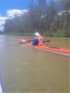
Hugh S So, logistics wise, Hugh Mac handled most of the bookings. We stayed the first night in Echuca at the Rich River Tourist Park, which was fine.
Hugh Mac: Yeah. And then we booked two nights in Tocumwal, so we stayed the Sunday night in Tocumwal. We set up at Tocumwal before we went to Yarrawonga for day zero briefing between 12 and 4, which was a bit of a non-event really, wasn’t it?
Hugh S: Yeah, it was a bit of a waste of time. We weren’t really given any information. It was just a means by which they can give us our decals for the boats and our numbers and our trackers.
Hugh Mac: So you’d find a way to circumvent short-circuit that process. Yes, one person gets it for everybody else. that would be a smart thing to do.
So, Sunday night we had in Tocumwal and drove to Yarrawonga on Monday morning for day one start, and finished that day in Tocumwal.
Hugh Mac: So that was great that we had tents already set up and we could just crawl into them and getting off the water at 4.30 and being able to just roll straight into the camp was fantastic because we were pretty spent.
Then started there the next day, so it was an easy up and out and Ryan, our land crew, was able to pack everything up and we were away with no bother really.
Yes. And moved from there to Echuca. Two nights in Echuca, back at the Rich River Caravan Park for Tuesday and Wed nights. Same campground, same camp spots as we had on our trip to the race. And sort of similar deal there too, which was great.
So we paddled into Echuca on Tuesday night, and then could just go straight to the campground.
Cute town too. And then final two nights in Koondrook, which was the finish point, which again had the advantage of, would have had the advantage that we’d be at the finish point. We would have walked out of our kayaks to our tents.
But this year they changed the course for the last day at the last minute, so we ended up having to be picked up way down the river. So I guess that’s always a thing to consider is that course changes can be sprung on you, depending on what’s happening in the forests and various things.
Yes, some people just stay at Echuca the whole time. It makes for some long drives here and there. And we stayed in tents, which is manageable, but people also stayed in cabins and various things, which would have been marginally more comfortable. But it’s hard to get a three-bedroom cabin.
Food.
Hugh Mac :Bring out your goop. Yeah, goop. Goop was a winner.
Goop is a mixture of two parts of maltodextrin to one part of fructose,
And make it a little bit on the runnier side. So it worked, I think, remarkably well. It’s incredible, you could be feeling after chasing somebody down, you could be feeling a little bit weak, and just grab that damn bottle and just squeeze, and you’ve just squeezed in, you know, $9 worth of commercial commercially bought things.
Hugh S: And those sachets are a pain in the arse, because you can’t stop in the kayak with wet fingers and try and tear the tabs.
Hugh Mac: No, just from a sport bottle with a nozzle. And in fact, I think what I would do next time, if I do this again, I will just put it in the bladder in on my life jacket, and another bag with three litres of plain water.
Hugh S: Yes. And how often were you drinking? Were you eating the goop?
Hugh Mac: I wasn’t as scientific about it as I should have been. But what I did do was basically, I had enough goop to provide me with food for half of the day. And so I would just assess it as I lifted up the bottle. How much did I have in there, versus how much of the day was left? And whether I could stomach another children’s packet of pear and apple. One year old, one year is much better than the six-month-old. And in fact, it was a refreshing change. Because when you do that, and it doesn’t take long, actually, to squeeze that stuff in, you can squeeze that stuff in quicker than you can the goop in the commercial sachets. Yeah, the top comes off a lot easier. And the few times I tried doing things like eating McVitie’s Hobnobs, I had instant digestive problems. So anytime I tried to eat any solid food, which you start craving, don’t you? I’m craving a bloody hamburger halfway through a section, thinking nothing but McDonald’s. If you eat anything solid, it just sits in your stomach.
Hugh S: Certainly, the first couple of days, the nine-hour days, and I found I typically wouldn’t eat for the first hour and then might be able to go for an hour and a half or so and then grab something like just a squeeze of goop. I also used some of the commercial gels for a couple of days and managed to get one of those in after a while. And then probably every hour I was trying to eat something. So I had some muesli bars, which, as you said, I felt I needed something solid after a little while, especially on the long days. towards the middle of the afternoon, I felt like I needed something like a half a muesli bar. And then I could just stick with a few lollies and things. Snakes.
Hugh Mac: And they work okay, but I think the goop is actually better for me. Well, scientifically it gets into your system better. That’s the point. So, your body can absorb a maximum. Some people apparently can train themselves to absorb as much as 120 grams of carbohydrate. So, the goop that I made was designed to… That 600 ml bottle held 300 grams of carbohydrate, which is not shabby considering the cost of what… That’s like 10 sachets. Yeah, yeah, yeah. 60 bucks or 40 bucks there.
And it’s just designed to get directly into your system. And you will still be hungry, but you will be absorbing the maximum amount of carbohydrates your body can anyway. You don’t want your stomach having to fight with digestion. So, if it’s fighting with digestion and trying to provide you with the carbohydrates, you’re going to get less carbs into your system.
Water
How much water were you using?
Denby said he was doing six litres a day. No way. No, I’m surprised. I probably didn’t do…
Hugh S: The maximum I would have done any day would have been three litres.
Hugh Mac: Yeah, I was the same. I think the long days, probably three litres, but those the last three days, I was barely getting through two litres in my back.
Hugh S :Yeah, I had my backpack. And that was about, you know, I was barely finishing.
Hugh Mac :And I was feeling fine. I wasn’t feeling parched or anything.
Hugh S: Yes, I did. But clearly dehydrated by the time I got off, given the colour of my urine.
Hugh Mac: You weren’t? Oh, you weren’t? Oh, I didn’t. Well, your performance was deteriorating then. I was not experiencing that. But I think because I was having those kids…What do you even call them? Yeah, baby food.
Fruit, baby food. Fruit, all fruit based. Because I had quite… I would probably have four of those during the day. That’s a fair amount. Four of those as well. That’s the good. Yeah, that’s what it was to do. Because that’s all carb. And I had the commercial gels. Oh, and yesterday, and I still got one left. I wasn’t taking my… I had commercial sachets with… they were caffeinated with espresso. Yeah.
Yesterday, I took two of those. I’m wondering why my performance was better.
Hugh S Yeah, well, I carried a little thermos of coffee and a couple of days I had coffee and sustagen mix. And if I was feeling particularly flat, I would actually stop and have a little capful of that. And did you feel it gave you a boost?
Yeah, the first day I started to feel a little bit of caffeine withdrawal headache. And so I thought,
oh, I better have a shot of coffee just to sort that out, which was fine. But I didn’t notice a big kick.
It was better from the goop. I did get quite a kick out of that caffeine yesterday.
Hugh S Yeah, a lot of it helps. A lot of it’s what it does to your head. You’re just feeling hungry and your stomach’s rumbling and you think, oh, I’ve got to get something in. And once you get something and it settles, you feel okay, content to concentrate back on the paddling again.
Hugh Mac: So yes, there’s a whole bunch of factors which go into it. But recognising that what your body, what your brain’s telling you, you need, may well be wrong. Science will tell you that what your body’s going to be able to absorb is basically just some really concentrated carbohydrates. You know, without any fibre, nothing too fancy.
Race start
Typically boats are set off in multiple waves. Try and get the earliest wave you can, would be our tip. That way you’ve got less concern about meeting time cutoffs at checkpoints.
That’s right. You’re less worried about meeting the cutoff and you’re probably going to get off the water a little bit earlier.
Yes, you’ll be getting off the water earlier. You will also be with a bunch of other people who will set off like scalded cats. And they’re great to follow for a while until they burn themselves out.
Yeah, so don’t worry about people charging off, let them go because you’ll catch them probably.
You will, unless they’re going to be winning in their category, you will.
But if you can find some, you know, big TK2 to sit behind, which we did on day one, we found
Angie and Dave in the…
Was that a TK2?
No, it wasn’t. That was a marathon double.
That SLR2 was a lovely, sleek racing boat with two people who were paddling at about our speed, and we could sit behind them quite happily for a while, couldn’t we?
So checkpoints, we talked to a couple of newcomers around the race time and they were saying that they learned that you don’t have to stop at checkpoints, so that’s one tip we would say.
Yes, don’t feel the need to stop at a checkpoint. And even when you get there, there are no amenities. There’s not a snack shack, there’s not a port-a-loo, you know, you’re on the banks with a bunch of other people.
Yep, and if you’re going to stop, try and not stop very long would be the tip.
If you have to get out for a stretch, just do that, get back in your boat, especially if there’s some flow, which there will be.
You want to take all your breaks on the water if you can, so you don’t lose too much speed.
Yeah, and when you take a break, take a break on a stretch there where the water, the wind and the current are working for you.
Don’t stop facing into the wind and then suddenly discover you’ve just gone backwards.
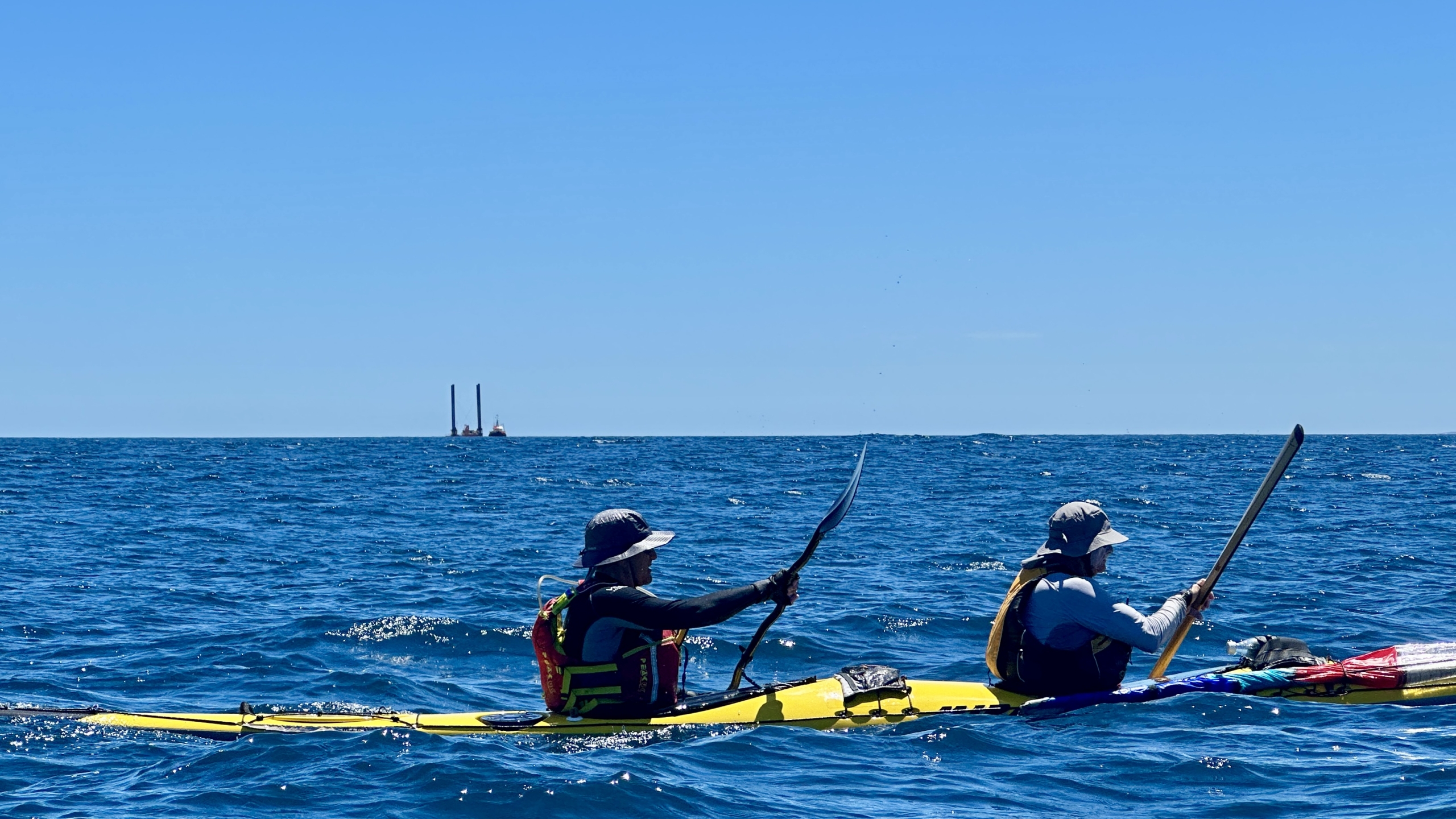
Racing:
 And race days, you know, we just need to find a rhythm and find a speed that you’re comfortable with and the water, the water will change volume, change velocity as it goes around bends. Constantly changing. So you need to keep working out where, which line to take.
A lot of people, and I noticed on day one, they were determined always to go with the fastest flow of the water, which means they were always going wide on the bends because that’s where the water would flow fastest. But we noticed the couple of the old timers, two guys racing an OC2 who’d done, you know, something like 60 or 80 marathons between them. And they would always cut the corner. You go in hard to the apex and then go straight out wide again, so you miss the back eddy and you try and get back on the fast water as soon as you can.
Follow the old blokes who had done it before and watch what they do would be my tip.
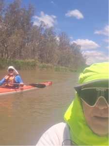
And in the wind that we had some days or day one, we had quite strong winds, I’d say 15 knots.
Yeah, and you know, there would be a point at which you probably want to just go for a bank to get out of the wind because the water, the wind, the water speed won’t, you know, but yesterday and, you know, day four and day five, the wind was a lot lighter.
And I just felt it was more important to follow the water than the wind, than worry about belting into a headwind because they weren’t really taking a lot of speed off.
And also sort of, hence, going into a headwind, don’t, don’t fixate on your, on your speed. Say, oh, my speed’s dropping, I’ve got, I’ve got power into it. You’re just wasting energy there. So I wouldn’t say throttle back going into the wind but get a good steady state.
And you’ll find those lulls, it’ll be blowing, blowing, and then it’ll stop for a second.
And that’s when you literally, you’ll say, I just pick it up, say, oh, crikey, here’s my chance.
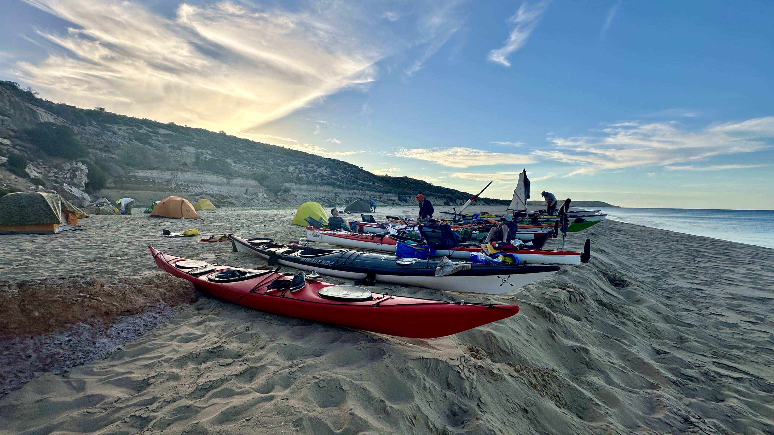
Setting up the boat:
And I had so much deck furniture on my boat, that big deck bag, and stuff for kayak sailing and the, the compass, which was useful.
Yeah. Yes, the compass was useful.
But that big deck bag I had, which was absolutely marvellous for its capacity, it’s like a damn windbreak.
Yeah, no question. I felt that before. Yeah, I took my deck bag off after day one. I found
I wasn’t using it. It was too slow. It was easier to have all my drink bottles and various bits and pieces either in my PFD or in, in, down in my lap.
Yeah. So we weren’t using spray decks, of course, we could just reach in and grab stuff out of the cockpit. Yeah. If I were to do it again,
I would take that deck bag off. I wouldn’t use it , because the contents of it, I mean, I basically use those two sport bottles with one with goop and one with electrolyte in it.
And what I would do is I just do it in some big camelback bags, one big three litre one and a one and a half litre one full of goop. Yeah.
Yeah. It was handy to have a bottle of Hydrolyte or Gatorade just for, towards the end of an evident, particularly last few days, it was quite hot. Hot. And I felt I needed to, didn’t want to cramp up. Yeah, grab some electrolytes because it just helps the recovery a bit better.
And so in terms of setting up the boat, we had to carry a first aid kit, which was in the back hatch. And all you need, all you need is a bag with the words first aid on it. And a roll of toilet paper.
Yeah. Their safety checks are somewhat peremptory.
But we should talk a little bit about, about the process of setting up because every day we got into a routine, you know, you had to, the night before you had to sit because you wanted to get away early and make sure nothing’s missing. So I would have a, a, all my food. So it was typically, you know, I’m usually bar a couple of gels, maybe a bag of lollies in my PFD.
Fill my water bottle in the back of my PFD. I had another bladder in the bottom of the boat. I had a couple of litres of water in it as a spare.
And then, which we both kind of needed, because both of us sprung leaks. Yeah. You do want to carry two water bladders, one as a, as a spare for sure. And then on the, so what was I going to say about food?
Getting to the race from camp
got up in the morning, make a pot of coffee, excellent coffee.
Jet boil. And the jet boil. Key piece of kit, a jet boil. And a table. And a small collapsing table. Jet boil burns water at record speeds. And the headlamps, of course, for early morning starts because we’re up at five, four thirty in the morning, a few mornings to get, to get going.
And, and then your bottle of Gatorade and I had a little thermos of coffee with me, I would put in a, in a bag that would always be my deck bag, have my hat, my sunglasses, gloves, anything that was going in the boat that I was going to wear or go in the boat was in a bag. So that would be my, my boat bag that I would just carry down to the start and get set up.
So first aid kit and I had a spare paddle in the back hatch of my boat, didn’t use it. It’s probably a bit unnecessary.
So then, yeah, so get in the morning, make up your, your oats, whatever, for breakfast, cup of coffee, and then throw all your gear, all your gear’s kind of ready to jump in the car, jump in the car and eat, drink, eat and drink all the way down. And then get to the start line, give your number to the lady waiting on the bank to register, get the boats off the car down to the bank, grab all your gear on, get everything set up, ready to go on the water.
Oh, Coban. Coban (self-adhesive elastic bandage) is your friend. Yeah. Blisters is a real problem for the first couple of days, a real problem for the first couple of days, particularly.
So we all, I had my fingers Cobaned up and, around the thumb, the old, um, the knuckle part, the big callus on the thumb,
But I also had a polypropylene glove that I tended to wear on my left hand because I know that’s, that often gets, I often get blistered at that hand if I’m doing these long paddles.
So the Coban goes on in the car, so a pair of scissors and a roll of Coban each. And a good, good hint for the right scissors, use the, uh, ones for a medical kit, the ones which are made for cutting bandages and things, so that you don’t stick yourself.
Yeah, that’s true.
And I didn’t use gloves. I just, because I’ve got a very light touch on my paddle typically, so I don’t get much of the way of blisters until it gets windy and you actually have to grip your paddle or your paddles get ripped out of your hands. So days one and two, uh, I actually develop blisters. Yeah, but I, which I really couldn’t cover with anything other than the glove, but I just don’t like wearing gloves. So, and I just feel it’s topical pain which I can put up with the discomfort.
Clothing
We just wore thermals. I had my, element, thick thermal uh, which is a, kind of a fluffy thermal for the first day, which was a bit cooler.
The first two days were chillier. Yeah, yeah. They were probably, you know, 18 during the day, overcast all the way through. Windy. And windy, yeah, yeah. So tended to get a bit more of a chill.
Long pants, booties, sunscreen and, uh, a good hat. Yeah, proper shoes. Yeah.
Day 2
 Uh, day two was much the same really. That was a long day, just hard slog. And…
Yeah, just had to, had to keep going and get that one done. Yeah. On day two, that was the day when I landed up, with that, that double, I landed up with them wash riding me for a while. Oh yeah. Which is hysterical. Yeah, especially since how they ended up, they just, uh, stopped their silly surging. Yeah, two, two young, two younger guys in their 40s who, uh, had just bought themselves a 730 about six months ago and were, uh, very new to kayaking all day.
We did a few rescues, didn’t we? Day one, we had to rescue a guy who tipped out of his epic.
His epic, yeah. And he didn’t know how to get back in. He’d been paddling for ages and the same with the, those chaps in the double. Yeah. They’d never practiced. They’d never tipped out of it.
We don’t capsize typically until you do. Lots of snags in the water. So you’ve got to be, have your eyes peeled all the time. Yeah. !found someone went sideways against a log. Yeah, I find these two young kids gone sideways against the log sitting out.
That’s probably how I’ve got that bang on the front of my boat actually. And then I had,I just had to go in between them and the log and push, push, push and get them to basically push off. They, they caught the current and swung backwards. They were no longer stuck.
So yeah, just, just had to really keep, keep an eye out for the, for the, strainers in the water and logs and various things, because they did tend to tip people out if you hit one.
And there are eddies and whirls. Yeah.
Yeah. Not too, too many. So I would say, noticed a few of them, but I mean, we were okay. If you were in a really, if you were in a boat that you felt tippy in, because you felt the need for speed, you would get a rather rude awakening. I think 60 Ks into a race. 60 Ks in when you’re feeling absolutely knackered. Well, your, your, your, your senses are dulled by pain and fatigue. You, you, you’ll flip and not even know why.
Yeah, exactly. Yeah.
And then day three was a shorter day. That was a 70-kilometre day.
No, that was what? 70, 73 or something. Anyway, whatever it was, it felt, it felt a lot better. A lot easier doing that day and it felt a lot better after it.
Oh, it was so nice to be finished earlier so we could get back and wash clothes and have them dry. Getting into wettish clothes in the morning is not fun.
So take a few changes of clothes. The weather up here is pretty dry usually, although we had rain the first night.
We had rain the first two days. Yeah.
Just light sprinkles, but enough to wet anything that was left outside.
So bring a couple of change of paddling clothes, I’d suggest. I had, I think I went through, probably only used three tops and two sets of pants. What that’s worth.
Yes, that’s pretty much the same. Yeah, I used my Vaicobi V-Flex,uh, long, uh, long, long tights in the first day and then the shorts for the rest of the time and the Vaicobi, What do you call these? Rashi. Rashi basically for the rest of the time. That was adequate. The times at which you were chilly, but never cold enough for it to affect you. To be worried, no. Except when you’re waiting for the effing race to start.
The crowd
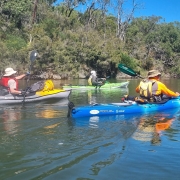
Yeah, so, most, most, the, generally the race was pretty well organized in terms of getting boats on and off the water and it was great to have, kids, the whole bunch of teams of kids, uh, high school students here who were great value cheering and that as you came in, that was a way that was very well, uh, well received.
Yeah, it’s great for morale. It really is. And, and while it was totally unnecessary for our ground crew to be there at the checkpoints, I can imagine why for some people it would be. Yeah, absolutely. For instance, for, for, uh, uh, Russ Schmidt from Compassion, you know, the guy, he had his, his family would go to all lots of stops and he would just stop off, say hi to them and then take off and beat everybody all again.
Catch up to the leaders.
The paddlers:
Lots of skis paddling, weren’t there? There were 10, I think.
The most skis he’d ever had.
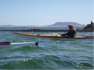
And a ski wouldn’t be a bad, a bad thing. If you had a stable ski, we wouldn’t have been a bad boat to use on that race.
Yeah.It’s what I’ll use next time.
Yeah. But things like the Grafton Sports Fusion,there was about two or three of those. TK, a couple of TK1s, which went pretty well.
The guys paddling those did well. TK2s, quite a few 530s, 580s, 533s. And 730s galore. Probably 40% of the, 40% of the paddlers were probably in 730s.
15 or 20 of them, perhaps. Yeah. Used a lot of them, used in relays, of course, but, yeah.
It’s just an exceptional boat for those conditions.
So. If you did it again, what would you paddle?
If you were given, if you were given a free hand to pick your boat?
I would love to do it in a Fusion, one of those Grafton Sports boats, I reckon. Yeah.
Yeah, you can probably handle the tippiness. So, yeah, that initial tippiness really contributes to its speed. I just find that I sit there and I do that type of thing. I don’t like it.
Well, you really, I would really want to find a boat that I could sit in and take my hands off the paddle and I’d need to just find that boat.
Well, the Fusion is, is faster and tippier than the Time Traveler.
Is it?
Yeah.
Well, maybe not the Fusion then. Yeah.
Something like the Time Traveler would work, because I used that in the 200.
Yes. I don’t think I could handle the Time Traveler. I’d probably go over in it. I don’t have your level of expertise.
Or the Rebel 50s from the West Lakes Club, they would be fine.
The 46s, maybe not for me. It’d need to be a better paddler than me for a 46, I think.
But they would work.
And I will take my Epic 10s, my V10.
V10, yeah, yeah.
 Thank you Anne and Simon for going the extra mile(lots with the car shuttle) and assisting with the set up of others. We soon relaxed into a leisurely paddle from Moleside campsite to our 1st camp site at Georges Rest. A special mention to new club member Rosemary, for her effort, her great attitude, and enduring some members humour, persevering with steering issues and water intake until camp. While setting up camp, and cooking a meal, Rosemary also re-adjusted her kayak setup and repaired a hole…all before the sunset. Great effort for a 1st timer. Another test to Rosemary, and to all, was the organiser ( me) had sourced wrong info, and the paddle was 3.5km longer than predicted. The obligatory ribbing was received.
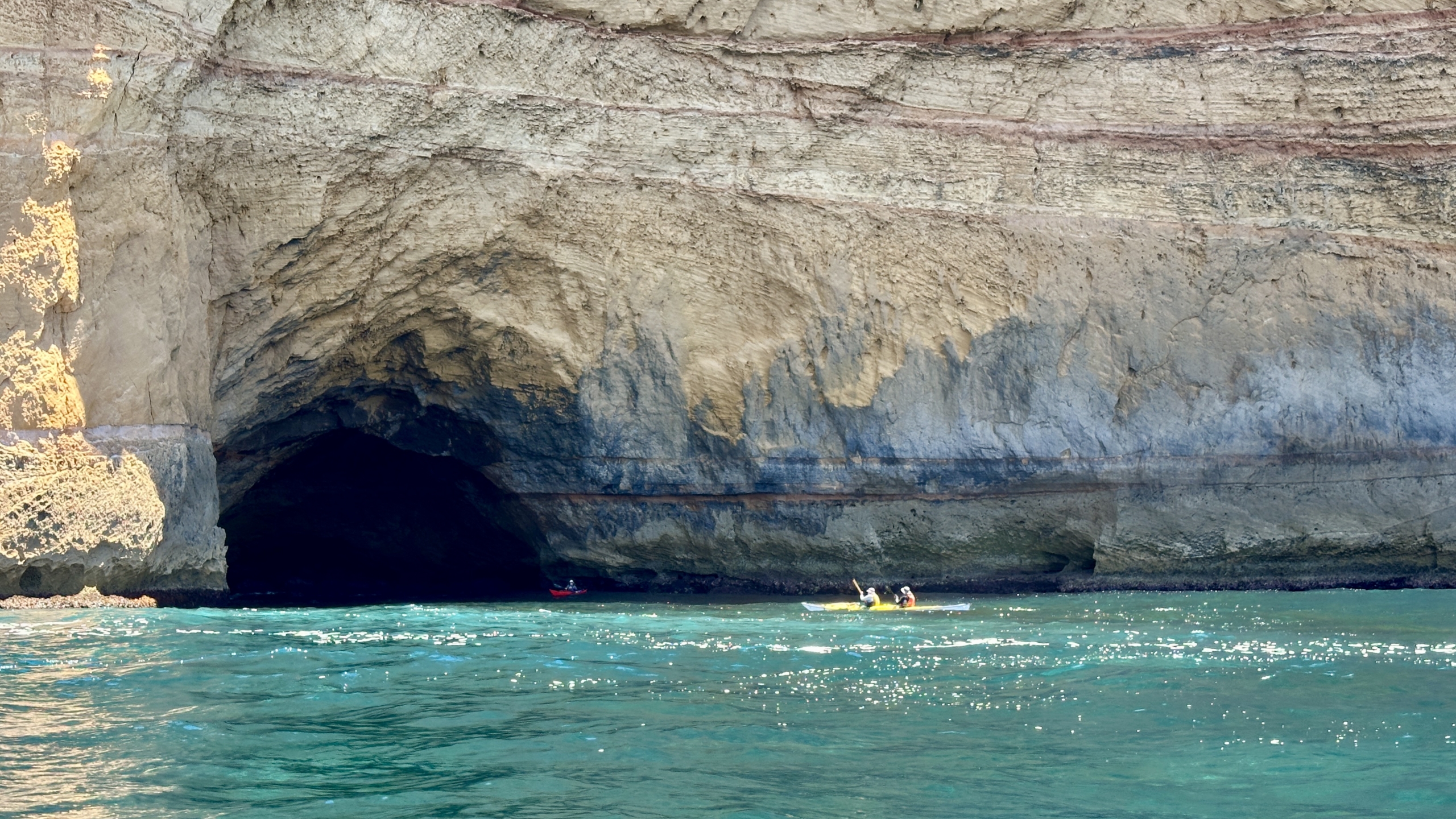
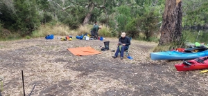 The second day had a perfect 18km paddle to Lasslets Camp site. The weather was cool, the rest stops lovely, and bird life interesting. Many experienced emus in water for the 1st time. The very relaxed atmosphere of the paddles each day, led to paddlers playing under branches, around obstacles, into caves and under over hanging cliffs. A little bit of splashing, racing and bumping may have going on as well.
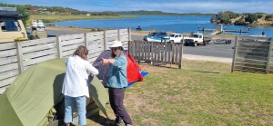 What we received instead was: the rain stopping well before we arose. Then a breeze actually assisted us all morning heading West, and again after a break, when the river was now meandering East toward Nelson as the wind then strengthened to a steady following wind, making our last hour a very comfortable and hastened paddle. Rosemary, had to work a bit as she adjusted to the following winds in her new kayak, but soon appreciated the extra speed. This ended up being the perfect 15km to finish the trip. The scenery, the cliffs and the greenery were much enjoyed each day. There was no lightning and the rain held of till we had packed up at Nelson, and set up our tents. Dinner was again at the local hotel, where various fresh made pizzas were enjoyed along with a few drinks and laughs.
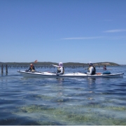
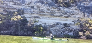
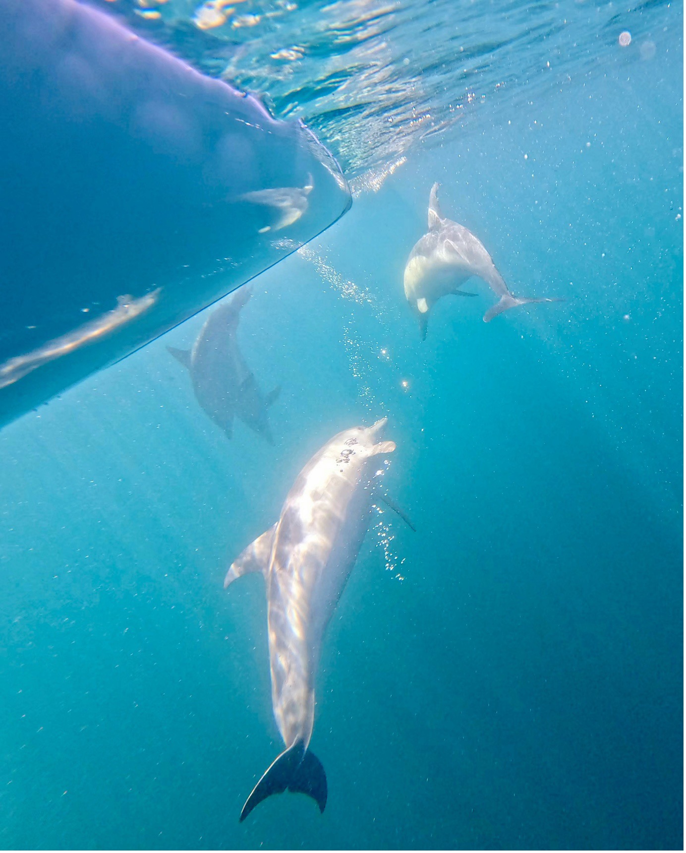
 The paddle out from Coffin Bay township to Black Springs camping area was great. We saw seals on The Brothers Islands and lots of marine bird life. We booked our usual camp site which has a beautiful view over the water towards the oyster beds and Point Longnose. Highlights of the day included the small beach we stopped at for lunch, catching a ride on the swell and looking into the crystal clear water.
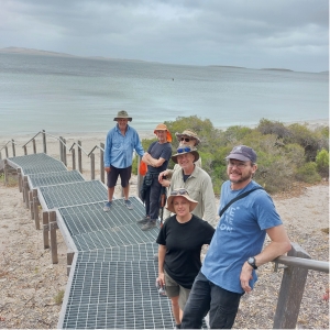 On the third day we relocated to the sheltered side of Lincoln National Park. The road into the camp ground at Woodcutters Beach was 4WD and gave some of us their first experience of bouncing over rocky ground and missing pot holes. The drive was well worth the effort as we had a beautiful beach-side camp all to ourselves. In the afternoon we walked to Stamford Beach and then up to the monument on Stanford Hill before completing the loop back to camp.
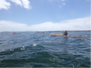 Overall we had a great week. Everyone was friendly, fun and flexible as we discussed alternatives and problem solved the weather forecast, coming up with Plan B which worked very well.

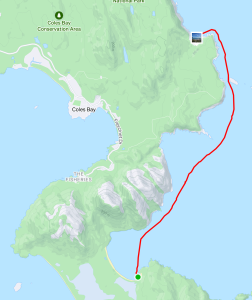
 In discussing the likely conditions on the night before there was some concern at the forecast 20Kn southerly winds that we would need to punch into for the 24Km down to Schouten Island. The group decided to give it a go. We had contingency plans to camp at Cook’s Beach or one of the other pristine beaches along the way if all got too much.
 The forecast for this day was for a 2m swell but light winds so we looked forward to an easy trip up the coast. On paddling out of the shelter of the bay we met huge mountains of water charging down the channel between the island and the peninsula. The paddle up to Wineglass Bay was not going to be as easy as discussions the night before suggested. Most had not paddled in such a swell and those that had took time to adjust. Once out of the channel and heading north along the cliffs things got worse as the 4m swell hitting the cliffs gave huge rebound effects creating clapotis like waves.
 At times, when perched on top of a steep peak, it was hard to reach the water with your paddle! The leaders surveyed the group to ascertain if all were confident to continue as planned. Surprisingly all were up to it and after a time settled into the task with confidence. Being on top of one of the extra large swells and looking 5-6m down the face to the paddlers in front of the group was extraordinary. This day was a challenging, exhilarating paddle pushing everyone to their limits. We described it as “dirty dancing with the sea” or like “paddling in a washing machine”.


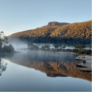
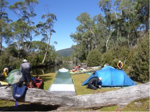 We set off at about 10am in perfect conditions, a slight breeze and blue sky. The tree covered hills of old growth forest and mountains in the distance provided stunning scenery as we paddled up to Echo Point for an early lunch stop. There was a tiger snake on the beach as we pulled in but it quickly disappeared into the scrub. Then it was on to Narcissus Hut, which is a short paddle up a small creek from the end of the lake. The landing spot at the hut was very steep so we paddled further up the creek and found a large, flat, grass-covered area and quickly had kayaks landed and tents up. A few people took advantage of the afternoon to go for a hike.
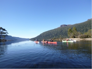 The glassy water was covered in mist as we paddled out from our creek and into the main lake. With the sun shining, we had amazing reflections of the trees lining the bank and the mountains. We paddled down the eastern side looking for a creek that came out from Lake Laura. The plan was to walk up the creek to see the lake. The attempt looked quite funny for those who opted not to try. The intrepid explorers were still visible, giving up after only a short distance, because the scrub was impenetrable and the creek rocks were difficult to negotiate.
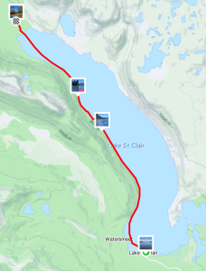


 We arrived at the launching spot near Customs House Houseboats about midday on Saturday. We quickly unloaded the kayaks from the cars and packed, as we were all eager to set off before it got too hot. A short paddle across the river, and then we let the current take us down Suders creek to get to Hypurna Creek. This was not as eventful as it normally is. The big tree which normally blocks the creek seems to have been washed away which made the trip down relatively easy.
 After finding a suitable campsite we pulled up and set up camp. We soon put up tents, inflated mattresses, assembled tables and chairs. After such effort, we took a cooling swim in the creek, disturbed only by the shrimps nibbling on your feet if you stayed still for too long.
 Luckily Wiperna creek proved to be mostly clear despite being narrower than all the other creeks we had been through. Mostly clear. Right at the end, 100 m from the camp, the creek was completely blocked by a large fallen tree, necessitating people having the climb out of their kayaks, onto the log, drag the kayak over the log, and then climb back in again. Some people opted to skip the last step and just walked back to camp while the kayaks drifted back.
 Next morning we packed up the camp and headed off down Hypurna creek. This time with the current so all the obstacles were a bit easier to manage. We opted to do a short (100m) portage to get back to the Murray rather than try and paddle back up Suders creek. This wasn’t too bad despite the kayaks being loaded. Carry straps and six people per kayak made short work of it. We took the opportunity to have a final swim before setting off to do the final few kilometres to get back to the launching spot.


 With almost perfect conditions, the group enjoyed the serene views offered by the glassy water. At times, landmarks disappeared behind mirages, sparking conversations about this fascinating phenomenon as we paddled closer to them.
 The next day, the weather forecast predicted winds of up to 16 knots, but the reality was even more challenging, with winds exceeding 20 knots hitting the sides of our boats throughout the day. Despite the tough conditions, the paddlers handled them with expert skills, making for an exhilarating paddle across the rest of the lake. We travelled from the Narrows to Point Sturt for lunch and then from Point


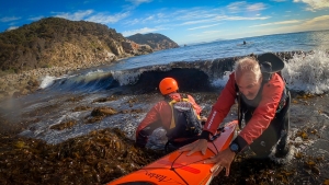
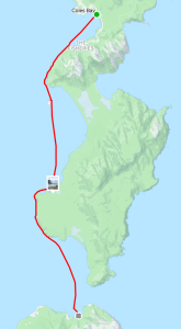
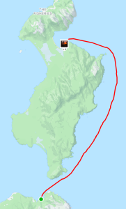
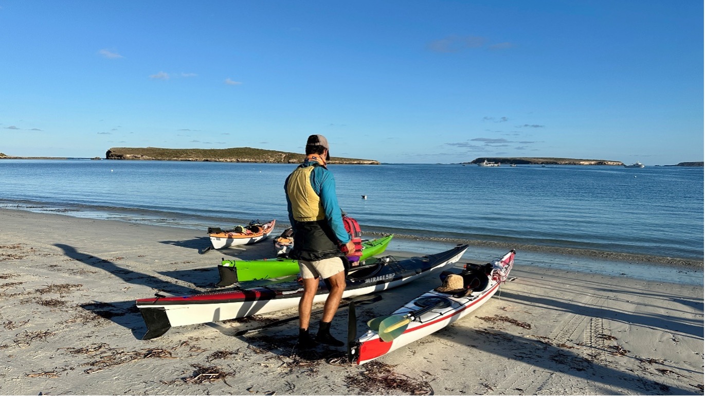
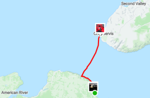
 WOW what a weekend paddle to Antechamber Bay on Kangaroo Island we had. It gave us a bit of everything sea kayaking has to offer.
 And so it was…and for a short time conditions were above the forecast 12Knts, probably up to 15 with even some 18Knt gusts. These conditions challenged some of the group and progress was at times quite slow with Ryan suitably tested as leader in keeping the group together. As Backstairs Passage is a commercial shipping lane, kayakers need to stay in a tight grouping and less than 50m apart. This also applied to the mandated equipment the group required for such a paddle. We were in “unprotected waters” where for every 5 paddlers an EPIRB, flares, VHF and other equipment was required and the group must be within 50m of each other and such equipment.
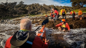
 On the way across we split into two smaller groups. This decision was based on the fact that we had a diversity of sea kayaks in the group. Some very quick and others just quick. I believe all paddlers would have been working their bodies just as hard. It was just a fact that some of the kayaks travelled at a higher speed due to design. At the other side there was only about a 30minute difference in the time to complete the crossing.


