The crossing of Backstairs Passage from Cape Jervis to Penneshaw and return on Saturday 25th and Sunday 26th May really achieved it’s main goals- a challenging paddle with a great camp at the end. The trip was also part of the Sea Leadership Program conducted by Paddle SA Education/Phil Doddridge. Greg A and Hugh Mac are undergoing this training.
The Preparation

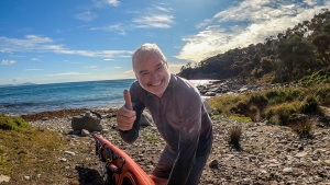
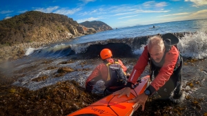
Preparing for departure

Pre-departure picture
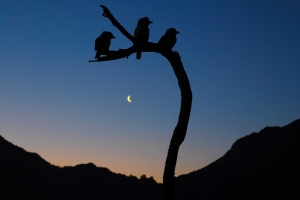
Backstairs Passage is exposed and it is rare to get calm days but we scored a beauty for the paddle over to Penneshaw. We had favourable winds, tides and sunny skies. The temperature was quite mild once the sun came up given winter was just a few days away.
The paddlers were:
- Phil Doddridge paddling in double with Hugh Macmillan (Mirage 730)
- Abelardo Pardo paddling in double with Marg Doddridge (Delta 20T)
- Mike Dunn (Mirage 583)
- Matthew Eldred (Delta 17)
- Jason Schulz (Seabird Discovery)
- Ryan McGowan (Delta 17)
- Berny Lohmann (Perception Ecobezig)
- Greg Adams (Expedition Kayaks Audax)
Marg, Jason, Ryan and Berny were attempting the KI Crossing for the first time. Greg was doing Cape Jervis to Penneshaw for the first time. He had done Antechamber Bay to Cape Jervis last year as part of the Victor Harbor to Adelaide expedition.
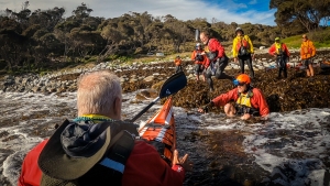
Up Early

Chat before departure

First strokes
To get the tide just right the group needed to be taking first strokes by 8am which, for some, meant being on the beach by 7am to get packed. Marg and I however had decided to stay in one of the Eco Tents at the Seafront Holiday Park and had little to pack. I highly recommend this option should the trip be repeated in the future-luxury! We also were going to the Penneshaw Hotel for dinner which lightened the load further.
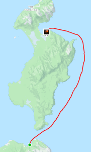
The coastal views across the Passage were stunning as we gathered for our 730am briefing. An important logistical issue in doing this trip is to stay well out of the path of the KI Ferry. We notified the business of our presence and planned a path well to the east and parallel to the ferry route. The first part of our journey was to Land’s End before heading out across the Passage; this would keep us well east of the ferry. On the crossing our heading was 220ºM. As part of the sea leadership training I discussed the best way to keep the group together and on track. From past experience I found that having a lead paddler out in front with others following achieved the best outcome. At least one paddler needed a compass designed for use at sea; better if two paddlers are equipped and can check each others readings.
Once at Land’s End I swung the kayak to the required heading and identified a prominent feature on the hills of KI. Each paddler took turns in leading the group and paddling at our target. The paddler leading the group does not need a compass; if they have one their focus is on the identified feature in the distance NOT the compass! This is for accuracy and to avoid sea sickness.
Breaking it into stages
It is more demanding to be out in front so the lead paddler was changed each 30-40 minutes. At the change the heading was checked and the feature to aim for was adjusted. To allow for tidal influence we used a technique called “splitting the tide”. The first half of the journey was done in the ebbing tide taking us further to the east and the second half in the flooding tide bringing us back to the west. We planned to be half way at 930am. Up until 930am each of the features to aim for were slightly east of the last. From 930am the features moved slightly westward due to the tide.
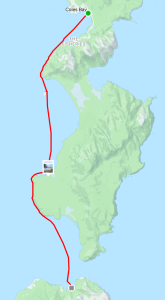
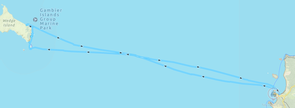
There are images of the plans and actual route as recorded on a GPS attached.
The Crossing

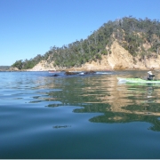
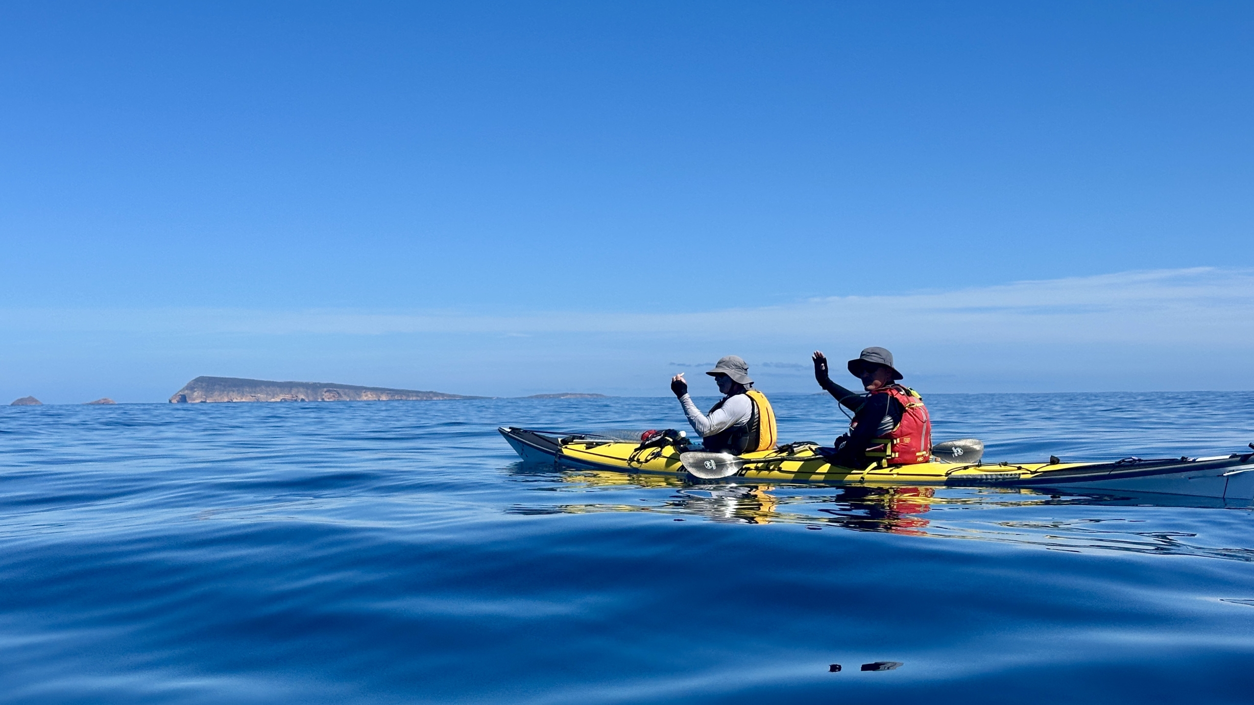
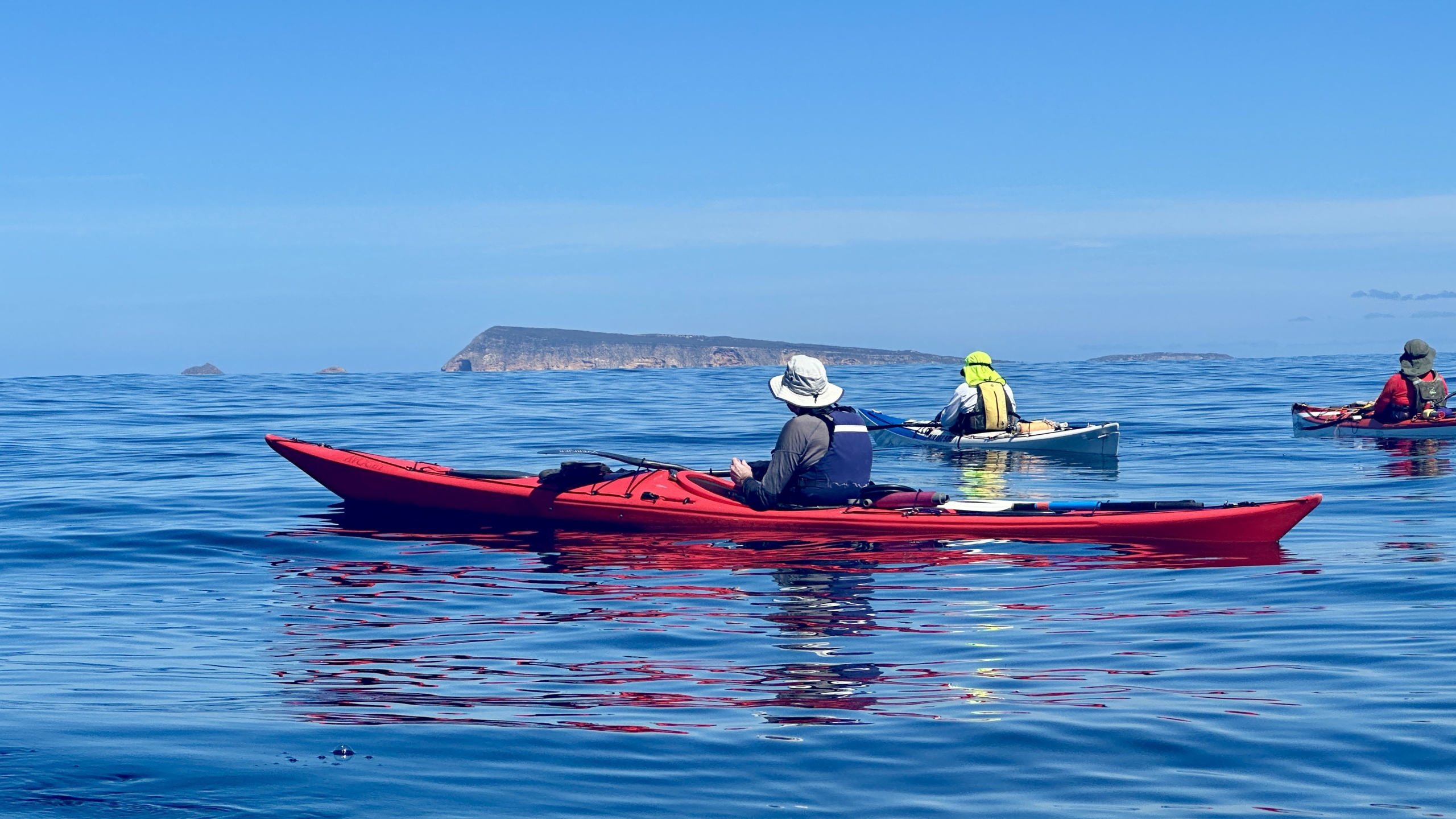
Middle of the crossing
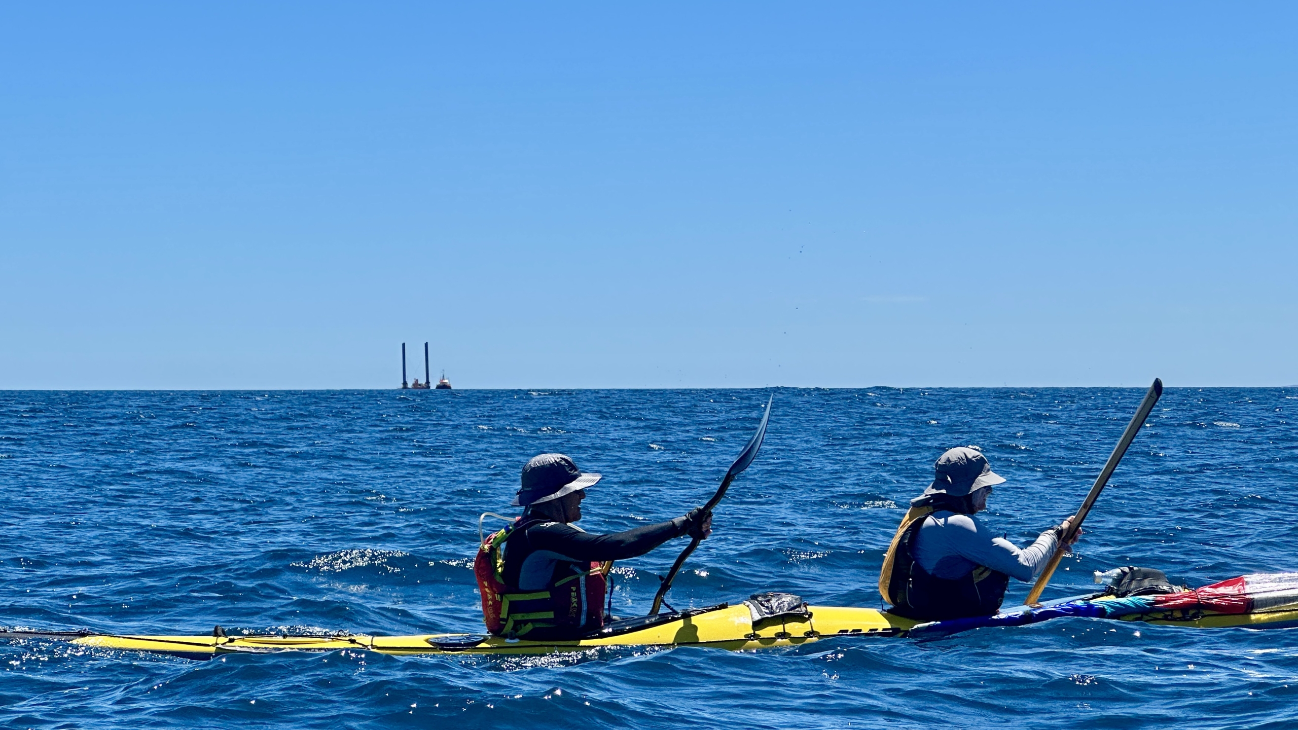
It was a fantastic crossing, one of the best I have experienced. Unfortunately for kayak sailors there was not enough wind to fill the sails! For safety the group had at least one sail up so other vessels would see us more clearly. On the day two container vessels went through although I do not think that they would have altered their course if they saw us in the way! It is surprising just how fast these big vessels move and how quickly they go from a spot on the horizon to a big hunk of metal in close proximity! An old saying that applies here “Never take your eyes off the ocean”; I regularly did a 360º scan of the horizon!
We had several members of the group carrying injuries and I was concerned about the rate we could paddle at. I have very badly damaged shoulders and chose to paddle in a double to take some of the pressure off…a Mirage 730 is a very fast kayak needing much less effort than any other I have paddled to cover the kilometres. Paddling with Hugh Mac made it even less of an effort! In fact for the first half of the journey I don’t think I added to progress at all, Hugh did it all.
The second half

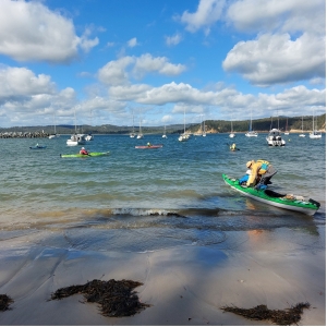
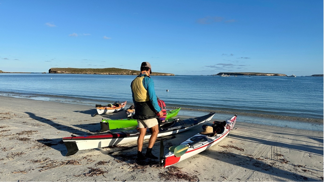
Clear water in Penneshaw

Arrival to Penneshaw
In the second half the group needed to give Jason a helping hand. ACC events are notorious for travelling at a “fair clip”! Jason’s 4.3 m Seabird was no match for the 5.8m Deltas, Mirages and of course the two doubles in the fleet. The initial tow was applied by Matt and after he had done his bit Phil and Hugh Mac took over. I always like having doubles on potentially challenging trips for this reason, they are brilliant towing vessels; the effort needed by two paddlers is much less. After awhile we applied a “V” tow with both doubles powering Jason’s kayak along. I’ll be willing to bet that was the fastest the little Seabird had ever gone!
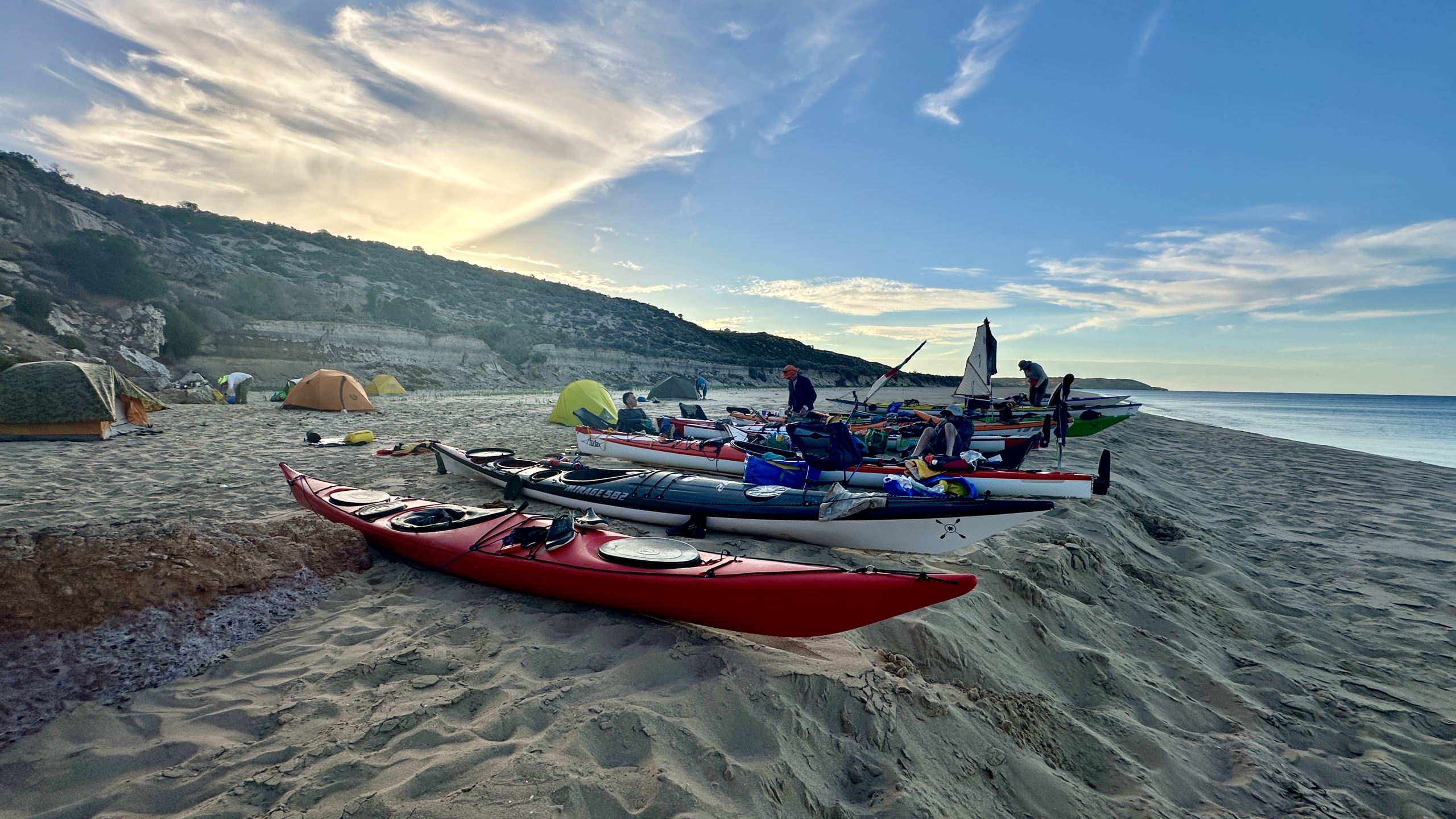
The crossing was completed in a little more that three hours and we arrived in Penneshaw in bright sunshine and landed on the white sand beach through crystal clear water(see pics). The Seafront Holiday Park was just over the sand dunes and the group had a leisurely lunch before making camp.
Accommodation and Dinner

Penneshaw Beach

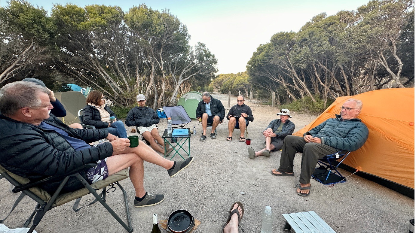
Chat before dinner
I was impressed by the improvements made to the caravan park since last visit. Besides us low budget kayak travellers there were a lot of beefed up 4×4’s towing big caravans…I see this where ever I go! So much for minimal impact travelling (personal budget and planet). The hot showers were a treat! After an afternoon of chatting and comparing notes the group walked into the Penneshaw Hotel for dinner. The hotel too had undergone a makeover since last I was there. The food was great as were a few wines or beers depending on personal preference!

Catching the last Ferry back
We said farewell to Greg and Mike shortly after dinner as they were catching the 10pm ferry back. Mike had commitments for Sunday and Greg had caught a ride down with him. It was a stunning night for a boat trip! Jason also chose to take the ferry back next day.
The Return

About to launch into return
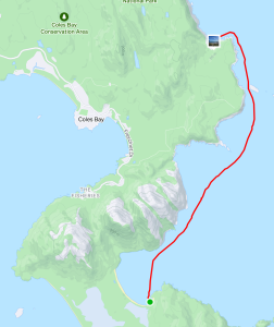
Sunday’s weather forecast was for a warm day with light northerly winds and our plans were to make a leisurely paddle down to Cuttlefish Bay before heading back to Cape Jervis on the incoming tide. This would have made the trip about 5Km longer than journey over. Well a forecast is only a forecast and the weather gods had other ideas! As we were preparing to launch the winds were a little stronger than forecast. The seas were a little rough with small whitecaps forming out in the Passage. Small surf was breaking on the beach which unfortunately meant a wet launch if your timing was out. The group decided to stay to plan and see how things developed.
Direct to Cape Jervis
It wasn’t long before it was obvious our plans were best changed. Traveling along the rocky coast had us in confused seas with a lot of rebounding waves. The group moved further out away from the coast but there was little difference. It was bumpy, wet and hard work. A quick survey of the group voted for a change of plans and we would head direct to Cape Jervis hoping that as we went further from the coast the seas would calm down a bit. This plan worked for a while and then the wind began to increase; recordings in the area had it peaking at 20Knots during our crossing. Initially I had the lead paddler just keeping to a heading based on best “course over the ground” navigation. This had us punching almost directly into the wind/waves which was slow and energy sapping.
Or not so direct…

Forecast? What forecast?
Another saying I have is “best to get a crossing done, quickly as achievable, and sort it out on the other side”. I changed the group’s heading so that the wind and waves would hit us on an angle of 30-40 degrees from the bow. This meant we would travel faster with less strain on each stroke and would be a little drier. Unfortunately the dry bit did not apply to Marg and myself who were in the front seat of the doubles; the kayak is simply too heavy to lift over the waves so it just plowed through and the waves slapped us in the face!
Needless to say we were all pretty tired when we reached the coastline just east of Cape Jervis. As I had set up navigation to have us east of Cape Jervis and the final few kilometres were aided by the flooding tide to the west…a welcome relief. The crossing back took three and half hours; it felt like double that!
Back in Cape Jervis
When acting as leader I always prefer to have my group land as one and insisted we all just “float” in on the tide as there was no hurry. Also in the last few hundred metres on approach to Cape Jervis the group would encounter a strong tidal race that forms off the breakwater. If you don’t know what it is like it can sweep you past the entrance to the harbour and it was really pumping!
The tidal race can also sweep you into the path of the ferry which would just be bad advertising for the competence of sea kayakers!
So we paddled into the harbour happy in having accomplished a significant milestone also avoiding the tidal race to be greeted by a Marine Safety Compliance Officer on the beach. He seemed happy but had many questions for me relating to the safety of our trip and the gear we were carrying. In the centre of the Passage we were more than 2NM from either shore and in “Unprotected Waters” (See the Marine Safety SA’s page on Boating safely: equipment & operation).
Safety Equipment
The group was required to carry the prescribed safety equipment. Paraphrasing Marine Safety SA…“when travelling as a group with at least 2 other vessels(kayaks)… within 50 metres of each other…one vessel can carrying 2 hand held red flares, 2 hand held orange smoke flares, 1 compass, a map or chart of the area of operation and an EPIRB.. the other vessels are exempt from carrying the equipment”.
Another way of doing this is for the group to have all the gear but carried by different group members. The prescribed equipment is carried for up to five paddlers. If more paddlers are in the group then a full set is required for each group of five or part thereof. We had all the gear. The compliance officer just questioned me and did not want to sight the gear. (Bernard G commented that he has been checked by officers on his trips in this area previously). All of this is for the safety of those at sea and I am appreciative of Marine Safety doing their job!
After all the excitement the gear was loaded onto vehicles, some of the group had to head off but Phil, Marg, Matt and Berny headed to the ferry terminal for a coffee and review of the day before beginning the drive home.
Conclusion
The attached pics tell more of the story. This was one of the most enjoyable crossings that I have done; probably approaching 20 or so over the past 30 years! Great conditions for the most part, great people to share the adventure with and we are so lucky in SA to have such a coastline to explore. Thanks to all who took part and the support crews who helped with transport.
Overall statistics (Links point to GPX track files)
 The Rock’n’Roll event is the NSW Sea Kayak Club’s premier annual gathering for paddlers, showcasing their enthusiasm for kayaking and camaraderie. It features trips, training, talks, and information sessions, with a strong focus on socializing and community building. The event attracts paddlers from various Australian states,.
 Saturday evening was the Rock’n’Roll dinner, with Paul Caffyn as a fascinating guest speaker. Paul had paddled the coast of Alaska, amongst other things. The diners were also entertained by “The Pogies”; which was a ‘competition’ of short videos made by paddlers. (Some of our ACC videos would have been stiff competition!)
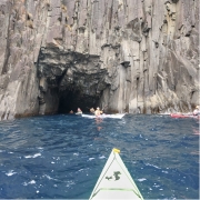
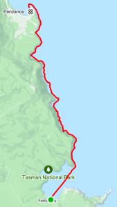
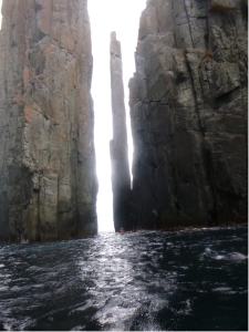 Our first day paddling from Fortescue Bay was out to Cape Hauy. There, we admired the dolerite columns called the Totem Pole and the Candle Stick. We had protection from the southerly wind as we skirted along the rocky cliffs and enjoyed the swell crashing in and the rebound waves. There was a sea eagle spotted perched on the cliff and it didn’t seem worried by our proximity. Within the protected area beside the Totem Pole and Candle Stick there were lots of seals that swam around our kayaks. Venturing further out on the exposed side of Cape Hauy the wind was quite strong and had generated waves which broke over the bow of kayaks almost to the cockpit. The group split; with some paddling around the outer islands, called The Lanterns, while others stayed on the sheltered side and paddled the northern side of these islands.
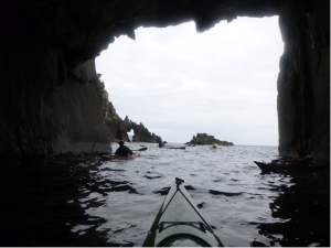 This day’s paddle was to the north from Fortescue Bay past the Devils Kitchen, Tasman Arch and the Blow Hole then into Pirates Bay finishing at the boat ramp. Because this was a one way paddle we organised a car shuttle to have a few cars at the landing spot.
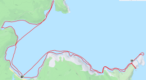


 In discussing the likely conditions on the night before there was some concern at the forecast 20Kn southerly winds that we would need to punch into for the 24Km down to Schouten Island. The group decided to give it a go. We had contingency plans to camp at Cook’s Beach or one of the other pristine beaches along the way if all got too much.
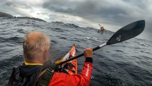 The forecast for this day was for a 2m swell but light winds so we looked forward to an easy trip up the coast. On paddling out of the shelter of the bay we met huge mountains of water charging down the channel between the island and the peninsula. The paddle up to Wineglass Bay was not going to be as easy as discussions the night before suggested. Most had not paddled in such a swell and those that had took time to adjust. Once out of the channel and heading north along the cliffs things got worse as the 4m swell hitting the cliffs gave huge rebound effects creating clapotis like waves.
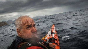 At times, when perched on top of a steep peak, it was hard to reach the water with your paddle! The leaders surveyed the group to ascertain if all were confident to continue as planned. Surprisingly all were up to it and after a time settled into the task with confidence. Being on top of one of the extra large swells and looking 5-6m down the face to the paddlers in front of the group was extraordinary. This day was a challenging, exhilarating paddle pushing everyone to their limits. We described it as “dirty dancing with the sea” or like “paddling in a washing machine”.


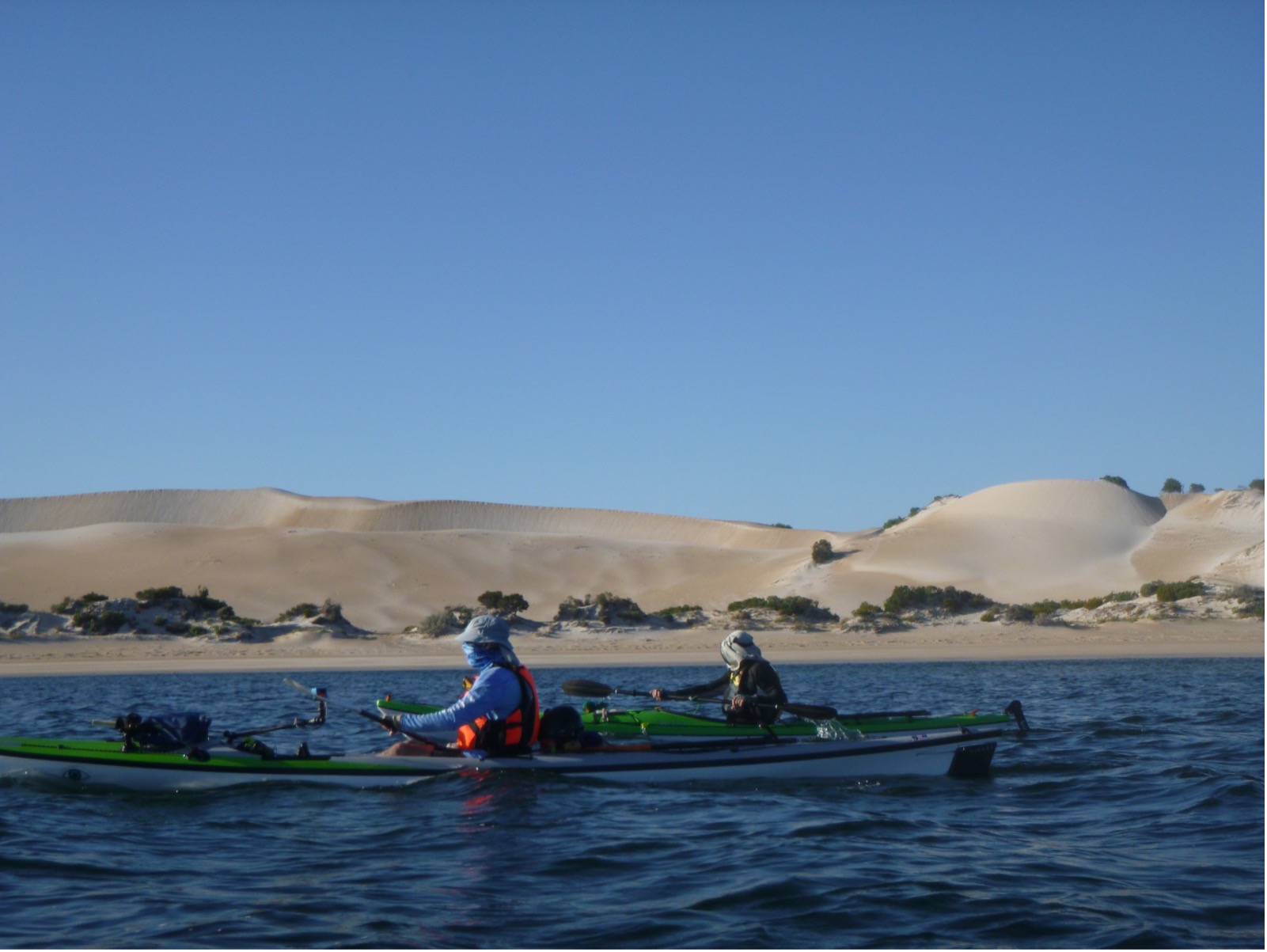
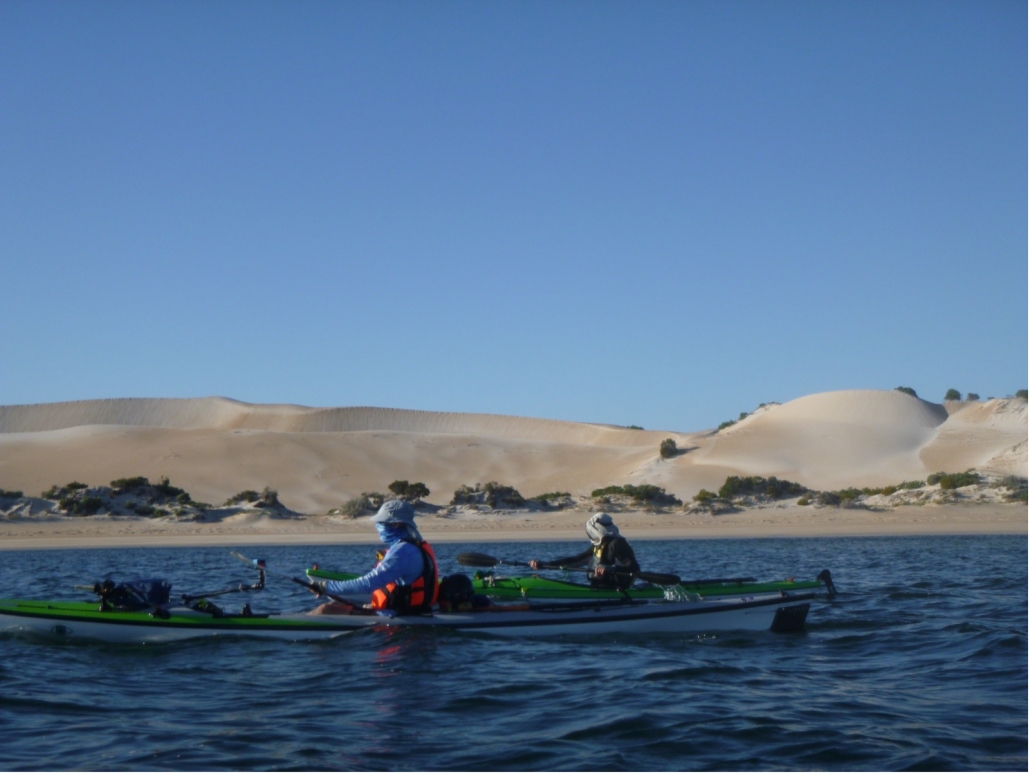
 This was another great day. We started with a slight side wind resulting in the occasional wave coming over the front deck but we were soon in the sheltered waters of the oyster beds (Coffin Bay’s famous industry). We stopped on Point Long Nose for a short break, congratulating ourselves on judging the tide and not running aground on its shallows. Our next stop was the whale skull, stranded quite high up on the beach. By now the slight breeze had completely dropped and we had glassy calm water as we paddled along the sand hills of Seven Mile Beach. Their colours and shapes make this section of the paddle very scenic.
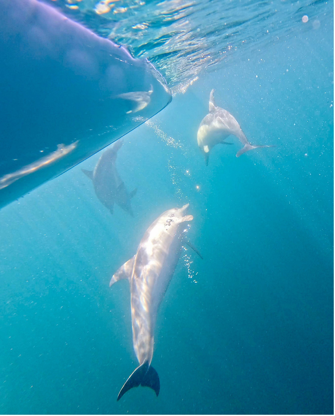
 The day started near perfect, and then the wind dropped further and again we had glassy calm, crystal clear water. The reefs part way along Seven Mile Beach called for another snorkel, rewarding us with lots of different fish. There was a large pod of dolphins feeding near us as we continued along the coast. It was time for lunch when we reached Point Long Nose but we had to eat standing up because the tide was coming in quickly covering the sand. Back in our kayaks the tide rushed us around the point then we headed back through the oyster beds.
 After hugging the cliffs for the first stretch of our paddle back we headed towards the Brothers Islands into a medium head wind. The shelter of the islands gave us a rest and a good view of a couple of big male seals. Luckily they were not interested in us. We timed our return to Coffin Bay township for the incoming tide so even though we still had a head wind we made very good time. After a much appreciated shower our day concluded with dinner at the Yacht Club again.
 We set off out the channel and followed the channel markers out into the gulf. We set off on a heading of 250M from the last channel marker and could see Port Clinton quite plainly. The wind was blowing at 15 kn pushing choppy wind waves under our Port side beam but it was quite manageable. The sea was the colour of an old flat white coffee with sea weed drifting by and the occasional large clumps giving a little distraction in the water. There were numerous white caps out on our port side with the occasional half a metre wave coming through causing the boats to yaw and buck a bit but nothing serious.
 It was nearly Low tide and the water was very low as we came up to the ramp. The give away sign was the yellow tractor 500 m from the High Tide mark standing out in the bay in 200mm of water. It was a long carry up the track to the beach. (Note to self – try to arrange for a High Tide if we do it again, Or bring a trolley.)


 WOW what a weekend paddle to Antechamber Bay on Kangaroo Island we had. It gave us a bit of everything sea kayaking has to offer.
 And so it was…and for a short time conditions were above the forecast 12Knts, probably up to 15 with even some 18Knt gusts. These conditions challenged some of the group and progress was at times quite slow with Ryan suitably tested as leader in keeping the group together. As Backstairs Passage is a commercial shipping lane, kayakers need to stay in a tight grouping and less than 50m apart. This also applied to the mandated equipment the group required for such a paddle. We were in “unprotected waters” where for every 5 paddlers an EPIRB, flares, VHF and other equipment was required and the group must be within 50m of each other and such equipment.
 On the way across we split into two smaller groups. This decision was based on the fact that we had a diversity of sea kayaks in the group. Some very quick and others just quick. I believe all paddlers would have been working their bodies just as hard. It was just a fact that some of the kayaks travelled at a higher speed due to design. At the other side there was only about a 30minute difference in the time to complete the crossing.


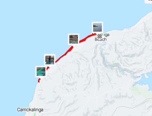
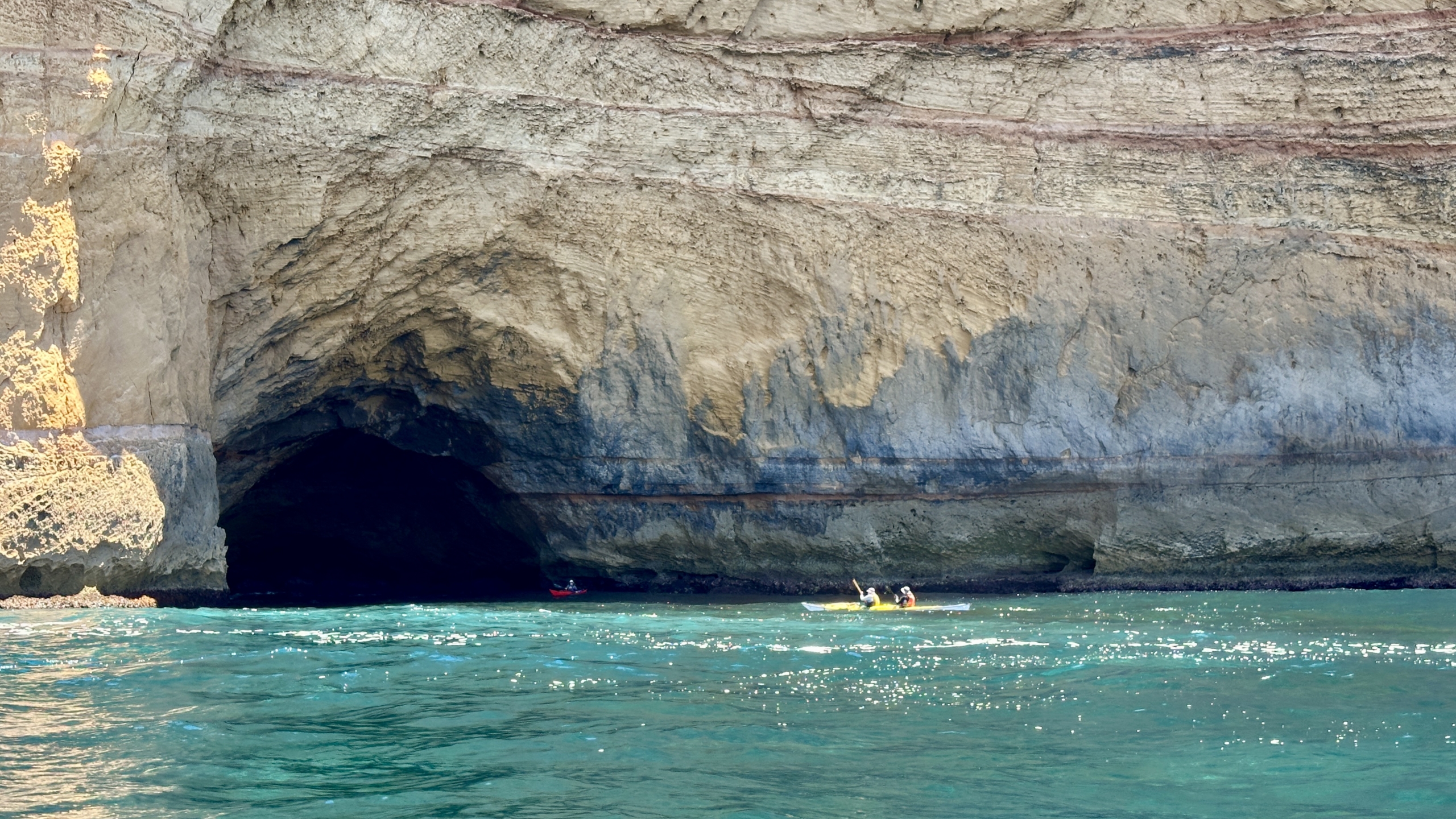
 B, Abelardo, Mark L and Warwick joined Anne and Simon for a paddle. We launched at Myponga Beach and headied south towards Carrickalinga. The sea conditions were perfect – clear water to observe the variety of sea weeds, virtually no wind and flat seas. We had a casual paddle along the rocky cliffs with Charlie leading some rock gardening along the way. There were a few new scratches seen on his boat as he loaded it back onto his car. That must have been from the time he was left high and dry as the very slight swell retreated. Conditions were so calm that we all ventured into caves. Some big enough to turn around in and others very tight, narrow and funnelling the swell to surge your kayak in or out of the gap.
 We had lunch on a small beach just north of Carrickalinga before returning to Myponga Beach.