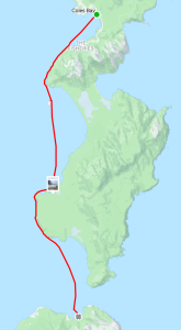
Glenelg River Kayak 3 day trip — 19-22 Feb 2026
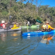
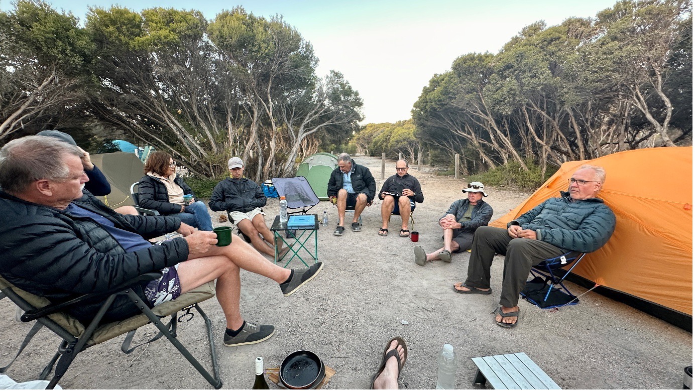
On a perfect Thursday, 9 paddlers with 8 kayaks met up at Nelson Vic Caravan Pk to set up camp in prep for 3 days paddling down the Lower Glenelg River.
This was just a taste of how the weather looked after us for the whole paddle, even giving us enough time to set up camp back at Nelson on kayak day 3, before the predicted rain returned.
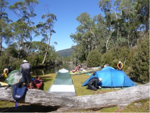
After a meal at the Pub Thursday night, we slept as a fog came in, giving the small seaside town a real fishing town feel. We awoke to a great day, and although there were some experiencing this kind of adventure for the 1st time, and with new equipment and limited set up experience, we set off with plenty of time.
Kayak day 1
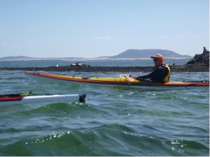
 Thank you Anne and Simon for going the extra mile(lots with the car shuttle) and assisting with the set up of others. We soon relaxed into a leisurely paddle from Moleside campsite to our 1st camp site at Georges Rest. A special mention to new club member Rosemary, for her effort, her great attitude, and enduring some members humour, persevering with steering issues and water intake until camp. While setting up camp, and cooking a meal, Rosemary also re-adjusted her kayak setup and repaired a hole…all before the sunset. Great effort for a 1st timer. Another test to Rosemary, and to all, was the organiser ( me) had sourced wrong info, and the paddle was 3.5km longer than predicted. The obligatory ribbing was received.
Kayak Day 2
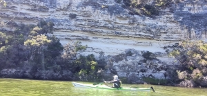
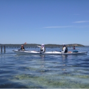
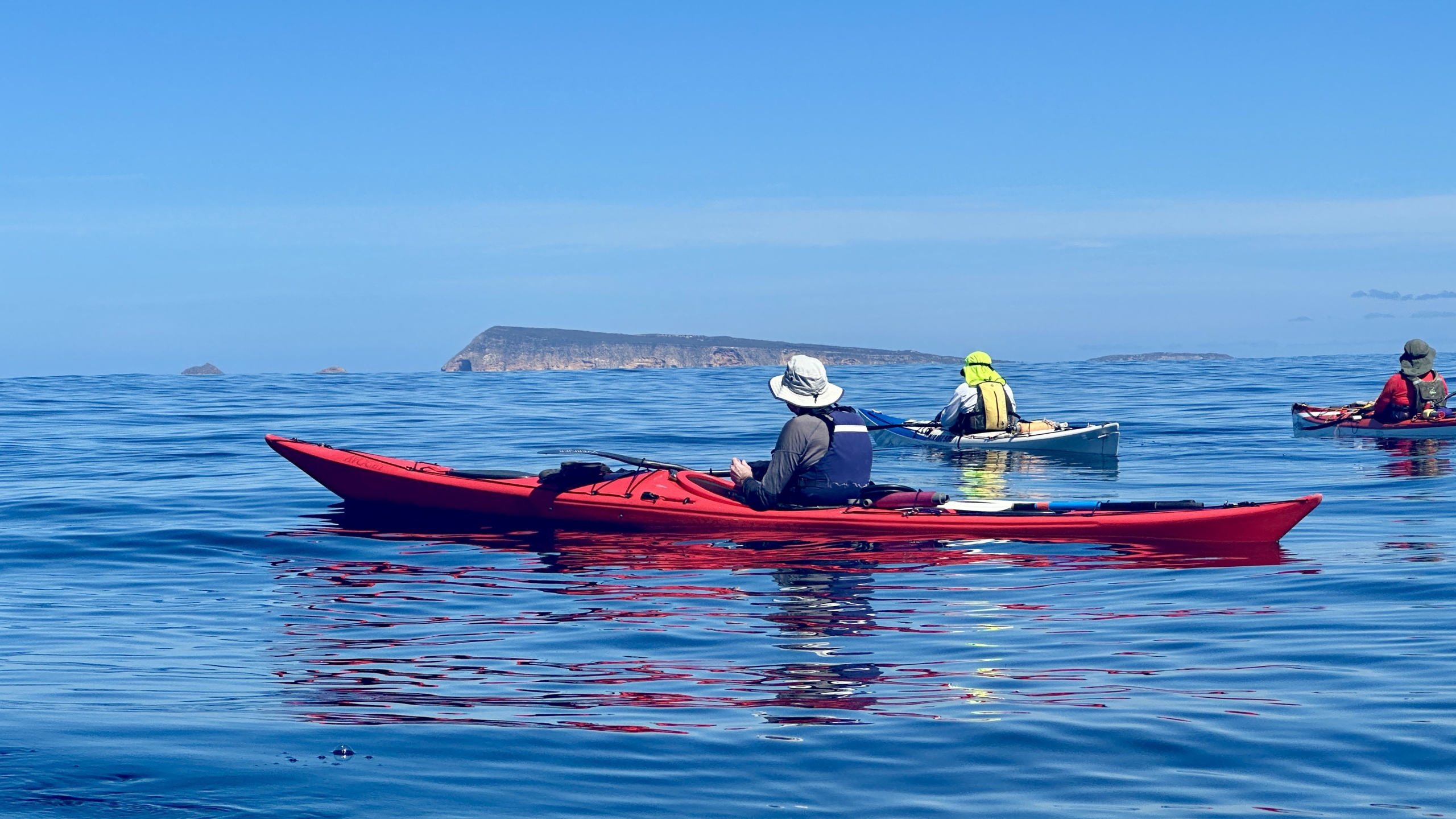
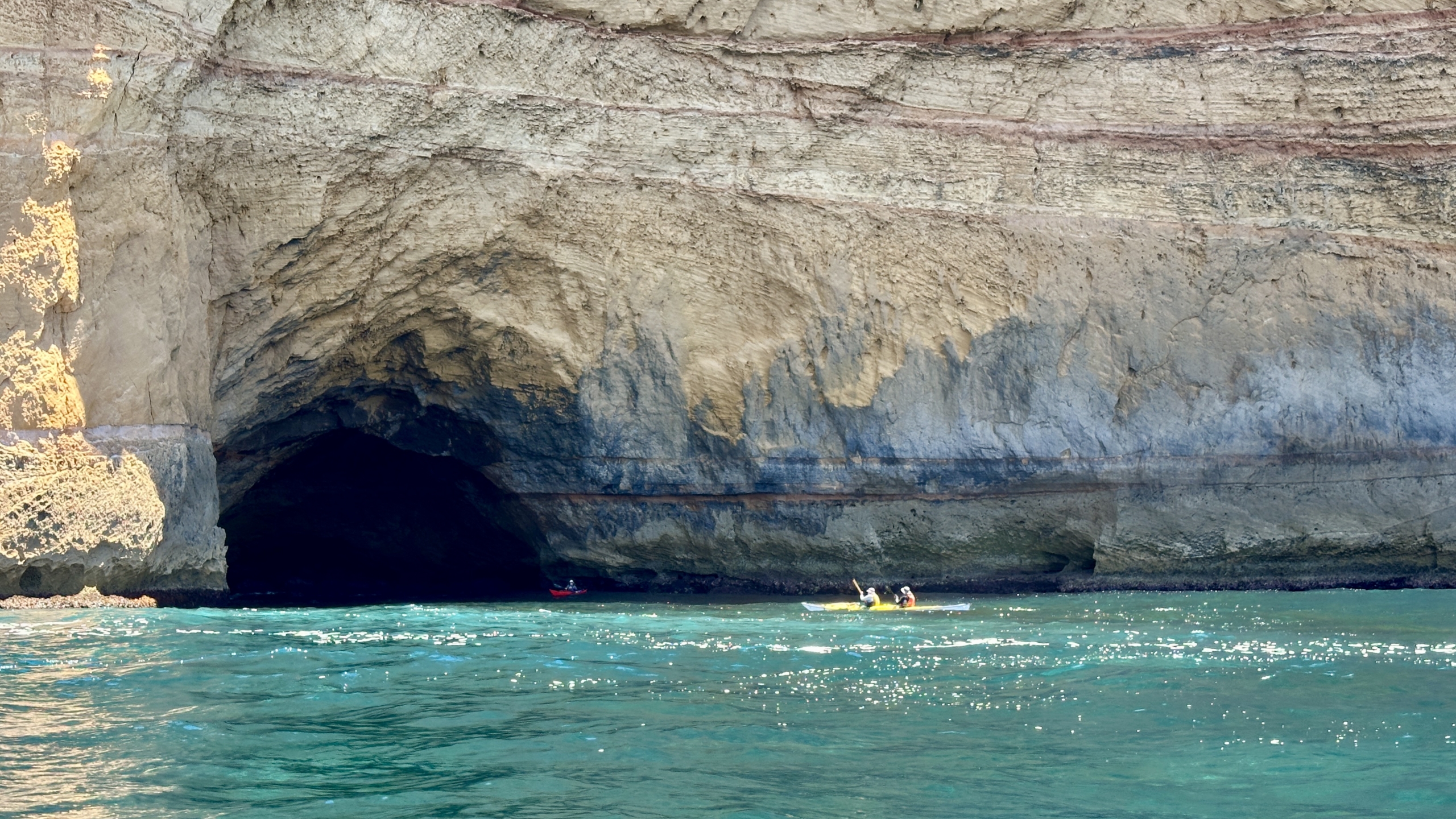
 The second day had a perfect 18km paddle to Lasslets Camp site. The weather was cool, the rest stops lovely, and bird life interesting. Many experienced emus in water for the 1st time. The very relaxed atmosphere of the paddles each day, led to paddlers playing under branches, around obstacles, into caves and under over hanging cliffs. A little bit of splashing, racing and bumping may have going on as well.
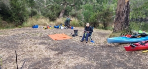
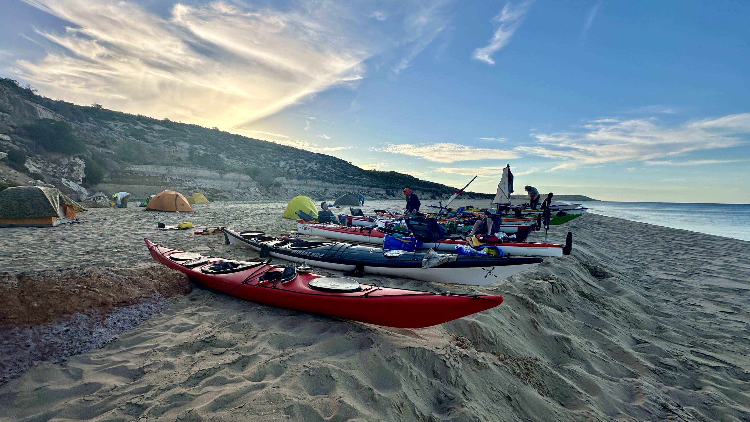
At the campsite, most took the opportunity for a swim, a read, or just soaking up the vibe. There were other paddling campers on the site, and all were commenting and predicting the concerning weather info we were expecting that night and the next day. We all retired for the night prepared for the possibility that it would be an AM packing of kayaks in the rain, then paddling in some rain and probable increasing head winds, and possible lightning.
Kayak Day 3
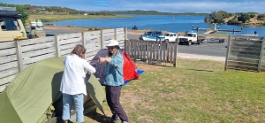 What we received instead was: the rain stopping well before we arose. Then a breeze actually assisted us all morning heading West, and again after a break, when the river was now meandering East toward Nelson as the wind then strengthened to a steady following wind, making our last hour a very comfortable and hastened paddle. Rosemary, had to work a bit as she adjusted to the following winds in her new kayak, but soon appreciated the extra speed. This ended up being the perfect 15km to finish the trip. The scenery, the cliffs and the greenery were much enjoyed each day. There was no lightning and the rain held of till we had packed up at Nelson, and set up our tents. Dinner was again at the local hotel, where various fresh made pizzas were enjoyed along with a few drinks and laughs.
Kayak Day 4
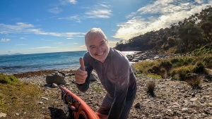
The next morning, we all parted company, some enjoying a visit to the beach lookout before saying goodbye. All very fortunate regarding: the weather, the campsites, the well kept toilets, the minimal mosquitos, ants and flies, and no leeches. It was one of those paddles where all got a lot out of the adventure and the company.
Highlights
At the end of each paddle day, Anne sourced highlight comments from each paddler. Here is a selection summary of responses:
- Day 1: The different colours of green, impenetrable scrub on each side, conversations with others, relaxed, companionable, good crew, Berny ‘flying past’ as he towed Rosemary. Going under low branches.
- Day 2, Limestone Cliffs and swimming at camp, exchanging paddles, trying a greenland, helpful tips, bird life, a Great Crested Grebe.
- Day 3, Fortunate, Fulfilled, Friends, Fun, Conversations, Spacious, Awesome, Good, Good, Good. Cliffs, Caves. Tail Winds, Stunning Scenery. Jokes, Magnificent.
And some insider comments:
- “Upside-down, right way up, and Forward (referring to the changing progress of Rosemary’s Kayak experience.)”
- “Its a scream ( referring to a certain paddlers vocal responses while kayaking into, around and under various tree overhangs.)”
- Lets go under that branch (referring to certain paddlers enjoying the challenge and sometimes testing physics and height limitations.)
- Weekend With Berny ( Alluding to A movie comedy).
Joke of the paddle: What do you call a man with a Rubber Toe? Roberto.
All very hilarious, I know. But all said a very good paddle, and great crew.
 The paddle out from Coffin Bay township to Black Springs camping area was great. We saw seals on The Brothers Islands and lots of marine bird life. We booked our usual camp site which has a beautiful view over the water towards the oyster beds and Point Longnose. Highlights of the day included the small beach we stopped at for lunch, catching a ride on the swell and looking into the crystal clear water.
 On the third day we relocated to the sheltered side of Lincoln National Park. The road into the camp ground at Woodcutters Beach was 4WD and gave some of us their first experience of bouncing over rocky ground and missing pot holes. The drive was well worth the effort as we had a beautiful beach-side camp all to ourselves. In the afternoon we walked to Stamford Beach and then up to the monument on Stanford Hill before completing the loop back to camp.
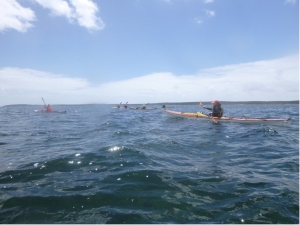 Overall we had a great week. Everyone was friendly, fun and flexible as we discussed alternatives and problem solved the weather forecast, coming up with Plan B which worked very well.
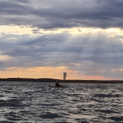


 In discussing the likely conditions on the night before there was some concern at the forecast 20Kn southerly winds that we would need to punch into for the 24Km down to Schouten Island. The group decided to give it a go. We had contingency plans to camp at Cook’s Beach or one of the other pristine beaches along the way if all got too much.
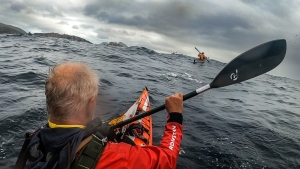 The forecast for this day was for a 2m swell but light winds so we looked forward to an easy trip up the coast. On paddling out of the shelter of the bay we met huge mountains of water charging down the channel between the island and the peninsula. The paddle up to Wineglass Bay was not going to be as easy as discussions the night before suggested. Most had not paddled in such a swell and those that had took time to adjust. Once out of the channel and heading north along the cliffs things got worse as the 4m swell hitting the cliffs gave huge rebound effects creating clapotis like waves.
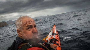 At times, when perched on top of a steep peak, it was hard to reach the water with your paddle! The leaders surveyed the group to ascertain if all were confident to continue as planned. Surprisingly all were up to it and after a time settled into the task with confidence. Being on top of one of the extra large swells and looking 5-6m down the face to the paddlers in front of the group was extraordinary. This day was a challenging, exhilarating paddle pushing everyone to their limits. We described it as “dirty dancing with the sea” or like “paddling in a washing machine”.
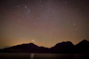


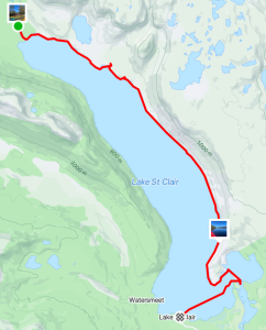
 We set off at about 10am in perfect conditions, a slight breeze and blue sky. The tree covered hills of old growth forest and mountains in the distance provided stunning scenery as we paddled up to Echo Point for an early lunch stop. There was a tiger snake on the beach as we pulled in but it quickly disappeared into the scrub. Then it was on to Narcissus Hut, which is a short paddle up a small creek from the end of the lake. The landing spot at the hut was very steep so we paddled further up the creek and found a large, flat, grass-covered area and quickly had kayaks landed and tents up. A few people took advantage of the afternoon to go for a hike.
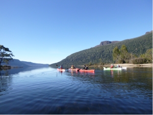 The glassy water was covered in mist as we paddled out from our creek and into the main lake. With the sun shining, we had amazing reflections of the trees lining the bank and the mountains. We paddled down the eastern side looking for a creek that came out from Lake Laura. The plan was to walk up the creek to see the lake. The attempt looked quite funny for those who opted not to try. The intrepid explorers were still visible, giving up after only a short distance, because the scrub was impenetrable and the creek rocks were difficult to negotiate.
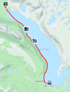


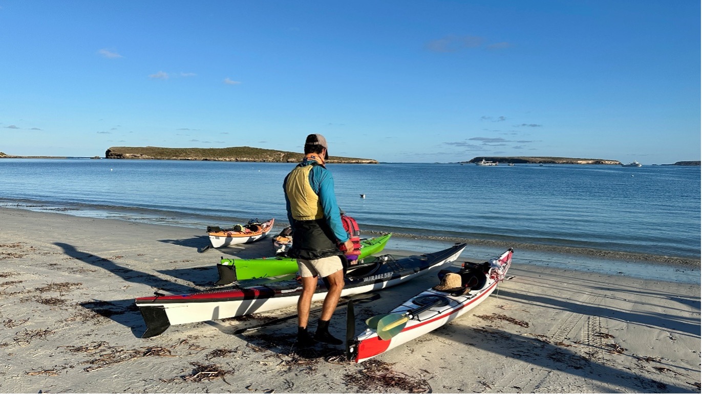
 We arrived at the launching spot near Customs House Houseboats about midday on Saturday. We quickly unloaded the kayaks from the cars and packed, as we were all eager to set off before it got too hot. A short paddle across the river, and then we let the current take us down Suders creek to get to Hypurna Creek. This was not as eventful as it normally is. The big tree which normally blocks the creek seems to have been washed away which made the trip down relatively easy.
 After finding a suitable campsite we pulled up and set up camp. We soon put up tents, inflated mattresses, assembled tables and chairs. After such effort, we took a cooling swim in the creek, disturbed only by the shrimps nibbling on your feet if you stayed still for too long.
 Luckily Wiperna creek proved to be mostly clear despite being narrower than all the other creeks we had been through. Mostly clear. Right at the end, 100 m from the camp, the creek was completely blocked by a large fallen tree, necessitating people having the climb out of their kayaks, onto the log, drag the kayak over the log, and then climb back in again. Some people opted to skip the last step and just walked back to camp while the kayaks drifted back.
 Next morning we packed up the camp and headed off down Hypurna creek. This time with the current so all the obstacles were a bit easier to manage. We opted to do a short (100m) portage to get back to the Murray rather than try and paddle back up Suders creek. This wasn’t too bad despite the kayaks being loaded. Carry straps and six people per kayak made short work of it. We took the opportunity to have a final swim before setting off to do the final few kilometres to get back to the launching spot.


 This was another great day. We started with a slight side wind resulting in the occasional wave coming over the front deck but we were soon in the sheltered waters of the oyster beds (Coffin Bay’s famous industry). We stopped on Point Long Nose for a short break, congratulating ourselves on judging the tide and not running aground on its shallows. Our next stop was the whale skull, stranded quite high up on the beach. By now the slight breeze had completely dropped and we had glassy calm water as we paddled along the sand hills of Seven Mile Beach. Their colours and shapes make this section of the paddle very scenic.
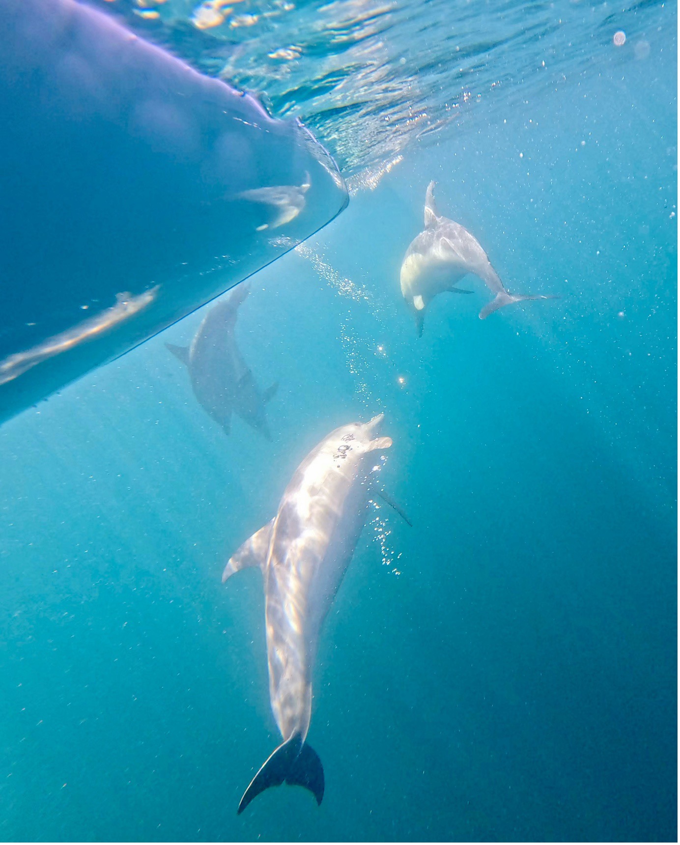
 The day started near perfect, and then the wind dropped further and again we had glassy calm, crystal clear water. The reefs part way along Seven Mile Beach called for another snorkel, rewarding us with lots of different fish. There was a large pod of dolphins feeding near us as we continued along the coast. It was time for lunch when we reached Point Long Nose but we had to eat standing up because the tide was coming in quickly covering the sand. Back in our kayaks the tide rushed us around the point then we headed back through the oyster beds.
 After hugging the cliffs for the first stretch of our paddle back we headed towards the Brothers Islands into a medium head wind. The shelter of the islands gave us a rest and a good view of a couple of big male seals. Luckily they were not interested in us. We timed our return to Coffin Bay township for the incoming tide so even though we still had a head wind we made very good time. After a much appreciated shower our day concluded with dinner at the Yacht Club again.
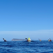


 With almost perfect conditions, the group enjoyed the serene views offered by the glassy water. At times, landmarks disappeared behind mirages, sparking conversations about this fascinating phenomenon as we paddled closer to them.
 The next day, the weather forecast predicted winds of up to 16 knots, but the reality was even more challenging, with winds exceeding 20 knots hitting the sides of our boats throughout the day. Despite the tough conditions, the paddlers handled them with expert skills, making for an exhilarating paddle across the rest of the lake. We travelled from the Narrows to Point Sturt for lunch and then from Point


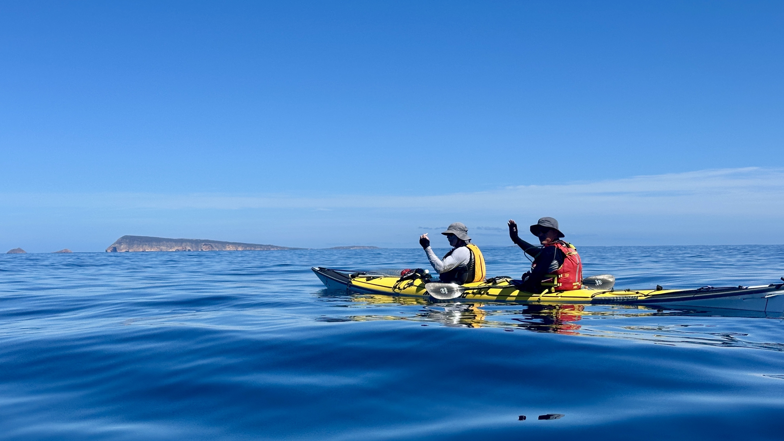
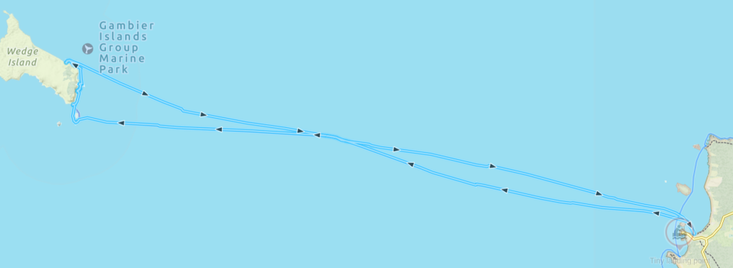
 WOW what a weekend paddle to Antechamber Bay on Kangaroo Island we had. It gave us a bit of everything sea kayaking has to offer.
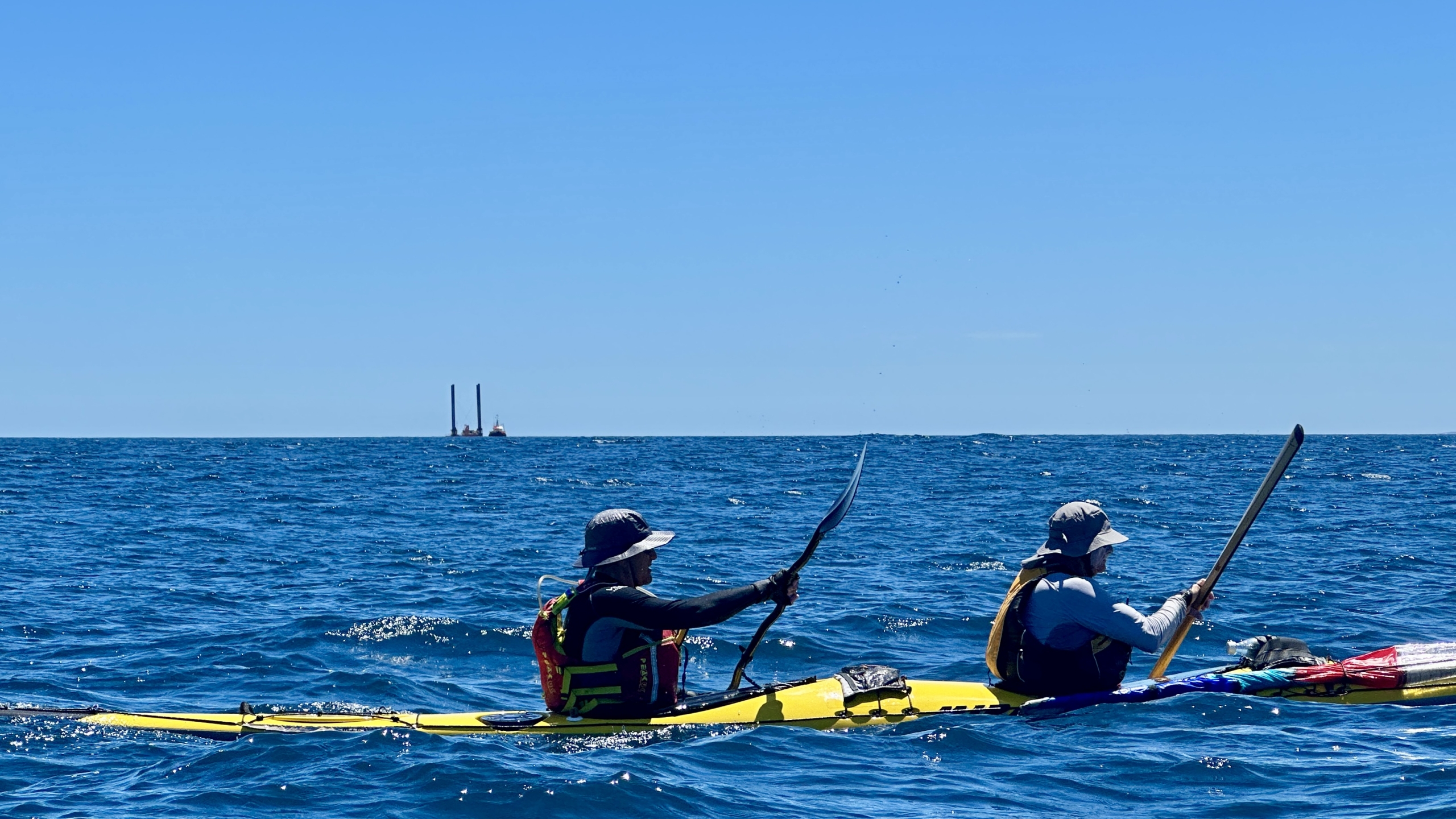
 And so it was…and for a short time conditions were above the forecast 12Knts, probably up to 15 with even some 18Knt gusts. These conditions challenged some of the group and progress was at times quite slow with Ryan suitably tested as leader in keeping the group together. As Backstairs Passage is a commercial shipping lane, kayakers need to stay in a tight grouping and less than 50m apart. This also applied to the mandated equipment the group required for such a paddle. We were in “unprotected waters” where for every 5 paddlers an EPIRB, flares, VHF and other equipment was required and the group must be within 50m of each other and such equipment.
 On the way across we split into two smaller groups. This decision was based on the fact that we had a diversity of sea kayaks in the group. Some very quick and others just quick. I believe all paddlers would have been working their bodies just as hard. It was just a fact that some of the kayaks travelled at a higher speed due to design. At the other side there was only about a 30minute difference in the time to complete the crossing.


