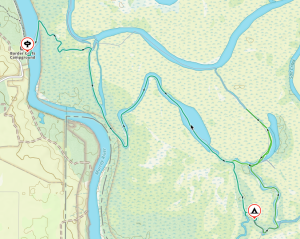
Murray River backwaters car camping – Katarapto, Eckerts Creek, The Splash — 19-21 September 2025
First Day
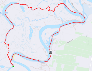
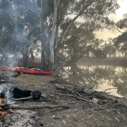
 Everyone arrived at the campsite on Friday, for a relaxed setup and chat around the fire. On-the-water time was set for 9:30 am on Saturday, but by 9am everyone was all set up and ready to go, so we set off up the Murray towards Lock 4, with a nice tailwind to help us along. Bernie phoned the lockmaster just before we got there, so there was no delay once we arrived. After everyone entered the lock, the gate closed behind us and we chatted to the lockmaster as the waters lifted us up, and the upstream gates opened.
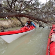
Just after the lock we took a scenic shortcut through the Ajax-Achilles Lakes and then continued up the Murray until we reached the entrance to Eckerts creek. An easy portage had us over the regulator, and then we let the water carry us downstream, weaving around all the fallen trees. One tree proved to be impassable, until Abelardo got out his trusty saw and cut us a way through.
Onto Eckerts Creek
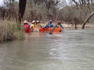
 Eventually we reached the Eckerts Creek Wide Waters, where the creek opened up into a nice, wide oxbow lake. We paddle up into a stiff headwind, which gradually turned into a welcome tailwind as we moved around the curve of the lake. After we reached the end of the lake, we continued down the creek until we reached Sawmill Creek, which would take us back to the Murray and our campsite.
Sawmill Creek is a very narrow waterway, luckily this time there was an artificial flooding event happening, and there was plenty of water in the creek. After a small portage around the regulator at the end of the creek we were back in the Murray river, and only a few hundred meters from our campsite.
Second Day
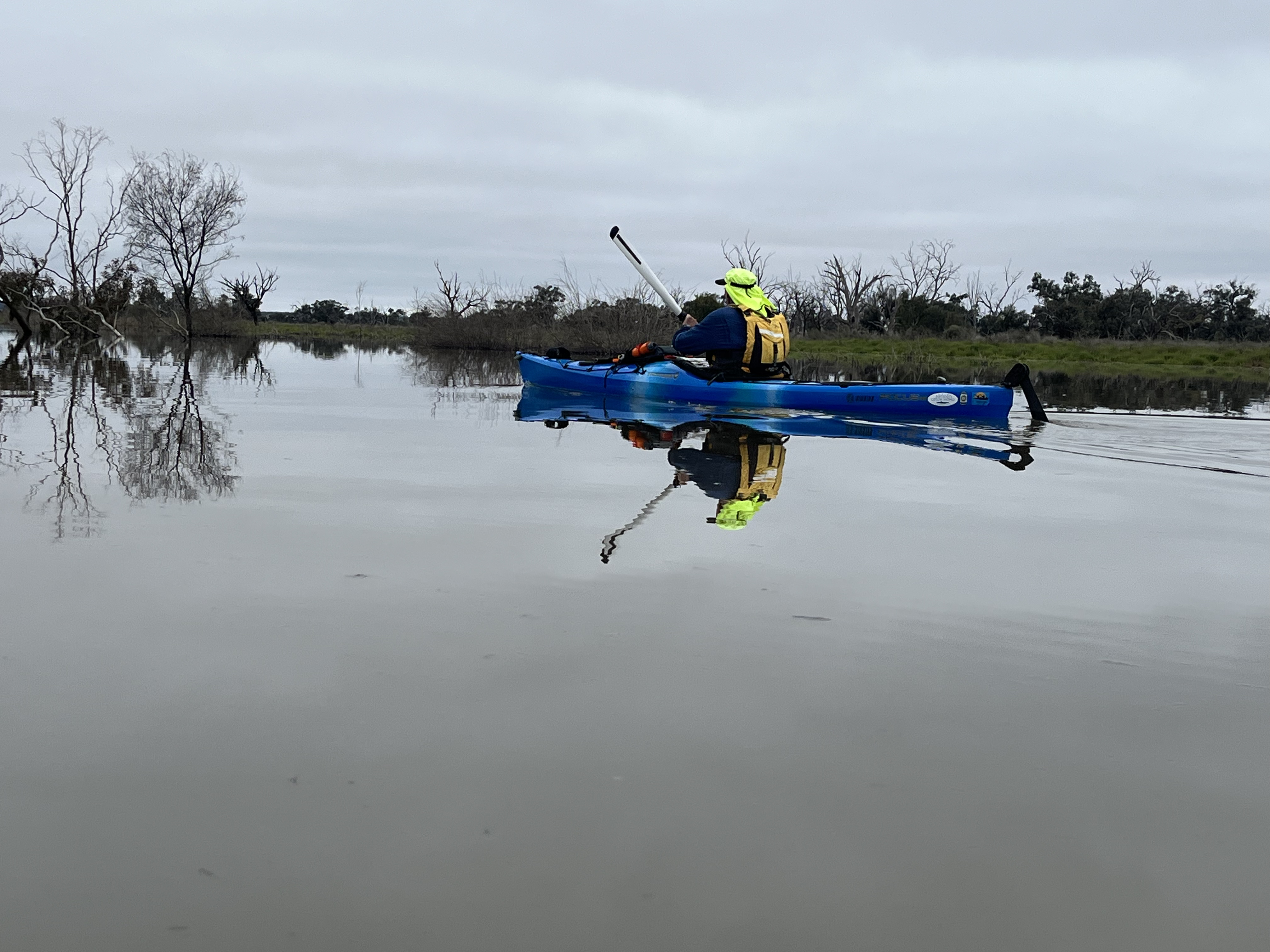
 Sunday morning we packed up the camp first, before heading downstream to do a loop in the opposite direction. The first obstacle was the rocky weir just below the campsite. There was a good flow of water over the rocks, and despite some trepidation, everyone managed to paddle over the weir and navigate the turbulent water below it without and capsizes.
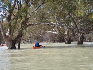
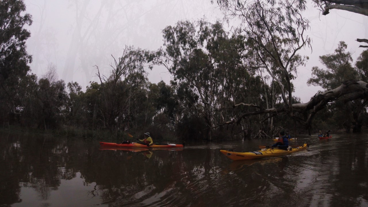
We continued down Katarapko creek until we reached the regulator at the end of The Splash. Unfortunately, due to the artificial flooding event the regulator was closed, necessitating a difficult portage over the regulator. We were rewarded with the creek being in full flood above the regulator, and continued upstream, meandering amongst the trees along the flooded creek. A leisurely paddle, with much checking of the GPS to make sure we didn’t end up in a dead end in the floodplain, we followed the creek up until we reached Sawmill Creek again, but this time from the other side.
Wrapping up
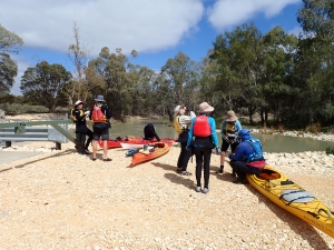
Another short paddle down the creek, around the many fallen trees, and over the regulator, and we were back at the cars and ready to return home. With a stop at the nearest bakery first of course.
Overall Statistics (Links point to GPX files)
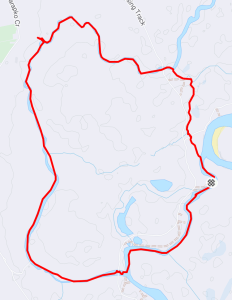


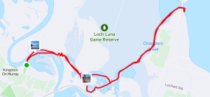
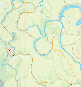
 Based at the recently reopened Kingston-On-Murray caravan park, we launched on a gloriously sunny Saturday morning and made our way up the Murray river to the small creek which gives you access to all the backwater channels of the Chambers Creek and Loch Luna channels. We opted to explore the Chamber Creek side first, and so turned right at the end of the creek, into Chambers Creek, slowly meandering up the creek trying not to disturb all the pelicans, swans and other birdlife. Conditions were so good, and everyone was paddling so well, that we got ambitious and opted to go all the up the creek to Lake Bonny for lunch. After a quick lunch we launched again for the trip home, aided by a gentle tail wind. The recent floods seems to have cleaned out some of the channels, as we were able to return via some previously reeded-up routes. It was amazing to see the height of the flood levels marked on the trees, at least 5 meters above the waterline and well above the surrounding floodplain, the water must have spread out for kilometers. We reached the campsite again at 3:30 pm having traveled 19.1 km (by my GPS), just within the trip leaders promised distance of “oh, definitely less than 20km”.
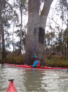 Sunday morning the weather forecast had deteriorated a bit, with winds up the 15 knots forecast, so we cancelled our plans of paddling down the Murray, and headed back into the sheltered backwaters, this time heading north up Nockburra Creek towards Loch Luna. We made our way slowly up the creek until it opened in Loch Luna, the weather forecast was a bit optimistic as the Loch was a mass of waves and whitecaps, with winds of at least 20 knots. We immediately cancelled any thoughts of exploring the Loch, and turned tail back down the sheltered creeks, away from the wind. We slowly made our way back down a different creek towards the Murray, sticking close the bank to shelter from the wind. Luckily the wind had dropped a bit by the time we reached the camp so loading the kayaks on the cars wasn’t too much of a problem.
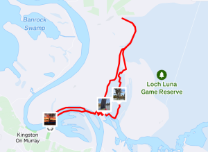
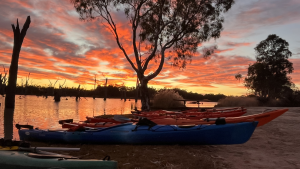

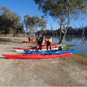
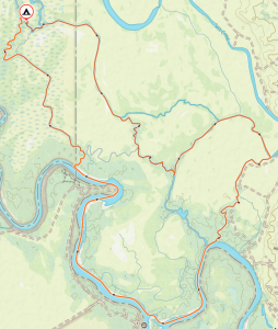
 We arrived at the launching spot near Customs House Houseboats about midday on Saturday. We quickly unloaded the kayaks from the cars and packed, as we were all eager to set off before it got too hot. A short paddle across the river, and then we let the current take us down Suders creek to get to Hypurna Creek. This was not as eventful as it normally is. The big tree which normally blocks the creek seems to have been washed away which made the trip down relatively easy.
 After finding a suitable campsite we pulled up and set up camp. We soon put up tents, inflated mattresses, assembled tables and chairs. After such effort, we took a cooling swim in the creek, disturbed only by the shrimps nibbling on your feet if you stayed still for too long.
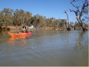
 Luckily Wiperna creek proved to be mostly clear despite being narrower than all the other creeks we had been through. Mostly clear. Right at the end, 100 m from the camp, the creek was completely blocked by a large fallen tree, necessitating people having the climb out of their kayaks, onto the log, drag the kayak over the log, and then climb back in again. Some people opted to skip the last step and just walked back to camp while the kayaks drifted back.
 Next morning we packed up the camp and headed off down Hypurna creek. This time with the current so all the obstacles were a bit easier to manage. We opted to do a short (100m) portage to get back to the Murray rather than try and paddle back up Suders creek. This wasn’t too bad despite the kayaks being loaded. Carry straps and six people per kayak made short work of it. We took the opportunity to have a final swim before setting off to do the final few kilometres to get back to the launching spot.


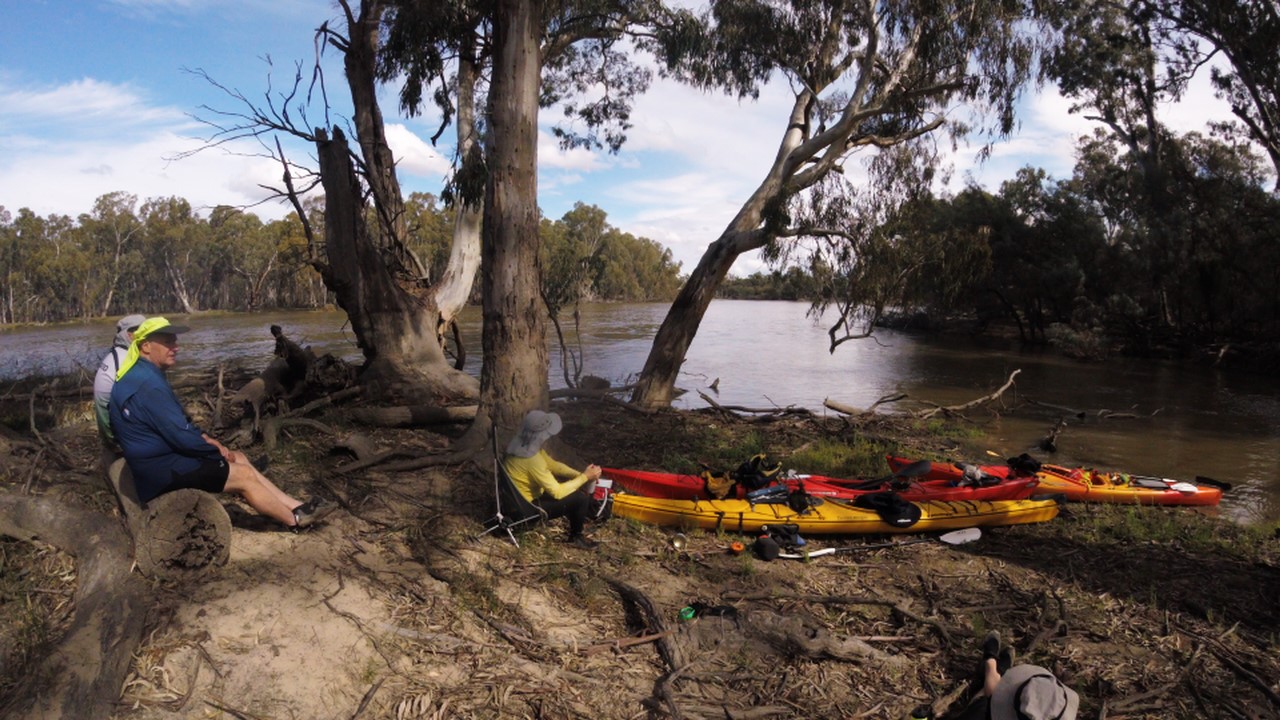
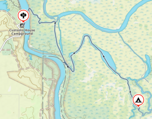
 That afternoon we had a short paddle down Katarapto Creek to check out the regulator at the bottom of The Splash, which, to our alarm, was closed. This would mean a nasty portage in the coming days. We all retreated back to the campsite to discuss options around the campfire with a glass of wine.
 After a much dragging of kayaks over, under and around logs, we eventually got to clear water where the creek widened out into a horseshoe lake, which abounded with pelicans and other birds.
 Sunday morning we headed off in the other direction, down Katarapko creek. Everyone had fun running the short white-water section over the weir, and we let the current take us down to the massive regulator at the end of The Splash. This is normally open to paddle through, but the Parks Board had closed it off to create an artificial flooding event upstream. This meant a strenuous portage over the weir, luckily everyone was still fresh and the kayaks were unladen. The regulators are good for the river, but I wish they would consider the kayakers and give us some good access points.


