Crossing of Backstairs Passage from Cape Jervis to Penneshaw and return — 25-26 May 2024

The crossing of Backstairs Passage from Cape Jervis to Penneshaw and return on Saturday 25th and Sunday 26th May really achieved it’s main goals- a challenging paddle with a great camp at the end. The trip was also part of the Sea Leadership Program conducted by Paddle SA Education/Phil Doddridge. Greg A and Hugh Mac are undergoing this training.

The Preparation

Preparing for departure

Pre-departure picture

Backstairs Passage is exposed and it is rare to get calm days but we scored a beauty for the paddle over to Penneshaw. We had favourable winds, tides and sunny skies. The temperature was quite mild once the sun came up given winter was just a few days away.

The paddlers were:

  • Phil Doddridge paddling in double with Hugh Macmillan (Mirage 730)
  • Abelardo Pardo paddling in double with Marg Doddridge (Delta 20T)
  • Mike Dunn (Mirage 583)
  • Matthew Eldred (Delta 17)
  • Jason Schulz (Seabird Discovery)
  • Ryan McGowan (Delta 17)
  • Berny Lohmann (Perception Ecobezig)
  • Greg Adams (Expedition Kayaks Audax)

Marg, Jason, Ryan and Berny were attempting the KI Crossing for the first time. Greg was doing Cape Jervis to Penneshaw for the first time. He had done Antechamber Bay to Cape Jervis last year as part of the Victor Harbor to Adelaide expedition.

Up Early

Chat before departure

First strokes

To get the tide just right the group needed to be taking first strokes by 8am which, for some, meant being on the beach by 7am to get packed. Marg and I however had decided to stay in one of the Eco Tents at the Seafront Holiday Park and had little to pack. I highly recommend this option should the trip be repeated in the future-luxury! We also were going to the Penneshaw Hotel for dinner which lightened the load further.

The coastal views across the Passage were stunning as we gathered for our 730am briefing. An important logistical issue in doing this trip is to stay well out of the path of the KI Ferry. We notified the business of our presence and planned a path well to the east and parallel to the ferry route. The first part of our journey was to Land’s End before heading out across the Passage; this would keep us well east of the ferry. On the crossing our heading was 220ºM. As part of the sea leadership training I discussed the best way to keep the group together and on track. From past experience I found that having a lead paddler out in front with others following achieved the best outcome. At least one paddler needed a compass designed for use at sea; better if two paddlers are equipped and can check each others readings.

Once at Land’s End I swung the kayak to the required heading and identified a prominent feature on the hills of KI. Each paddler took turns in leading the group and paddling at our target. The paddler leading the group does not need a compass; if they have one their focus is on the identified feature in the distance NOT the compass! This is for accuracy and to avoid sea sickness.

Breaking it into stages

It is more demanding to be out in front so the lead paddler was changed each 30-40 minutes. At the change the heading was checked and the feature to aim for was adjusted. To allow for tidal influence we used a technique called “splitting the tide”. The first half of the journey was done in the ebbing tide taking us further to the east and the second half in the flooding tide bringing us back to the west. We planned to be half way at 930am. Up until 930am each of the features to aim for were slightly east of the last. From 930am the features moved slightly westward due to the tide.

There are images of the plans and actual route as recorded on a GPS attached.

The Crossing

Middle of the crossing

It was a fantastic crossing, one of the best I have experienced. Unfortunately for kayak sailors there was not enough wind to fill the sails! For safety the group had at least one sail up so other vessels would see us more clearly. On the day two container vessels went through although I do not think that they would have altered their course if they saw us in the way! It is surprising just how fast these big vessels move and how quickly they go from a spot on the horizon to a big hunk of metal in close proximity! An old saying that applies here “Never take your eyes off the ocean”; I regularly did a 360º scan of the horizon!

We had several members of the group carrying injuries and I was concerned about the rate we could paddle at. I have very badly damaged shoulders and chose to paddle in a double to take some of the pressure off…a Mirage 730 is a very fast kayak needing much less effort than any other I have paddled to cover the kilometres. Paddling with Hugh Mac made it even less of an effort! In fact for the first half of the journey I don’t think I added to progress at all, Hugh did it all.

The second half

Clear water in Penneshaw

Arrival to Penneshaw

In the second half the group needed to give Jason a helping hand. ACC events are notorious for travelling at a “fair clip”! Jason’s 4.3 m Seabird was no match for the 5.8m Deltas, Mirages and of course the two doubles in the fleet. The initial tow was applied by Matt and after he had done his bit Phil and Hugh Mac took over. I always like having doubles on potentially challenging trips for this reason, they are brilliant towing vessels; the effort needed by two paddlers is much less. After awhile we applied a “V” tow with both doubles powering Jason’s kayak along. I’ll be willing to bet that was the fastest the little Seabird had ever gone!

The crossing was completed in a little more that three hours and we arrived in Penneshaw in bright sunshine and landed on the white sand beach through crystal clear water(see pics). The Seafront Holiday Park was just over the sand dunes and the group had a leisurely lunch before making camp.

Accommodation and Dinner

Penneshaw Beach

Chat before dinner

I was impressed by the improvements made to the caravan park since last visit. Besides us low budget kayak travellers there were a lot of beefed up 4×4’s towing big caravans…I see this where ever I go! So much for minimal impact travelling (personal budget and planet). The hot showers were a treat! After an afternoon of chatting and comparing notes the group walked into the Penneshaw Hotel for dinner. The hotel too had undergone a makeover since last I was there. The food was great as were a few wines or beers depending on personal preference!

Catching the last Ferry back

We said farewell to Greg and Mike shortly after dinner as they were catching the 10pm ferry back. Mike had commitments for Sunday and Greg had caught a ride down with him. It was a stunning night for a boat trip! Jason also chose to take the ferry back next day.

The Return

About to launch into return

Sunday’s weather forecast was for a warm day with light northerly winds and our plans were to make a leisurely paddle down to Cuttlefish Bay before heading back to Cape Jervis on the incoming tide. This would have made the trip about 5Km longer than journey over. Well a forecast is only a forecast and the weather gods had other ideas! As we were preparing to launch the winds were a little stronger than forecast. The seas were a little rough with small whitecaps forming out in the Passage. Small surf was breaking on the beach which unfortunately meant a wet launch if your timing was out. The group decided to stay to plan and see how things developed.

Direct to Cape Jervis

It wasn’t long before it was obvious our plans were best changed. Traveling along the rocky coast had us in confused seas with a lot of rebounding waves. The group moved further out away from the coast but there was little difference. It was bumpy, wet and hard work. A quick survey of the group voted for a change of plans and we would head direct to Cape Jervis hoping that as we went further from the coast the seas would calm down a bit. This plan worked for a while and then the wind began to increase; recordings in the area had it peaking at 20Knots during our crossing. Initially I had the lead paddler just keeping to a heading based on best “course over the ground” navigation. This had us punching almost directly into the wind/waves which was slow and energy sapping.

Or not so direct…

Forecast? What forecast?

Another saying I have is “best to get a crossing done, quickly as achievable, and sort it out on the other side”. I changed the group’s heading so that the wind and waves would hit us on an angle of 30-40 degrees from the bow. This meant we would travel faster with less strain on each stroke and would be a little drier. Unfortunately the dry bit did not apply to Marg and myself who were in the front seat of the doubles; the kayak is simply too heavy to lift over the waves so it just plowed through and the waves slapped us in the face!

Needless to say we were all pretty tired when we reached the coastline just east of Cape Jervis. As I had set up navigation to have us east of Cape Jervis and the final few kilometres were aided by the flooding tide to the west…a welcome relief. The crossing back took three and half hours; it felt like double that!

Back in Cape Jervis

When acting as leader I always prefer to have my group land as one and insisted we all just “float” in on the tide as there was no hurry. Also in the last few hundred metres on approach to Cape Jervis the group would encounter a strong tidal race that forms off the breakwater. If you don’t know what it is like it can sweep you past the entrance to the harbour and it was really pumping!

The tidal race can also sweep you into the path of the ferry which would just be bad advertising for the competence of sea kayakers!

So we paddled into the harbour happy in having accomplished a significant milestone also avoiding the tidal race to be greeted by a Marine Safety Compliance Officer on the beach. He seemed happy but had many questions for me relating to the safety of our trip and the gear we were carrying. In the centre of the Passage we were more than 2NM from either shore and in “Unprotected Waters” (See the Marine Safety SA’s page on Boating safely: equipment & operation).

Safety Equipment

The group was required to carry the prescribed safety equipment. Paraphrasing Marine Safety SA…“when travelling as a group with at least 2 other vessels(kayaks)… within 50 metres of each other…one vessel can carrying 2 hand held red flares, 2 hand held orange smoke flares, 1 compass, a map or chart of the area of operation and an EPIRB.. the other vessels are exempt from carrying the equipment”.

Another way of doing this is for the group to have all the gear but carried by different group members. The prescribed equipment is carried for up to five paddlers. If more paddlers are in the group then a full set is required for each group of five or part thereof. We had all the gear. The compliance officer just questioned me and did not want to sight the gear. (Bernard G commented that he has been checked by officers on his trips in this area previously). All of this is for the safety of those at sea and I am appreciative of Marine Safety doing their job!

After all the excitement the gear was loaded onto vehicles, some of the group had to head off but Phil, Marg, Matt and Berny headed to the ferry terminal for a coffee and review of the day before beginning the drive home.

Conclusion

The attached pics tell more of the story. This was one of the most enjoyable crossings that I have done; probably approaching 20 or so over the past 30 years! Great conditions for the most part, great people to share the adventure with and we are so lucky in SA to have such a coastline to explore. Thanks to all who took part and the support crews who helped with transport.

Overall statistics (Links point to GPX track files)

Innes National Park, November — 4th and 5th November 2023

I first visited Innes National Park-Dhilba Guuranda more that 40 years ago as a surfer, then scuba diver and now as a sea kayaker. Although the inland nature of the park is more manicured to pamper the modern camper the coastline is unchanged, wild, visually stunning, partly inaccessible from land and challenging to sea kayak. The rolling swells, ocean winds and currents are ever present factors to be considered in planning and when paddling.

As the weekend approached the weather and swell forecasts looked ideal for a sailing and sea kayaking adventure of great proportions. Winds up to 15 knots and low swell for this region. The plan was to camp at a favourite site called Shell Beach over Friday and Saturday nights and to paddle Saturday and Sunday.

Saturday

On Saturday morning all the group members had arrived at Shell Beach. Karl, Chris, Charlie and myself on Friday and Abelardo on Saturday.

Saturday’s paddle plan was to explore from Cable Bay around the very exposed Cape Spencer then northwards to Pondalowie Bay having a look at an amazing feature called The Gap and nearby Howling Cave Beach on the way. Given the forecast of ideal winds we decided that paddling all the way back to Shell Beach was also achievable. The total distance being a bit over 20 kilometres. Great plan.

On arrival at Cable Bay the wind was gusting over 20Knts from the south east and the promise of a sunny day was just that…a promise. It was heavily overcast and quite cold. Not deterred all paddlers were keen to give it a go and quickly prepared their craft and kit.

The launch was easy with no waves breaking on the beach. I had selected each launch and landing site carefully to minimise the chance of breaking waves.

Karl had paddled the day’s route several times and was elected to lead out through the small reefs and bombies. There was quite a bit of apprehension in the group calling for a cautious approach to this section and a tight group structure. A capsize could have occurred at any moment in the confused seas which reached their most challenging rounding Cape Spencer. The swell was coming from several directions and rebounding from the rocky shoreline. Charlie rated this section a BLACK ZONE on the new ACC rating system! We were all relieved to get around to the western side of the Cape and into less demanding conditions. It was a downwind run to The Gap and Howling Cave Beach but with the wind gusting over 20Knts it was decided not to hoist the sails just yet…we were travelling plenty fast enough!

The Gap

The Gap is an interesting coastal formation where erosion has carved a huge “amphitheatre” into the high cliff line. Begin in a more sheltered area we were able to explore inside the feature. Stunning high vertical sandstone/limestone cliffs all around!

Howling Cave Beach sounds like a place you just have to visit if you have an adventurous spirit. The small bay was very sheltered with only a tiny wave breaking on the beach, so we landed for an enjoyable lunch.

After lunch it was a fast paddle with sail up past Ethel Beach and West Cape to find another sheltered beach just inside West Cape to land and stretch the legs. From here we could look towards Pondalowie Heads and the numerous breakers between us and the next sheltered bay. We cautiously picked our way through these keeping an eye to seaward for “sneakers” at all times.

Crossing Pondalowie Bay to Royston Head was a real slog with side winds to 20Knt. It was such a relief to find a perfect and sheltered sandy beach on arrival. We landed for an extended rest and photo opportunity producing some awesome pics!

The final leg back to Shell Beach was something I had been dreading as it would be a slog straight into the wind. It turned out to be the best part of the day! The coast was littered with rock gardens covered with stunning growth. By staying in amongst the rocks we could avoid the wind and enjoy the challenge of manoeuvring through the gaps and riding the surging waves.

Upon reaching Shell Beach two big challenges awaited…getting the kayaks up the steep steps to the campground and retrieving the cars from the launch site. These were achieved with a minimum of fuss and a well-earned meal and wine finished off the day.

Sunday

Sunday morning brought sunshine but persistent strong ESE winds. We agreed that the original plan of another 20Km day was a bit optimistic and would not lead to a fun day’s paddling. With the winds further to the east there would also be no sailing. We opted to go search around Corny Point for some nice coastline to explore.

After another leisurely breakfast we headed to Berry Bay where a large number of school students were enjoying a surf lesson in the beautiful small waves and offshore winds. Quite ideal really apart from the steep and long set of stairs from the carpark to the beach. We’d done enough hoisting kayaks yesterday so needed another option. Karl had noticed and other beach with access on the way and went to check it out.

He arrived back with good news. Gravel Bay looked ideal with a 4WD track down to a sandy beach and no breakers. Our plan became to launch from Corny Point township, head west and downwind around Corny Point, south along Berry Bay to exit at Gravel Bay. All up about 9 Km which would lead to a reasonable landing time to begin the drive back to Adelaide. Perfect for how we were feeling.

Once at Corny Point township it was close enough to lunchtime to get some pies, sandwiches and iced coffee’s from the general store and then it was off to the beach boat ramp.

Launching

The beach launch was quite stunning with pure white sand, crystal blue sea and a huge sandbar that required some walking before paddling. Corny Point was one of the highlights (amongst many) for the trip.

Paddling down along spectacular Berry Bay with it’s pure white sands we encountered dolphins and seals. It wasn’t long before we had paddled and drifted down to Gravel Bay surrounded by rock gardens with plenty of growth clinging to the outcrops. This brought the end to paddling for the day. We piled into Chris’ minivan and back to the launch site to retrieve other vehicles, load up and began the trip back to Adelaide. A very satisfying weekend of adventurous sea kayaking and camping.

Report by Phil Doddridge, photos by Karl Meyer

Overall Statistics (Links point to GPX files)

Saturday 4/Nov Cable Bay – Shell Beach 24.5Km

Sunday 5/Nov Corny Point to Gravel Beach 9.77 Km

Murrumbidgee River; Darlington Point to Hay – Sunday 22 to Friday 27 Oct 2023

The group

The Murrumbidgee River from Darlington Point to Hay is fantastic. The serpentine river ‘keeps you on your toes’ changing from peacefully calm, to requiring maneuvers past snaggy fallen trees and submerged logs. It provides stunning scenery, lots of wildlife including kangaroos and many different birds. The banks are covered with trees and there are beautiful campsites – what more could you want from a paddle?

Setting out

Bogged

Charlie and Marina Walker, Berny Lohmann and Peter Drewry joined Simon and Anne Langsford for the 230km paddle from Darlington Point to Hay. We set off in perfect weather with the river running at about 2.5m depth and the flow pushing us along at an extra 2km/h. Being a weekend there were many other people out enjoying the river, camping and fishing. We came across a couple of blokes that had well and truly bogged their car trying to launch their fishing boat. We stopped to lend some assistance and our colourful kayaks helped their friend locate the bogged car. The car wasn’t the only thing we saw stuck. We passed a canoe and a sit-on-top kayak both very wedged in fallen trees. Charlie thought about rescuing them but decided towing them all the way to Hay would be too difficult.

Wildlife along the river

Kerarbury homestead

There were lots of birds. Most notable were the flocks on Rufous Night Herons that appeared from the dense foliage of willows and other introduced trees. There were also many White Faced Herons and a few Pacific Herons spotted. Of course there were lots of Cormorants swimming, catching fish or resting on the fallen trees along the river. This year we also saw many Yellow Billed Spoonbills and a very large flock of Black Shouldered Kites. Our days started with Kookaburras laughing at the sunrise followed by a huge variety of birds calling the morning in. Whenever we stopped there were Swallows darting around and occasionally we spotted Kingfishers.

Finding Kerarbury homestead

Portage with Charlie

Peter was on a quest to find Kerarbury homestead. His wife’s grandfather had worked there as a wool classer. He asked around Darlington Point but no one could help locate it until we met a local at the Punt hotel when we went there for dinner before starting our paddle. Now with the knowledge that it was either 15, or 50km down river we set off hopeful of locating it. On the second morning’s paddle we rounded a bend to see the magnificent homestead. We stopped and chatted with the owner so Peter could verify it was Kerarbury. Then it turned out that the current owner was also related to Peter’s wife. It is a small world!

Twists, turns, mud, wind and other fun

By road the distance between Darlington Point and Hay is about 115km; by river it is about 230km. The river twists and turns often and the recent floods have provided some short cuts. Berny enjoyed the fast flowing water through some of these short cuts. However, we did need a portage in one which had a tree right across the water. Further down the same ‘shortcut’ Charlie had to get into the water to push our kayaks over an offending log.

Peter and shoes

In places the floods had washed away parts of the bank exposing the intricate tangle of tree roots.

There were a couple of very windy days, over 20 knots, but the trees on each bank protected us most of the time. We had short spells of paddling into the headwind, but soon turned another bend and enjoyed a tailwind along the next stretch. Berny’s kayak was particularly stable in the short choppy waves whipped up when wind and current were in opposite directions.

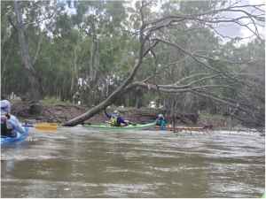
There are lots of trees in the river, creating snags, so you can’t just watch the scenery or relax too much. Even though the front paddlers kept a look-out there were snags that either caught someone momentarily. This year the water level was dropping as we paddled down, leaving the once sandy beaches covered in mud. Peter found a particularly deep patch and had to hunt for his shoes which the mud had sucked off his feet. The retrieved shoes and Peter needed a good wash before joining us again.

Personal best records

Camp 5

This paddle saw ‘personal best’ records shattered. Peter did a PB for distance 3 days in a row and Marina achieved the furthest she had paddled for a trip on day 4 with 164km completed. She then paddled another couple of days to reach a new record, 230km. This section of the Murrumbidgee is a very looooong paddle but we all agreed it was an addictive section, ever changing with another beautiful spot around each of the many, many bends.


Image below links to the GPX file

Trip Map

St. Kilda weekender with overnight stay in Community Hall — Sat 9-10 September 2023

St Kilda Weekend History

Another great weekender out to St. Kilda was conducted on Saturday 9th and Sunday 10th September. Weather, wind and tidal conditions were perfect for the ten club members who participated.

The St. Kilda weekender has been a feature of the ACC calendar for over ten years now. It is an easy trip requiring paddlers to carry minimal equipment. We stay in the St. Kilda Community Hall overnight and go to the pub for dinner and drinks.

It’s All About the Tides

The devil is in the detail of planning however and the critical elements lie in getting the tides just right. The trip takes in most of the Port River estuary which is highly tidal. On the wrong day the currents can be severe and in places the water just disappears at low tide.

I have used the tide in a couple of ways for this trip over the years. This time around I used the dodge tide to minimise the impact of tidal currents and extremely low water levels. A dodge tide is a phenomenon almost unique to Gulf St. Vincent and Spencer Gulf. It also occurs in the Persian Gulf and the Gulf Of Mexico. A dodge tide is where the water levels change minimally over a 24 to 48 hour period; it is if the tides miss a day! Last weekend we had a 15 hr tide on Sunday resulting in negligible current and change in water levels. The water level did not go below 1.2m during daylight hours which is most important when planning to explore the mangrove creeks of the Barker Inlet and the Section Bank at Outer Harbor.

I have also used spring tides (nothing to do with the seasons!) to create a fun “ride the tide” experience. On this type of tide we begin at Largs Bay and travel into the Outer Harbor Channel where the rapid inflow of water to the Port River due to the rising tide is quite amazing! With just an easy paddling effort you can achieve 10 or more kilometres per hour.

Departure from UniSA Kayak Shed

Departure from Uni SA Kayak Sheds

Thus trip’s group including Mark L, Abelardo, Terry, Greg, Anthony, Bella, Charlie, Marina, Giresh and myself. We assembled at the UniSA kayak shed near Adelaide Marina on the main arm of the Port River to launch for the 16Km paddle out to St. Kilda. This is the first time we launched from here and it was most convenient as we could leave our vehicles locked up securely in the compound. We planned to finish the trip here as well. Big thanks to club member Dr. Scott Polley, who is a senior lecturer at UniSA for granting access.

North Arm and Ships Graveyard

Paddling Amoungst Ship’s Graveyard (2)

The journey out to St. Kilda was via The North Arm and Barker Inlet which is such a stunning and little known part of Adelaide. Travelling up the North Arm we observed the maritime relics left abandoned in the “Ships Graveyard”  early last century. The remains of vessels such as the Glaucus, Garthneil and Seminole give an insight into early shipping in South Australia. You may find more information about this unique section of the River. 

Barker Inlet and Swan Alley

Even more captivating was the exploration of the mangrove creeks of the Barker Inlet. When paddling through the maze of creeks flowing off the “mainland” you get the feeling that you’re far from civilization. It’s a stunning, waterlogged forest. Exploring comes with a warning! You have to know the impact of the tides. Get it wrong and you can encounter fast flowing water that can wash you under low tree branches resulting in capsize and a heap of real issues. At the other end of the spectrum you can run out of water…the creeks go dry at low tide heights. The creeks are best paddled on a dodge tide with a water level of at least 1m which is what we had!
Exiting Swan Alley

Our journey entered the system via Swan Alley. We then took the Embankment Channel which is artificial and links  Burrows Creek, Post Creek and Garnets Creek. Due to the tide height there wasn’t much dry land for lunch. We exited Burrows Creek to find a small sand island to haul out on before returning to the mangroves and continuing down the channel.

Arrival at St Kilda and Community Hall

On exiting the mangroves the next target was the St Kilda Channel and down to the St. Kilda Boat Club to store kayaks overnight and walk to the Community Hall. The pub meal was a little disappointing for some…. squid snitty not up to the usual standard!
Return via Bird Island and Outer Harbor

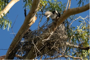
Sunday began with even better weather for our journey out to Bird Island and the Outer Harbor breakwater. Bird Island is a sand spit that has been increasing in size since I have been visiting the area. I first remember it some 20 years ago as a couple of hundred metre strip of sand running northward from the breakwater without much vegetation but plenty of bird life. It is now a couple of kilometres long and well covered with vegetation and trees. It is an important bird breeding area and one of the few location in Adelaide that Pelicans raise their young. The sand flats to the NW of the breakwater are stunning. It is easy to imagine you’re in the Bahamas!

There were also plenty of long nosed fur seals on the breakwater. Several young ones swam some distance with us and may have never seen a kayaker before.

St Kilda Dusk

The group had a slight incoming tidal current to push us the final few kilometres back to the shed. On the way we got to see one of the Naval ships under construction and were warned by Mark to stay out of the “Restricted Zone”; no saboteurs allowed!

When back to the shed it was a quick clean up of gear on the nice lawned area of the UniSA compound. A great weekend had by all!


Overall statistics (Links point to GPX track files)


Morning in Chowilla

Four days exploring the creeks in the Chowilla reserve, in the Riverland — 19-22 Aug 2023

From Plan A to Plan B

Enjoying the calmness of ChowillaThe original trip was planned to traverse the Lindsay River. But the high river levels put paid to that, as the whole Lindsay Island was closed to the public. Making the best of a bad situation, we changed the trip to the Chowilla area, where high water levels open up a lot of normally dry creeks.

We launched at midday on Saturday and crossed the Murray to find the entrance to Suders creek, which is the entrance to backwater area. This is normally a challenge, with the entrance to the creek being narrow and fast flowing, but this time the levels were high and the current very manageable, and we were soon through to Hypurna creek, which we followed up for a few kilometers before setting up a base camp where we would stay for the next three nights.

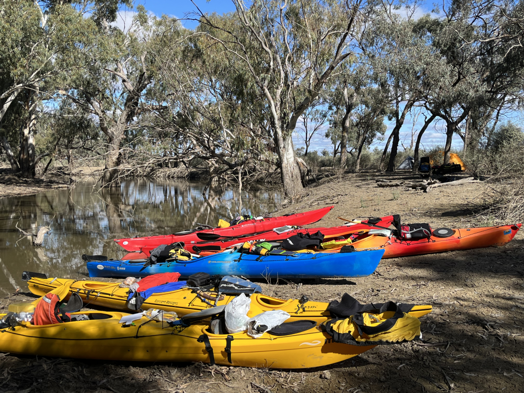
Setting camp for the trip

After setting up camp and relaxing for a bit, we went off for an afternoon paddle to check out if the short-cut through to Salt Creek was open, as we planned to take that route the next day. Luckily the normally dry creek was easily navigable so we didn’t have to change our plans. We then retired back to camp to start dinner and sit around the campfire solving important world issues.

Day 2

Next day was an early start as we didn’t have pack up the camp. We were soon paddling through wide creeks and flooded trees through to Salt Creek.  We followed it upstream for about 8km to a horseshoe lagoon which we normally bypass. Encouraged by the high water levels we decided to explore it. We were rewarded with yet another new creek which took us back to Salt Creek, cutting 4kms off our trip.

After a few hundred meters on Salt Creek we found an unmarked creek which was flowing in the right direction. We decided to throw caution to the wind and set off down it into the unknown. Flowing water is always a good sign as it has to go somewhere. We were pleasantly surprised to find ourselves ending up in Hypurna Creek, which is where we were planning on going. After a gentle 5km paddle downstream we ended up back at camp. We were soon relaxing around the campfire discussing the next day’s paddle.

Day 3

Lunch break before paddling the MurrayNext morning, after a quick breakfast, we set off back up Hypurna Creek to do another circular loop in a different area. We passed the entrance to a shortcut to Wilperna Creek which had been planning on using, only to find that the water level was not quite high enough to make it passable. Disappointed, we carried on up to Salt Creek to have a mid-morning break and talk about our options. After a bit of discussion we decided to continue to the Murray, and follow that around to the entrance to Wilperna Creek.

Normally we try to avoid the main channel of the Murray, too big and too busy. But this time we found the river pretty much deserted. A relaxed paddle had us going down the river at 10 km/h. There was a lot of water in the river! At that pace we were soon through Higgins Cutting and did the 8kms to Wilpurna Creek with no trouble at all.

Wilpurna Creek is one of my favourite creeks, narrow and winding, with not too many obstacles. But it can be hard to find, as the entrance is small and is just downstream from the NSW border. Unfortunately the sign for the border is about ½ a kilometre away from the actual border, on the wrong side of the creek. Luckily my trusty GPS had the entrance marked with a waypoint. We practically floated down Wilperna Creek, around fallen trees, escorted by curious emus and seeing the occasionally kangaroo, and were soon back at camp again.

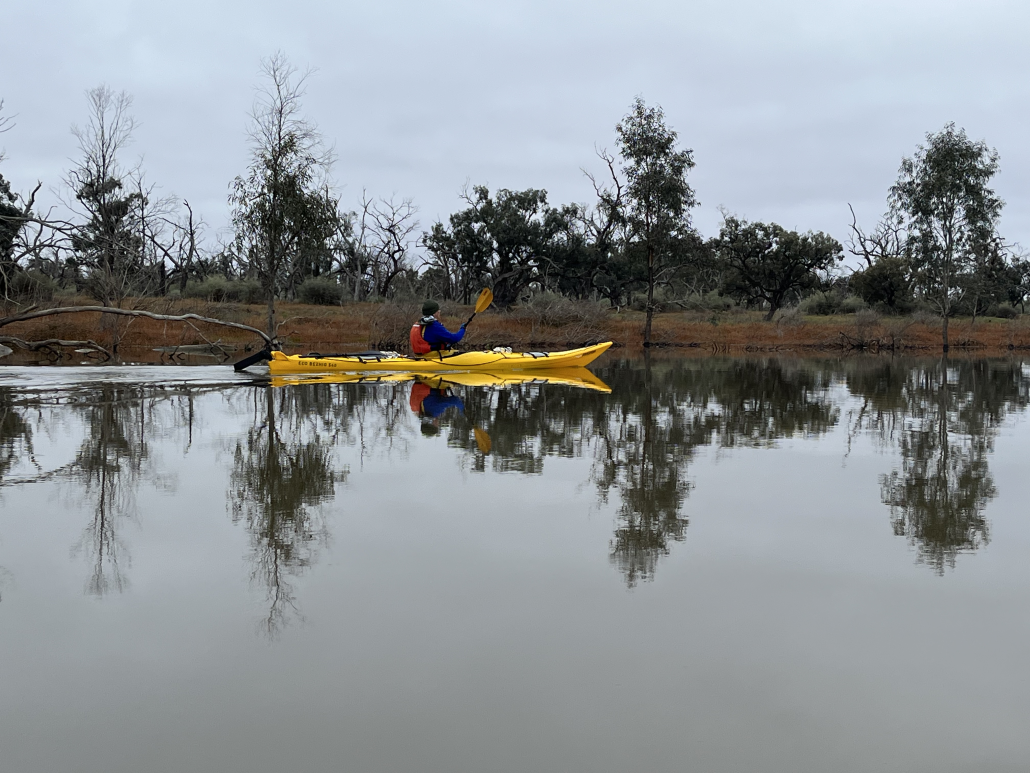
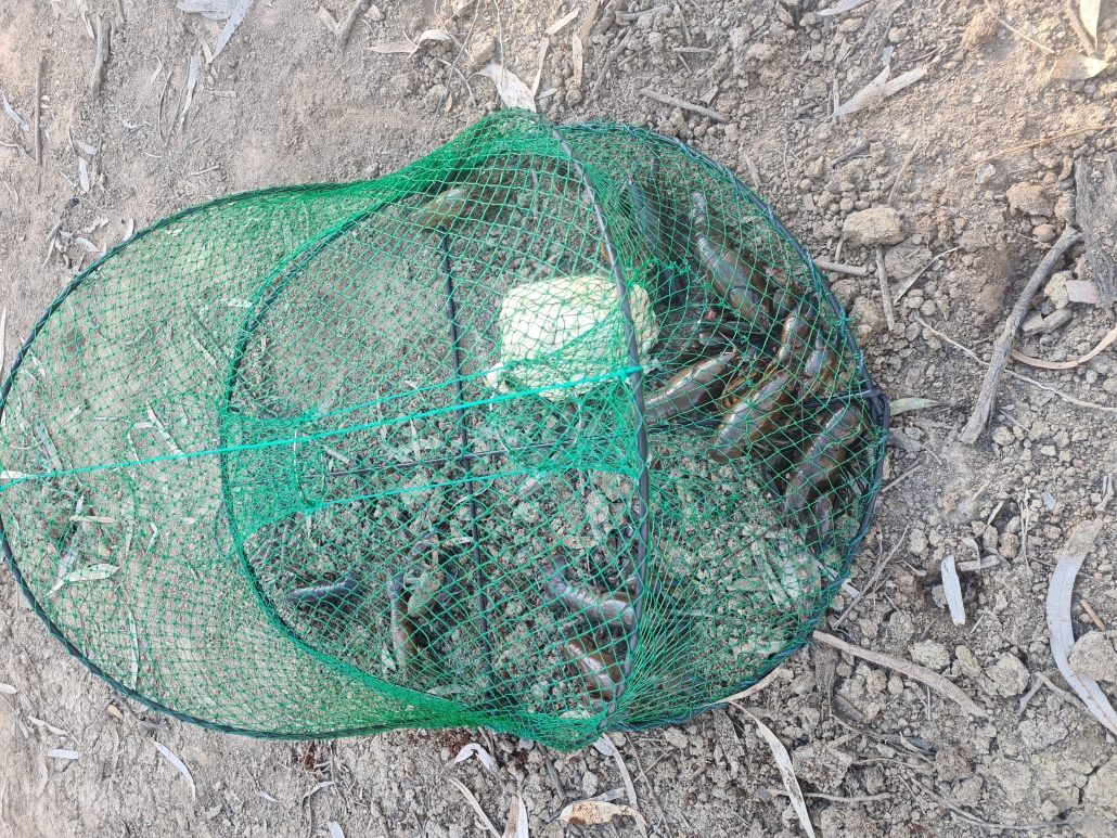
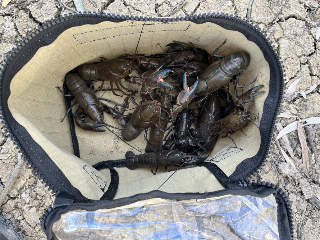
Chris had bought his yabbie nets along (I don’t know how he fits it all in his kayak), and had got lucky while we had been away. That night he treated all of us to some fresh yabbie meat snacks.

Day 4

Salt creek navigationOvernight our luck changed, and we had a bit of rain. Nothing heavy, but just enough to turn the ground into sticky mud, 10 steps were enough to add a few kilograms of the stuff to your shoes. After breakfast the camp was packed up quickly and carefully, trying to avoid most of the mud, and stopping occasionally to scrape the worst of off your shoes. Most of the gear went into the kayak reasonably cleanly, but the kayak cockpits ended up decidedly brown.

We paddled back down Hypurna Creek, aided by the current, paddling through trees which normally line the side of the creek. Some paddlers decided to do the portage back the Murray, while the rest decided to try paddling back up Suders. The portage point is well signposted, but we couldn’t find any of the signs, can only think that they must have been underwater. Kayaks were soon carried across to the Murray. The rest of the paddlers set of to try our luck going up Suders Creek. This proved to be an anti-climax, as it was an easy paddle back to the Murray and the cars.

We quickly threw  all the gear back in the cars, loaded the kayaks on the roof and put on some presentable clothes.  We then headed back to Renmark and the nearest bakery to indulge in a cup of hot coffee and some unhealthy treats before heading back to Adelaide, and a lot of washing of kayaks and gear.

Overall statistics (Links point to GPX track files)

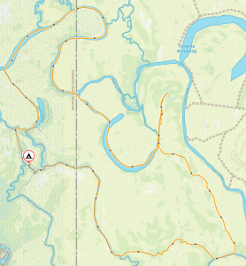
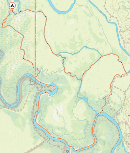
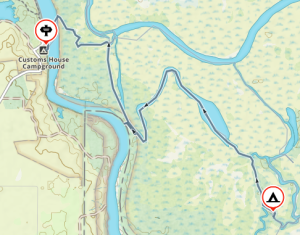
Saturday 19 August – Customs House to Campground, recce in the arvo – 11.95Km

Sunday 20 August – Salt Creek, Horseshoe Lagoon, Hypurna Creek – 24.1Km

Monday 21 August – Salt Creek, Wilpurna Creek, Murray River – 26.0Km

Tuesday 22 August – Campground, up Suders creek back to Customs House – 7.45Km

Sunset at Murrumbidgee River

Murrumbidgee River, Darlington Point to Hay, 30 Jan – 4 Feb 2023

A good week in the oasis of the Murrumbidgee River

Anne and Simon Langsford lead a fantastic trip down the Murrumbidgee River, from Darlington Point to Hay. Paddlers included Berny Lohmann, Robert, and Robin Phiddian (AKA Rob & Rob), Terry Holder, Courtney Kirkwood, Simon Delaine, Hugh Stewart, and Peter Vincent. The group met at the Darlington Point caravan park on Sunday evening after a car shuffle that left two cars at Hay. It had been raining much of the late afternoon.

A bumpy start (Monday)

The weather cleared overnight for a 9 am start on the water, after parking the cars. Anne and Simon L gave a briefing about what to expect for the trip, including the dangers of snags lying under the water. The group slid their kayaks off the muddy banks, gathered in the water, and set off, passing under the Darlington Point Bridge. The river was flowing at a good pace, and it was nice being able to coast and watch the trees go by. But soon whistles were blown, and we turned to see an upside-down kayak! Robert had been pulled into some bushes and capsized.

Simon L, tailing the group, swiftly rescued Rob, and his kayak, though Rob’s paddle was lost in the roll, likely dragged underwater and lost in branches. The group continued down the river, learning how to spot dangerous ripples in the water. Unfortunately, one was spotted too late, and Terry badly hit a snag on the side of his boat which soon began leaking. We applied duct tape  as a temporary repair, luckily mostly holding for the remainder of the trip. We made camp after 36km.

Days without incident: 0 (Tuesday)

Another 8:30ish start on the river. A smooth day of paddling until Terry capsized on a snag after lunch. This got us accustomed to calling out snags as some can be easy to miss. Bird life was proving to be wonderful. Australasian Darters were spotted, and Rainbow Bee-eaters visited our camp late in the evening. Despite a shallow stream of water flowing right beside our camp, the mosquitos were not as bad as we had feared. This was a theme for the whole trip.

Getting into the groove (Wednesday) 

Last night ‘boat-monitor’ Berny heard water lapping at the kayaks, so he rose to shift some forward. Each morning it was clear the water level had risen. Being day three, everyone was quicker getting their boats packed. Saw the first small motorboat of the trip. We came across some shortcuts on the river which we took advantage of after checking enough water was flowing through. Peter, in his durable plastic kayak, checked on one shortcut but had to turn back. We had westerly winds for much of the day and by the end most people were getting exhausted. Started looking for campsites, but a few good options had houses nearby. Eventually found a suitable camp in a small forest reserve after travelling 43km. Many of us enjoyed a refreshing swim close to shore where the current wasn’t too strong.

Halfway (Thursday)

I (Simon D) didn’t check the elevation between my tent and the river last night. Turned out it wasn’t much, and the rising water got very close! Another quick getaway this morning and we soon passed a bridge marking the very approximate halfway point. It was a windy day but luckily there weren’t too many straight sections of river, plus everyone’s fitness levels seemed to be rising so we were mostly able to power through it. Rob & Rob were doing a remarkable job keeping up in their much smaller 12ft Carolina Perception kayaks. Saw more birdlife today, including Yellow-billed Spoonbills, Sacred Kingfishers, and Peter was excited to spot a White-bellied Sea Eagle after spotting them on previous trips. We made camp after 42km, landing on a beach beside a large, forested area. Some enjoyed another swim and wash. The wind became quite intense in the evening, and we retreated to our tents for an early night.

‘Love the fallen tree’ (Friday)

It was a very windy start to last night but not all of us had the same experience. Hugh had his tent flattened soon after getting to bed, yet Terry said he heard the wind but barely felt it. The day started with action when Courtney backed up from shore into a branch and capsized. Luckily her insulated coffee floated. The wind was still blowing so she put on a cag to prevent wind chill. Today was forecasted to be the windiest day and it felt like it.

We came across an interesting section of river where a tree had fallen most of the way across. Peter and Berny were up the front and chose a zig-zag route to the right. However, the middle route at first look seemed viable. Courtney was next and chose the middle section but found a large log laying just beneath the surface. Fortunately, she acted quickly, remembering the advice given at the start of the trip, and leaned into the log to prevent the flowing water from capsizing her boat (a technique known as ‘love the rock’ in white water kayaking). She did well to keep calm while flowing water kept her kayak pressed up to the log, as Simon L and Peter devised a rescue plan.

After Peter traveled back upstream, Simon L attached a rope between Peter and Courtney’s boats. Some hard, upstream paddling from Peter eventually freed Courtney’s boat from the log. A good rescue effort. Though slower in the straight sections, Rob and Rob’s shorter, plastic kayaks cruised through these tight sections. At lunch break Simon L had the group discuss what happened. We reflected on how crucial the ‘love the rock’ technique was in that situation as it’s unknown how big that log was or what lay beneath the surface. In future tight sections, we held paddles above the head horizontally, earlier, to hold the group back while the front-runner (mainly Peter) found a safe route.

Back on the water after lunch, we heard barking dogs by a house and Anne said on the last trip the dogs tried to herd them off the river. This time we sneaked by without the dogs noticing. During the afternoon tea break, we discussed how much longer to continue as campsite opportunities would become less frequent the closer, we got to Hay. A short, sharp shower fell after setting off for the final leg before camp.

After 41km we pulled onto a wide beach for camp. The weather was kind enough to let us set up tents before unleashing wind and rain. Simon L set up a tarp for the group to shelter under, and this action seemingly stopped the rain. Turned out this campsite is a bit of a rookery for White-necked Herons now, with many nests scattered high in the forest. These White-necked Herons were abundant for most of the trip, taking advantage of all the recent wet weather.

Back to civilization (Saturday)

A perfect start to the final day. The wind and rain of yesterday had mostly subsided and the sun was out but not too hot. We pulled up for morning tea on a beach about 18km from Hay. Anne said they’d tried to camp here on a previous trip but were told to move on as the farmers were planning a party. Hugh, Peter, and I decided to sprint the final stretch into Hay. The whole group made it into Hay by around 1:30 pm after 30km. People were relieved to have made it and surprised by how fast the trip went. Simon L looked after the kayaks while Anne and Berny drove everyone else to pick up their cars from Darlington Point. The group farewelled Rob & Rob and the rest drove back to Hay for a pub dinner at the New Crown Hotel. Now, off to clean a muddy kayak.

Winter day paddles at Blanchetown and Punyelroo — 30/31 July 2022

 ACCCC

The Adelaide Canoeing, Caving and Climbing Club. Maybe that’s what we should rename the club. There was some of all of that on the weekend trip to Blanchetown and Punyelroo.

Saturday

Paddling around Blanchetown

The winter weather in the Riverland is normally much better than Adelaide, but not for this trip. Five paddlers set from Blanchtown on Saturday morning. The sky was overcast with a stiff headwind and the temperature reading a chilly 9 degrees. A bit of brisk paddling soon warmed us up. We crossed the Murray and headed up Cumbunga creek, threading our way through the dead gumtrees. We tried not to disturb the pelicans while being serenaded by the cockatoos, who must be preparing for spring.

The channel soon narrowed as we approached Roonka Conservation Park. This is where our first mishap occurred. Having done this trip many times I didn’t bother bringing my GPS, wandered up the wrong channel, and soon found myself in a dead end. I was firmly wedged in a thick bunch of reeds which I had tried to push through. Despite much pushing and pulling I was stuck, and was slowly resigning myself to a winter swim. Julie managed to attach a rope to the end of my kayak and pull me free. Many thanks Julie.

After backtracking and finding the right channel we soon found the Murray again, and crossed the river looking for more backwaters. Going up the narrow channel behind Julia Island, we found a secluded lagoon where we stopped for lunch. This didn’t take long thanks to the cold weather, and we were soon back in shelter of our kayaks, continuing upstream. The lagoon narrowed at the northern end of Julia Island, and we had a short portage over a road before getting back into the Murray River again.

Heading back

We decided to head home on the Murray, taking advantage of a good tail wind and a fast flowing current. Thanks to the winter, we had the whole river to ourselves. We gently paddled past the golden cliffs and magnificent gum trees, still being serenaded by the local cockatoos, until we reached our launching spot.

The group split up here. Some going back to Adelaide, while the rest of us set off to Punyelroo Caravan Park. We would stay for the night before Sundays paddle.

Thanks to new member Ghanshyam for being well prepared  and brought an electric heater and kettle. We managed to stay up in the cold and chat for a while before retiring to our tents for the night. With two sleeping bags, an insulated mattress, a couple layers of clothes, and a beanie, I had a warm cosy night.

Sunday

Campground near Punyelroo

Next morning was a leisurely start as we waited for Abelardo to come up from Adelaide for the Sunday paddle. We set off from the Caravan Park, and headed directly across the river into the lagoon to try and find Punyelroo cave. This would have been much quicker if I had my trusty GPS. We eventually managed to locate the entrance and dragged the kayaks up out of the water. We then

replaced our PFD’s and spray decks with helmets and head torches, and entered the cave to do some exploring.

The cave

Punyelroo cave is supposed to be about 3 kilometres in length. I don’t think I have ever managed to get more than a hundred meters into it before my enthusiasm gives out. We spent a good twenty minutes crouching under low roofs, scrambling over fallen boulders, banging helmets on rocks and bruising shoulders on rocky walls before called it quits. We sat for a while in the pitch darkness and total silence, imagining what it must be like to trapped in a place like that. After emerging back into daylight and fresh air, we got back into our kayaking gear and carried on up the lagoon.

The Murray river levels were high due to all the rain the country has been having. The caravan park manager told us that it was now possible to paddle all the way up the lagoon into Swan Reach, and then join the Murray river again. We reached the top end of the lagoon, and sure enough the channel was high and clear, with a good current flow.

Not enough space go under

We slowly made our way upstream, paddling right over the bridges and pipes that would normally stop us. Our luck lasted right up to the end of the channel, a few meters from the Murray. The raised river level now worked against us. The footbridge across the channel, normally easy to paddle under, was now impassable. Only a few centimetres of clearance, and no easy landing due to all the reeds.

Desperate times call for desperate measures. By standing up in the kayaks, it was possible to climb up over the bridge, and then drag the kayaks out of the river through the reeds. After everyone was over, we had a well-deserved rest and snack on the grassy bank. Shortly after, we took advantage of the current to take us back down the river back to Punyelroo and the (heated) cars, and headed back to Adelaide

Overnight Trip from Wally’s Landing, Finniss River to Currency Creek and Return — 9-10 July 2022

DAY ONE – WALLY’s LANDING

Winds south westerly 0-5knots predicted felt like 8knots. The small group comprised of Simon Langsford, Peter McLeod, Matthew Eldred as trip leader. We gathered at Wally’s landing for the overnight paddle to Currency Creek. Peter was unable to stay the night due to work commitments and would return to the cars after lunch at Clayton Bay. We set off with the new paddle plan in place making our way through the reeds and into the lagoons to disturb the 100s of black swans that call it home.
Wasn’t long before the water ways widened, and we were heading to the Goolwa channel where we would turn left for lunch at clayton bay.

After lunch the team followed the northern bank of Hindmarsh Island protecting us from the southern wind. As this was a small back track west to currency creek, we were able to line Peter up with the Finniss river and send him on his way under sail.

Now there was two. Simon and Matt followed Hindmarsh Island until we reached the eastern bank of Currency creek. Finding camp at around 3:00pm we decided to set up the tents unload the kayaks and have a late afternoon paddle further up Currency creek.

The night-time activities were dinner and telling stories around the camp fire under the cold winter’s night.

DAY TWO – CURRENCY CREEK

Winds Northly 5-10knots predicted and felt like it. A frosty start to the day and the fire was re-ignited to defrost us from the night’s sleep. Camp pack up was quick and on the water by 9am. Today’s route we followed the western banks of Currency creek and around the islands at Goolwa north. Not to trace to much of our path from the day before, we stuck to the opposite sides of the rivers.

The trip was success and Simon is keen to attend again and explore more of the lower lakes.

Matt Eldred

Camping in Finniss River

White Water trip to Eildon, Victoria — 11-14 March 2022

It was refreshing and liberating to be back at Eildon after two years!

Most of us arrived on Friday. Charlie and Marina got there a night earlier and were surprised at the activities on the Sump. Fire rescue team and their rafts, Tafe students in their canoes and a few private little boats all practising. Never seen so many on the Sump at one time.

We inadvertently picked a long weekend in Victoria and were a little worried about the crowds. But this didn’t prove to be much of a problem. The only downside was that the group was spread across different sites.

Saturday

Challenging stretch in Goulburn river

On Saturday, Scott Polley did some instruction on the basics for those who had not done any white-water before; Esther did very well, Anthony showed no fear (trying to keep up with his son?), and Leigh is a natural (who would think he has never done any white water) as he soon ended up surfing the big wave at the Sump without much trouble. After a little warming up, Anne, Simon, Fred, Will, Marina and Charlie played around the pumpkins (big man-made concrete blocks designed to create turbulence and eddies in the river), the s- bend and, for the more daring ones, the Sump in the afternoon.

Fred and Will played the role of the two acrobats putting their canoe polo skills to use (Fred managed to position himself in his boat on a pumpkin). And Phil who was the elegant smooth wave rider.

Water levels were quite ok at first, then on Saturday they seem to have released water from the dam, and some of the pumpkins were soon under water. Luckily the water did not seem as cold as it normally is in January.

The Campsite

Kayak on rock in the middle of the river

Moored in the river

Besides people coming into the camp kitchen to do their dishes, we were lucky enough to have the kitchen pretty much to ourselves, as the local hotel was still closed so we had to cook in the campsite. Next year we will remember to check the Victorian calendar before pick a date! In all, we all surely had a lovely time, and Charlie and Marina finished their stay with a 52 kms downstream paddle to Molesworth on Tuesday, having enough water to paddle down at a good speed.

Coffin Bay — 14-17 February 2022

First leg to Black Springs

Starting the trip

Anne and Simon Langsford were joined by Frances and Bernard Goble, Phil Doddridge, Mark Loram, Stephen Carter, Matthew Eldred, Simon Delaine, Charles Walker, Jo Molsher, Julie Rohde and Peter Vincent to paddle from Coffin Bay township out into the Coffin Bay National Park. The first day saw us heading out of the town bay towards Rabbit Island. The tide was very low by the time we got there and some of us walked our kayaks over the Mussel and Razor Fish beds. However, it was not long before we hit deep water again and those with sails enjoyed a good tail wind.

When we stopped for lunch on the beach past the Yangie Bay inlet Julie found her missing spray deck which had become squashed up in the bow as she packed other things. At last water-tight she enjoyed the rest of the day.

We arrived at Black Springs with plenty of time to pitch camp and relax, looking out over the amazingly blue ocean. After dinner that evening it started raining, and Simon and Anne’s emergency shelter was put to good use! as we sat huddled under it. Most people headed to bed early as we planned an early start to catch the tide around Point Longnose.

Lightning Day

So much serenity

Lightning, thunder and heavy rain greeted us the next morning, so the early start was postponed. By mid-morning the storm had passed but the wind forecast made paddling onwards unwise, so we did the walk to view Black Rocks on the southern side of the peninsula, then after lunch split into groups to paddle close to camp. One group went along the picturesque rocks while another group went out to more open water while Jo did her first sailing effort. Although both paddles were much shorter than planned everyone had an enjoyable day.

Windy Day

Paddling along the coast

Wednesday’s wind forecast was bad – 20 knot winds with stronger gusts. Change of plan again! We paddled through the oyster beds and over to Point Longnose where we had a short stop while Mark emptied his water-filled front compartment and put the hatch on properly. Around Point Longnose is a beautiful beach where we had lunch before retracing our steps. Each day Matt would be seen looking for cockles on the beach to bait his fishing hook. He did catch some Whiting, but alas too small to keep so we didn’t get fresh fish for dinner.

Return Day

Preparing the departure

Now we had spent 3 days at Black Springs camp and there was not enough time left to venture out to Point Sir Isaac, so we decided to return to Coffin Bay township. Along the rocky cliffs we came across some seal pups that played with us and followed us for about half an hour. Then we headed to The Brothers islands so Peter could check out the birdlife. We were rewarded with sighting the rare Rock Parrots and there were also some large sea lions, one of which gave an aggressive display towards the kayaks before leaving us alone.

The group split again into ‘paddlers’ and ‘sailers’ to cross over to the northern shore of the bay. Lunch on a sand beach with a very shallow approach made us walk the kayaks again to save scratching them too much. Then it was a pleasant paddle along the rocky cliffs with some of us paddling into Mount Dutton Bay for a short distance.

Wrap up

Coffin Bay Strava

Bernard, Frances and Steve left the group to head homeward. The rest of us pitched camp at the caravan park and then headed to the pub for a drink and dinner.

In total we paddled about 66 km, a bit short of the plan but we had to manage the weather conditions and even with this shortened trip everyone enjoyed the trip.

Some memorable comments:

  • OK everyone, the plan for today is changed, – again. – Anne
  • We have got to know this camp site well. – Frances
  • I’m not talking about the wind forecast. – Simon L
  • Can we stay here another night?  -Text message from Jo (safely in her tent during the storm)
  • I’m glad I remembered everything and I didn’t capsize. – Simon D
  • My jaw is sore from smiling so much, the sailing was so much fun. – Matt
  • I’ve found my spray deck.  – Julie
  • Thunder and lightning, very, very frightening.  – Julie
  • The colour of the water at camp, amazing blue.-  Charlie
  • Great paddling with new people. – Stephen

Check the facebook post for additional pictures

Sea lions

Huddle to avoid the rain

Paddling with seals

Delta Fleet

Checking the landscape

Resting at the campground