Posts

Departing from Cape Jervis

Crossing Backstairs Passage – Cape Jervis to Antechamber Bay and Return — 18/19th March 2023

The adrenaline has finally stopped racing through my veins to allow me to tackle the promised trip report of our crossing of Backstairs Passage to Antechamber Bay and return on the weekend of 18/19th Mar 2023. What a paddle, with a SE gusting to 20Kn and seas over 2m at some stages. All paddlers did extremely well without any incidents, but special recognition should go to our two crossing first-timers: Abelardo Pardo and Simon Delaine.  Talk about jumping into the deep end!  Conditions in Antechamber Bay didn’t look too bad at departure, but steadily escalated during the return crossing.

Preparations

It was a great turn-out with twelve (12) paddlers participating. The trip was led by Phil Doddridge with Charlie Walker, Matt Eldred, Mark Loram, Mike Dunn, Peter Vincent, Anthony Aardenburg and Bella, Tresh Pearce, Abelardo Pardo, Simon Delaine and recent member Karl Meyer following Phil’s lead. Similar to our crossing in March 2022, the trip was aimed at demonstrating the splitting of the tide to achieve the most efficient crossing.

Four of the group (Mark, Simon, Abelardo and Phil) drove down on Friday Night and camped at the Cape Jervis Caravan Park ready for an early morning start. We used this site when training for our Bass Strait crossing and had fond memories of relaxing amongst the pines at the rear of the Park overlooking Backstairs Passage.

A lovely evening soaking up the view and not a ripple seen looking over to Penneshaw. In the evening the highlight was looking up towards the sky and counting the satellites passing overhead – I have never seen so many, there seemed to be a continuous stream passing just below the Southern Cross. A strong wind came up overnight which eased in the morning, but which probably should have been a warning of an approaching front.

Day 1 — The easy one

Enjoying the crossingUp and about around 6am and met the remainder of the group at Cape Jervis Boat Ramp in time for an 8.30am on-water start.

After loading kayaks (I overdid the equipment list again!) and after the safety briefing from Phil we set off at about 8.45am, following the coast east to Lands End to avoid the ferry’s path. We then set our bearing for Cape Coutts and headed out on our adventure, with a few whitecaps between us and the safety of Antechamber Bay; just east of Cape Coutts we were on our way.

A pleasant paddle across but no wind advantage which disappointed those with sails in the group, just a solid slog for 5 hours before we made Antechamber Bay, even explored a bit of the sandy beach to eventually reach Chapman River. Just checking that the mouth hadn’t moved!

Many hands made light work of the portage across the beach and we were soon paddling up the picturesque Chapman River, admiring the paper bark trees and new bridge as we approached campsite no 12 that Mike had kindly booked.

Setting Camp

After setting up camp most of us relaxed, enjoying the location while others went paddling to explore the upper reach of the Chapman River.

Once again the campground was pretty busy so we made an early appearance at the camp kitchen, admiring the stunning views. We had a very pleasant evening there – night solar lights might be handy, a note for future trips! The kitchen is very well set up and we spent the evening discussing kayaking adventures while being entertained by Tresh’s attempts to get his cooker operational.

Soon after we turned in and slept well, being serenaded by several Boobook Owls during the night. In the morning some fairy wrens visited, very elusive but I did manage to get a couple of pics as they checked out my tent.

Day 2 — The not so easy one

On our way to Antechamber BayNo rush in the morning with the plan to be on-water in Chapman River by 10am, bit of drizzle overnight and the additional time was put to good use sponging the tents and gear and getting packed up.  We said our farewells as we paddled under the KI version of Sydney Harbour Bridge and down to the mouth for another portage. The waters in the bay looked calm but the forecast for the crossing was increasing winds 15 to 20Kn SW. The sky towards Deep Creek threatened to bring squalls during our crossing.

The briefing was a bit somber and Phil gave the group the option of returning via the Penneshaw ferry instead of attempting a borderline crossing – we all mulled it over but the mutual decision was to paddle the return as the group was fired up to complete the crossing. These sort of situations are always difficult with experienced kayakers, particularly with several having done crossings in similar conditions.

We split into sail-assisted kayaks and those just going with the swell, although on the starboard beam. We headed off together before separating into two groups, with those sailing heading directly across the passage towards Deep Creek before following the coast back to Cape Jervis while our group of five (5) made a beeline for Cape Jervis. There was no time to relax on the four (4) hour return paddle, it certainly required continuous attention.  Phew, all back in the safety of Cape Jervis boat ramp by 3pm.

Arrived

Together in the bakerySunday’s return crossing was by far the most challenging that I have done and I breathed a sigh of relief when we all arrived back at Cape Jervis safely, with the sailors having arrived about 15 minutes prior to the non-sail group.

Looking back, the return paddle was probably borderline, but to achieve the crossing without incident is a credit to the experience within the Adelaide Canoe Club. This is due to regular sea kayak training provided to Club members over several years particularly from Phil Doddridge, Bernard Goble and Peter Carter. All of the group are also regular paddlers, both at Club events and privately, regularly working on improving their skills. The paddlers conducted themselves in a very professional manner exhibiting a good appreciation of group dynamics to ensure we all remained safe.

All of us wanted to celebrate and swap stories, so we adjourned to the Yankalilla Bakery to debrief. And yes, the adrenaline was flowing strongly for quite a while afterwards!
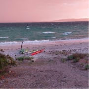
Kayaks in the beach in Coffin Bay

Coffin Bay — 7-11 November 2022

Head wind

The weather forecast for the week at Coffin Bay National Park was looking great as Bernard, Francis, Charlie, Marina and Anne set off from Coffin Bay township on Monday 7th November. With a 10-15 knot north easterly wind we paddled along the cliff edge on the northern side of the Bay We gained some advantage from the easterly component and sheltered from the northerly aspect until we crossed Mount Dutton Bay. The wind hit us again as we crossed above The Brothers Islands and made our way along the coast to Black Springs campsite. It wasn’t long

Seal behind a 2 person kayak with two sails up

Seal playing with the kayak at Coffin Bay

before we had set up camp and were relaxing.

Trying to get to Point Longnose

The plan for Tuesday was to paddle around Point Longnose and make our way to Morgans Landing camp. However, the forecast calm wind turned into at least 15 knots from the north and the swell was predicted to be about 2m. We battled into the head wind through the oyster farm to Point Longnose and beached the kayaks on the more sheltered side. Francis and Marina looked after the boats while Bernard, Charlie and Anne went to check conditions on the exposed side. The wind was very strong and it was whipping up waves which would have been breaking side-on to us along Seven Mile beach.

Back top Black Springs to see the eclipse

To continue would have given us about 12 km of very difficult paddling so we decided to retreat back to Black Springs. While we were checking conditions around Point Longnose a large wave and strong gust launched Charlie’s kayak back into the sea and quickly took it out of reach. Marina jumped into her kayak and managed to grab it but without a tow line to return it to the sandbar. She was stuck in waist deep water with a deep trench between her and the sandbar. We needed to work out how to reunite Charlie and his kayak. Bernard and Frances managed to ‘deck carry’ Charlie out to Marina and then it was easy to get everyone back into kayaks.

Moon eclipse in Coffin Bay

Moon eclipse in Coffin Bay

The strong northerly wind made sailing back a great option for those with sails. Anne and Marina decided to go around the coast while Bernard, Francis and Charlie planned to sail directly back. Luckily we did a radio check before we split the group and we had not gone far when we had radio contact that Charlie’s rudder wasn’t working and we collected together on the beach for repairs. That sorted we returned to camp, more or less as a group with some sailing nearer camp. In the evening as we walked along the beach we noticed the moon rising, but it didn’t look right. We checked Google and discovered we were seeing a total eclipse of the moon in progress.

Heading back

Wednesday’s winds were predicted to be even stronger and we woke up to rough seas and about 27 knot winds so we opted for a bushwalking day and visited the lookout to Black Rocks in Avoid Bay. We walked a little further along the cliffs and found an enormous Osprey nest perched on a rocky island, with the resident bird standing on top of it.

The wind forecast for Thursday was a westerly (tail wind returning to Coffin Bay) and Friday was back to easterly (head wind returning to Coffin Bay) so it didn’t take much discussion to pick Thursday as our last day. With a good tail wind we made our way along the coast then across to The Brothers Islands to check on the birds and seals there. There was one seal that swam around our kayaks checking us out as we photographed it.

Day paddle from Victor Harbor to Port Elliot return — 1 October 2022

Finally some sunshine!

Port Elliot

After months of cold and rainy conditions, the weather gods finally smiled on us. We had a warm sunny day as we launched our kayaks from the Kent Reserve at Victor Harbor for a trip to Port Elliot and back.

The water was fairly calm while we were sheltered behind Granite Island. We could see though lots of spray and white water out to sea, indicating that the forecast of 2m swells was probably correct. Sure enough as we emerged out into the open ocean the swells started to pick up, luckily they were big lazy, slow moving swells that gently picked the kayak up and lowered it as it passed underneath.

That changed as we approached Port Elliot and navigated the entrance between Pullen Island and the rocky headland. The breaking swell was creating lots of rebound waves and interesting conditions, compounded by the swell picking up in the shallower water and creating some surf-able waves. Luckily no-one was brave enough to try, and we landed safely near the new lifesaving club for lunch.

Visitors

Victor Harbor

Mark Loram, the club president, joined us for lunch as he was in the area visiting friends. He was unable to join the paddle due to family commitments. After a nice relaxing lunch and chat in the warm sunshine on the beach we climbed back into the kayaks for the return trip.

This time we went around the outside of Pullen Island for a change of scenery, which was interesting due to all the rebound waves on the ocean side of the island, even worse than when we came in. Nothing too serious, but not conducive to taking your hands of the paddle to take photographs!

We were expecting the conditions to improve as we moved away from the rocks into the more open sea.  But, for some reason, the unsettled conditions persisted all the way back to the shelter of Granite Island, resulting in frequent correcting strokes and bracing. We were all very glad to get out of the kayaks after getting back to Victor Harbor after 3 ½ hours, having done a round trip of 18 kms.

Ningaloo Reef, six day kayak trip out of Exmouth, WA — 31 July 2022

By:  Kaye & Stephen Parnell

Ningaloo Trip WA

NINGALOO REEF – 6 DAY KAYAK TRIP OUT OF EXMOUTH WA

The Ningaloo Marine Park is located on the north west coastline of Western Australia and is designated a World Heritage listed site due to its incredible biodiversity. On this trip we spent five days paddling and snorkeling between the reef and the beach and it was planned that we would land at pre-determined beach sites. The weather had other ideas.


DAY 1 – EXMOUTH ADVENTURE KAYAKS THEN CAMPING AT YARDIE CREEK

We were picked up at 3.15pm from our hotel for transfer to the Cape Range National Park with a detour to the Exmouth Adventure Kayaks depot to collect the camping gear along with wet suits, hats, rashies and other snorkeling gear plus dry bags for our personal gear. EVERYTHING – food, water (in bladders) had to be carried on kayaks. We filled the hatches at the front and rear with our gear, put the communal food and sundries in the centre hatch and then strapped down more gear on the top of the centre hatch.  The group numbered 11 keen paddlers plus our two guides to travel in the five double Sea Bear Packhorse kayaks and three singles.  The double kayaks were big and heavy and took a minimum of 6 people to carry unloaded.

The first night at Yardie Creek 86 kms from Exmouth was a permanent camp site of tin shed shelter with rustic sleepers made into a large table with bench seating with a luxurious “drop dunny” facility! Tents were pitched and after a delicious dinner of baked fish and salad we disappeared into our snug sleeping bags lulled to sleep by the booming of waves breaking on the Ningaloo Reef.

DAY 2 – CHALLENGE OF THE INDIAN OCEAN

Resting in a beach at Ningaloo

The day started with us carrying the kayaks through the sand dunes before loading them and heading into the waiting challenge of the Indian Ocean. The plan included an “average” day with 3-4 hours of paddling and with time for snorkeling. But our first paddling day had very strong head wind of 25 knot. White-capped waves greeted us as we launched off the beach. After 2.5 hours paddling and rain clouds rolling up from the south we had covered a grand total of just over 2 kms before the guides called a stop on a narrow beach fronted by sand dunes for a rest and rethink.  It was a very tough paddle and we were very grateful for the experience of our Sunday morning peer paddles with Matt at Semaphore.  Our guides managed to get a weather report that predicted wind and rain increasing until midnight so tents were hurriedly pitched in the little shelter provided by the small dunes and after a quick lunch of wraps and salad with heavy rain arriving we spent the rest of the day “holed up” in our little tents. We emerged briefly at dusk for a delicious meal cooked and eaten huddled under a canvas shelter held up by paddles before we all quickly retired to sleep out a night of driving wind and rain.

DAY 3 – A STUNNING DAY PADDLING WITH TURTLES AND WHALES

Miraculously the next day we awoke at 6 am to find all peace and tranquility with a southerly blowing up the coast.  We had everything packed up and ready to load before breakfast at 7am and an early start on the water to make up for yesterdays’ lack of distance.  What a difference a following wind makes! Our guides were very pleased with our progress, with the same distance covered as yesterday but in just ¾ hour. After stops for morning tea and lunch we were able to make up all of the lost time and distance arriving at the planned campsite after 16 kms of paddling. Being back on schedule made for happy kayakers and even happier guides and the chance to drift snorkel was an added bonus.  There were plenty of turtles popping their heads up along with fish jumping out of the waves ahead of us as we paddled along. There was even the sight of a whale breaching to make everyone gasp with wonder.  Thoroughly exhausted we sat on the sand hills and watched the sunset before staggering off to our tents.

DAY 4 – ON TO TORQUOISE BAY

Team work at Ningaloo

The destination for Day 4 was Torquoise Bay which proved quite a paddling challenge. We were given strict instructions on precision paddling in close double column formation with our guide drawing a detailed sand map for going through the gaps between the breakers of the reef where strong currents could see us whisked off in the wrong direction if we weren’t careful. Torquoise Bay is a beautiful and popular tourist spot with safe swimming and also provided an opportunity to restock supplies driven up from Exmouth.  Another chance for a drift snorkel with a nice slow day with a leisurely lunch before setting off further up the reef to another well chosen camp site.

This site entailed quite a tricky landing in a little cove with a strong cross current and tidal pull. The tide drop is quite marked here, with the water disappearing on us as we were landing. To safe guard the kayaks they had to be emptied and hauled right on the top of sand hills for safety. The actual reef was further away than for our other stops but the pounding and booming of the surf still provided a notable backdrop to the otherwise complete isolation of the campsite.

DAY 5 – MANGROVE BAY THEN BACK TO EXMOUTH

We were granted a lovely sleep in until 6.30am then yoga on the beach with El (our young guide from Seattle) and a cooked breakfast from Dave (our guide from NSW) before setting off to lunch at Mangrove Bay which was full of stingrays skimming through the shallows along with pelicans and little schools of fish plus the odd frolicking dolphin or two to entertain us as we casually paddled up the coast with Ningaloo Reef on our left and the beach and Cape Ranges on our right. While checking out the mangroves we took advantage of the opportunity to run aground – just to prove it’s not just a Phil Doddridge thing! Well away from the mangroves a previously unknown and yet to be named campsite was carefully chosen amongst dense scrub.  More unloading and lugging of kayaks to higher ground before settling into our last night of pitching tents.

Another restful start to the last day of our expedition as the tide was out at least 100 metres and the big packhorse doubles are not something you want to drag fully loaded. We all enjoyed walking and fossicking along the beach.  Finally underway around 11am with a short paddle to Tantabitti for a final snorkel, this time directly off the kayaks moored to a buoy proved a challenging method of getting in and out in flippers and full gear!  A late lunch after unloading kayaks and hauling everything to the trailer ready to load.  Arrived back at the depot in Exmouth (at this point only 36 kms away) where a chain gang formed to unload the van and sort our gear before finally and thankfully being dropped off at our respective accommodations for hot showers.  Such a luxury! We found the Ningaloo paddle a very physical but enjoyable trip and we are very grateful for the “training” paddles with the Club particularly those at Semaphore and on the Port Augusta Spencer Gulf trip. This was our first “expedition’ and the first time we have needed to carry everything with us. It is astounding what can be squeezed into these big NZ kayaks although there were occasions on that first rough day when we wondered at our wisdom in paddling a heavily laden kayak sitting so low in the water.


Day paddle at Port Elliot — 23 May 2022

A much reduced group of three paddlers set off from Victor Harbor on Monday morning. Originally scheduled for Saturday, but thanks to the government declaring an election on that day, we decided to move it to Monday. Apologies to all the working people, blame the government!

Starting to paddle in Port Elliot

We launched from Kent Reserve again, but this time we turned left and headed for Port Elliot and lunch.

We had a quick stop to admire the new causeway to Granite Island. After looking at the state of the old causeway from underneath its clear why a new one was needed, very corroded and damaged.

The entrance to Port Elliot looked its normal intimidating self. Waves breaking on the headland and Pullen Island, but with the small swell the passage between them was easy and were soon stretching our legs and soaking up the sun on the beach.

Around Port Elliot

On the way back we went around the outside of Pullen Island to have a look at the rocks there. Some interesting spots to explore, but they will have to wait for another day, in a smaller boat, with calmer seas.

The trip back was quicker thanks to the wind behind us, but felt longer, possibly due to the paddle the previous day. Whatever the reason everyone was grateful when we reached to beach and the cars.

Day paddle at Victor Harbor — 22 May 2022

Five paddlers took advantage of the glorious weather to go for a paddle out of Victor Harbor, around the Bluff and out to West Island

Paddling around Victor Harbor

The swell was a manageable 1-1.5m as predicted, but the weather forecast did not mention the chop, which made conditions a bit challenging, especially around the Bluff where there was a lot of rebound.

After launching from the shelter of Kent Reserve we made slow, steady progress to West Island, where some of the group chose to go around the exposed seaward side for some excitement while the rest chose to go on the sheltered side to check on the seal population, which is looking very healthy.

Kings beach looked inviting, so we stopped there for lunch and a leg stretch and a chat with the passing hikers. Launching should have been easy except for a sneaky rebound wave coming in from the side which resulted in one swim and a few near misses.

Choppy water around Victor Harbor

Pushing back into the 10 knot wind made things a bit chillier, but we were soon around the Bluff into some more sheltered water. We stopped in at Wright Island to check out the bird population which is also looking very healthy.

Some dolphins made an appearance, but were not feeling social and moved off following a school of fish.

Landing back at Kent reserve we left the kayaks on the beach while we went to retrieve the wheels from the cars. Unfortunately someone in the group neglected to pull up his kayak far enough, and by the time we got back to the water it was upside down in the surf a fair way down the beach. It is going to take me a while to get rid of all that sand in the kayak.

Upper Spencer Gulf, Port Lowly to Port Germein Crossing of Upper Gulf — 2 May 2022

THE TRIP

Steve and Gregg at Spencer Gulf

The crossing had been on the radar for several years as quite often when at Cockle Spit we would peer at the distant view of the tanks at the Port Bonython facility and wonder what if!  We consulted Google Earth and measured and checked possible routes. Gaining information and understanding of the wind and tides in the area was critical. We consulted with several sailors and told us stories of wind and waves in the area and the many challenges with currents. We knew that in windy and high tidal flows this a dangerous area that you should never underestimate the risk.  The decision to paddle the crossing would have to be dependent on ideal conditions.

Leading up to the crossing wind and tidal flows were considered.  The 7 day forecast on Willy Weather indicated that Monday 2nd May would be ideal for a West to East crossing. Daily checking reaffirmed that Monday would be the day.  Light northerly winds and a low tide of 0.8 at 1:30 pm.

DEPARTURE FROM POINT LOWLY

Final arrangements were in place, John Case would do the car portage. Paddlers were myself (Steve Carter) and Greg Watts.  Our other sea kayaking mate Paul Caden from Cowell was invited but he was committed to seeding crops with his son, much to his annoyance.

We departed the beach at Point Lowly at 10 am and once around the Point we set a bearing of 090 degrees.  This course allowed for southerly tidal slip and to arrive at the tip of Wards Spit.  We user our sails to take advantage of the slight (approx. 5 km/h) northerly.  Sea conditions were smooth but the out flowing tide was evident.  Eventually the water became shallower as we could see the sea grass.  Using the 2 navigation beacons we reconciled that we were south of our check point and we then headed north to land on Wards Spit at 2 pm.

A BREAK ON WARDS SPIT

A quick rest and stretch on the Spit.  By now the northerly had dropped out and the water glassed off.  The dark blue line of wind was in the south and eventually a slight southerly wind kicked in.  With this favourable wind we set off to Port Germein.  We used both compass and the land marks on the Southern Flinders Ranges for this section.

ARRIVAL AT PORT GERMEIN JETTY

Spencer Gulf sailing

Eventually we rounded the end of the Jetty.  Phew! Only 1.8 km or so to land.  We landed at 4:18pm and proceeded to portage the kayaks.  We were met by John and the car as he had driven over the flats to greet us.  Greg and I raced to pack up and load the car as in the inflowing edge of the water moved ever closer. Once at the carpark we stopped and had a celebratory beer for not only the crossing but also Greg’s 63rd birthday.

NOTES FOR FURTHER CROSSINGS

The tidal influence was what we expected, we had estimated a flow of 3 to 4 km/h and know it could be higher in other tidal conditions.  On Monday high tide was 2.8 and low of 0.8 however tidal variations of high 3.6 to a low of 0.2 would necessitate making greater allowance for tidal slippage.  The influence of wind and tide also needs to be considered carefully.

SUMMARY

Not sure if this is the first crossing of Spencer’s Gulf at this position. (perhaps the first crossing claim could be verified by some of the long term club kayakers) If it is the first Point Lowly to Port Germein crossing then Greg Watts has a wonderful way to always remember his 63rd birthday.  If it’s not the first, we celebrate our achievement.  Distance 23.59 km.  Time 4:18.

Spencer Gulf Crossing

Port Victoria coast exploration — 2-3 April 2022

Peter Drewry, Peter Vincent, Maria Kubik and Marina Walker joined Anne and Simon Langsford for an exploratory paddle from Port Victoria south 40 km to Port Minlacowie.

Saturday

Wauraltee Beach

On Saturday morning Anne and Peter V did the car shuttle to leave a vehicle at Port Minlacowie, the finish spot.  We then all set off from Port Victoria in beautiful conditions. There was a 13 knot south easterly wind which we avoided most of the day by sticking close to the coast. The water along this part of the coast was so clear we could see the range of sea weeds and sea grasses beneath us. Much of the coast is very rocky, even adjacent to the sandy beaches. When the tide was out this limited our choice of landing spots. However, there were enough clear sandy areas where landing was easy so we could enjoy lunch or snacks on the beach.

We were surprised at the numbers of campers, caravans and 4WDs on Wauraltee Beach. It looked like a nice spot to camp but not exactly ‘getting away from it all’. We arrived at Port Rickaby just before 5pm and managed to sign into the caravan park before the office closed. It was too late though for Peter V to order a hamburger from the shop. We used our wheels to get all the kayaks up to the camping area. It was a bit of work, but we had a nice grassy area and no sand blowing into everything as we would have had camping on the beach.

Sunday

Along the Yorke Peninsula’s coast

Sunday’s paddle continued south with milder (10 knot) winds, rewarding us with lots of wildlife. We had a close encounter with a pod of about seven dolphins, including a young one, swimming around us. We also saw a seal floating with one flipper in the air (from a distance it looked like a shark fin moving slowly around). Having identified the ‘fin’ as a seal flipper we were not so scared when we encountered a second seal doing the same graceful flipper wave. Peter V identified a couple of Wedge Tailed eagles attacking a Nankeen Kestrel, which managed to get away from them. We also saw Crested Turns, Sooty Oyster Catchers, Cormorants and of course Silver and Pacific Gulls. We arrived at Port Minlacowie boat ramp about midday and quickly got the boats ashore and did the return car shuttle to Port Victoria.

This was an enjoyable paddle. Highly recommended for another trip perhaps with an extra day to allow time for some snorkelling.

Backstairs Passage Crossing, Kangaroo Island — 26 March 2022

A very successful return paddle to Kangaroo Island. Paddlers were: Phil Doddridge, Mark Loram, Charlie Walker, Peter Vincent, Matt Eldred, Stephen Moore and new member Hugh Macmillan. This was the first crossing for Peter, Matt, Stephen and Hugh, so there were a few smiling faces when we arrived back at Cape Jervis. Well done paddlers! Trip was led by Phil and was aimed at demonstrating splitting of the tide to achieve the most efficient crossing.

The start

The early birds in the group arrived at Cape Jervis at 8.30am. There were a bunch of keen kayakers outside our group already there prepping for a training run to Blowhole Beach. We saw Tresh preparing his new/old 1980 Greenlander kayak, a familiar face in addition to Mark Benjamin. Mark (L). Phil and Hugh arrived just afterwards, with Mark L being a late starter, having just been released from lockdown. After loading up and a safety briefing from Phil we set off about 10.15am, following the coast east to avoid the ferry’s path.

Lumpy start

Landing in Kangaroo Island

We then set our bearing for Cape Coutts and headed out on our adventure, with only whitecaps between us and the safety of Antechamber Bay, just east of Cape Coutts. And yes, (as observed form the drive down the hill to Cape Jervis) the conditions were lumpy with swells reaching 2 to 2.5m. The wind was from the south east at around 15 Knots and slightly above forecast. The tide was still on the ebb until 12.30pm, so we had a slight advantage to balance the wind.

We had a nice sunny day but with the wind and the breaking waves, all very glad we had opted to wear CAGs. Crossing time was 3.5 hrs of solid paddling then overall a total of 4 hours including the short portage into Chapman River, over 22km.

The landing

Conditions eased as we entered Antechamber Bay. There was still enough swell to practice our surf landings. Phil showed the way and Charlie provided the entertainment with a stern first landing in his P&H Valkyrie. Didn’t take long for the portage and we were all looking forward to enjoying the campsite and surrounds with the early arrival at 2pm. Once in the river Matt noticed the plentiful mullet and wished he had packed his fishing rod. The paddle down the dead flat and picturesque Chapman River felt like another world compared to the crossing.

The camp site

We paddled further up the Chapman River to campsite No 12 that Phil had previously booked. We were welcomed by a new bridge – apparently styled on the Onkaparinga River Suspension Bridge at Old Noarlunga. Quite a few dollars have been spent since out last visit. We later discovered a brand new drop loo very close to our campsite – sheer luxury!

After we settled in, Matt, Peter and Mark completed a 3.5km exploration of the river with picturesque paperbarks on the bank. Peter was rather happy with the bird life.

The campground was pretty busy. We made an early appearance at the camp kitchen, admiring the stunning views of the Chapman River. We had a very pleasant evening and turned in early and slept well, being serenaded by several Boobook Owls during the night. Also brought back memories of Coffin Bay with a few in the group being visited by friendly mice during the night.

Back on the water

Happy paddlers in the beach at KI

The next day back on the water by 10am. The water conditions from the beach looked perfect, not a breath of wind or a sign of a whitecap as far as the eye could see. The plan for the day was to head for Blowhole Beach and play with the tides during the crossing. We stuck to this plan, however the winds and tide were not favourable, pushing us further east than we would have liked. Once again the tide was on the ebb until 12.30pm, particularly noticeable on the GPS track, but with the flood assisting our path to Blowhole Beach.

Conditions on the water started off perfectly until the seas got very mixed and choppy which made for an interesting paddle. 21km and we landed at Blowhole Beach for a welcome leg stretch and bite to eat after the 4.5 hour crossing in messy seas. Wind was from the north and again above forecast, mostly around 12-15 knots.

After lunch it was only a quick 9km paddle.  Back to Cape Jervis where 7 tired paddlers loaded their kayaks and headed home after a very successful and enjoyable weekend. For the Club it was the first paddle across Backstairs Passage for the year and for 4 of the members it was their first crossing…. but by no means their last. Stay tuned for the next planned crossing, perhaps in a spring tide to really show the tidal influence in Backstairs Passage.

Crossing to KI

Return trip to Cape Jervis

Paddle to Cockle Spit from Port Germein — 19 March 2022

Paddling from Port Germain

The plan was a Club paddle to Cockle Spit off Port Germein Jetty. We had been attempting to combine our efforts with the Royal Port Pirie Yacht Club who have for the last few years organised a cricket match on the Spit.  Originally it was with the Whyalla Yacht Club but this had folded as some events do!  The vision is for the Adelaide Canoe Club (ACC) to join the event in the future and perhaps field a team. Tina from the Royal Port Pirie Yacht Club has been very helpful and we are hoping to catch up with them next year.

The preparation

We considered all the potential routes for the day including Pirie to Spit. The longest option was Weeroona Island to the Spit or just Port Germein to the Spit. Unfortunately, all included the dreaded 1.3 km portage at low tide at Port Germein. The option of Weeroona to Germein was decided. The paddlers from Adelaide were supposed to meet the Upper Gulf paddlers on Saturday. Then on Friday night COVID struck and Mark was in isolation as a close contact. Our Adelaide members had to cancel and left Greg Watts and myself (Steve Carter) to hold the fort and paddle out to find the Spit.

The paddle

We met at 1:00pm near the jetty at Port Germein and commenced the 1.3 km portage out to the 3rd steps off the jetty. Kayak trolleys essential – but there has to be a better way!

Paddling from Port Germain

The paddle was straightforward on a bearing of 240⁰ from the end of the jetty ruins. Conditions were ideal with a SE wind of 0 to 5 knots. The white of the Spit became visible after 3 km. After another 2 km we hit the southern end and paddled along the Spit for 1 more km just to be sure.

We had a break on the Spit. True to its name, it is made up of cockle and other shells, rather than sand. After a brief wander around – no cricket being played today – we commenced our return journey. We expected a tail wind home after the change of tide and usual afternoon sea breeze. But the slight wind dropped off and the sea glassed over, which made for a very pleasant return paddle.

On return, the tide was out even further. We landed near the jetty with 2 cars parked under it, just like a carport. Then a long portage alongside the jetty back to our vehicles.

The pub

Off to the pub where we learnt more about driving out on the flats. This has always terrified me as I wish for my car to last longer than rusting out.  We found out that some of the specialist vehicles can be arranged to do a pick up.  The solution to cleaning salt and sand under the car is to place the sprinkler under the car for 10 minutes or so. Guess what: next time it’s a car drive out to pick up kayaks!

This is the 5th or 6th journey for me, however on my favourite trip we didn’t even see the Spit but had a downwind journey in 20 knots winds from Third Creek (south of Pirie) to Port Germein. There is much more to do in this area, and I look forward to other trips