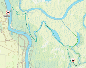
I had been very keen to paddle the Coorong after reading about Mike and Tresh’s paddle in January 2021. We replicated their Salt Creek to Goolwa trip as a three-day trip in the club calendar for late October. Just when we were about to cancel the trip due to lack of bookings Matt Eldred booked. After a phone call we agreed on a plan to paddle the northern lagoon from Parnka Point to Goolwa (approximately 80km). Neither of us had paddled this part of the Coorong. After my paddle to Cattle Point with Mike, Tresh and Peter McLeod on the recent Snake Pit trip, I was keen to explore more, hopefully without the 35kn winds!
Getting there

Kayak with a sail in the Coorong with the dunes in the background
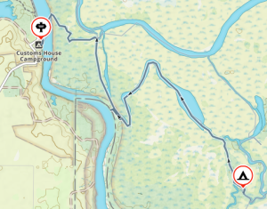
We had transport (kindly arranged by Matt) from Strathalbyn to Parnka Point at 7:30am on Sunday 31 Oct. The countryside on my early morning drive looked great and judging by the crops, appeared to have had good rainfall. I arrived to Strathalbyn just after 7.30am, and we were soon on our way via the scenic route and a ferry crossing at Wellington. Coorong Park Rangers Chris Hannocks and John Gitchem (thanks to our Meningie member, Julie Palmer for the suggestion) advised that the water levels were the highest they had ever seen. Didn’t take long to get everything transferred and we were soon on our way. Our confidence increased as we observed more water in Pink Lake as we approached Meningie, so hopefully Coorong levels would be good as well.
Day One: Sunday 31 October
Arrived at Parnka Point about 9.30am ready for our first challenge – would everything fit into the kayaks?! Maybe we were not travelling so light after all, good to have a bit of contingency! Yes Tresh, I took some chai tea along as well as a nice slab of home-made focaccia to go with the cheese, and Matt brought some Green Ginger wine.
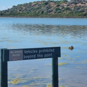
Looked a lovely day ahead of us, with only a hint of breeze, unfortunately from the north. Launching was easy, we set off about 10.30am just south of the Parnka Point Boat Ramp. Couldn’t resist getting a photo of the sign warning that cars were not to proceed any further. Yep, the Rangers were correct; plenty of water in the Coorong.

Shed in the Coorong
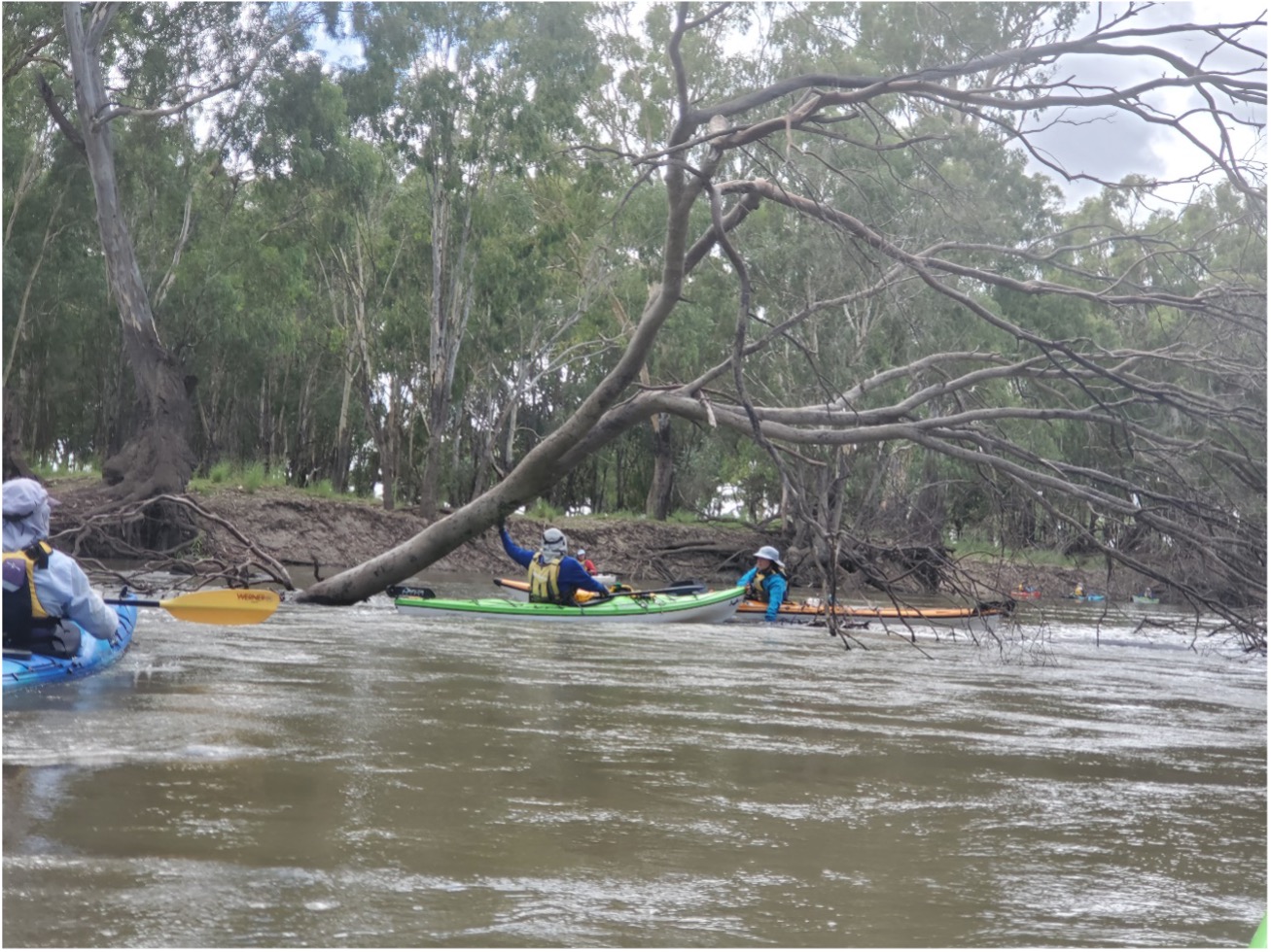
We spotted a couple of fishermen launching from the boat ramp, so Matt took the opportunity to ask about conditions. They were headed further south but confirmed we wouldn’t have a problem navigating The Needles. We paddled towards the Parnka Point Campground (discussing car camping opportunities on future trips) until we spotted what we thought was Needles Island. We had a perfect paddling day with a clear sky and calm water, great for paddling unknown waters with the channel clearly defined and easy to follow. There were sandbars, but easily spotted and avoided. The shallower water was covered in algae which did slow our progress somewhat and had to be occasionally cleared from paddles and kayak decks.
I kept having flashbacks from Mike and Tresh’s report, dreading having to drag our kayaks through the limestone reef around The Needles. We brought Matt’s Delta and my Prijon, so the last thing we wanted was a sharp limestone reef. The Kayak Gods must have been on our side as we paddled over the narrow channel with at least 0.5m of water. The Needles is well marked with a pole on the SW corner of Needles Island, and sections of the reef were clearly visible during our transit. We spotted several small birds foraging on the algae weed mat formed around the narrow channel. We became mesmerised by the scenery and calm conditions until the paddle blades encountered numerous limestone bommies.
The channel continued to be very pronounced and easily navigated, a stark contrast from Mike and Tresh’s experience. Aside from the waterbirds, we had the Coorong to ourselves, having left the one and only boat we encountered at the boat ramp. Wind was from NW around 5 to 6kn, so my sail remained stowed, however Matt managed to get some assistance at times after we cleared The Needles. The wind dropped mid-afternoon and changed to SSW from about 3pm, so we set the sails and sat back to enjoy the sand dunes rolling past. Only had about 5-6 kn from SSW but getting along at 6 to 7 km/hr. I said to Matt, with the sand dunes rolling by, it reminded me of a trip down the Nile River, just didn’t see any feluccas.
Around 1pm we spotted Camp Coorong, with several shacks visible from our mid channel position. Also passed a few well-established homesteads around the area. We had considered this as a start point, but after confirming water levels we opted for Parnka Point to check out the islands of North Lagoon – Rabbit Is, Snake Is and Needles Is. The scenery continued to improve, if this was at all possible as we paddled and sailed further north. The vegetation looked very healthy from the water, especially around some of the little bays we passed. Judging by the number of reedbeds, and bird populations these were freshwater soaks.
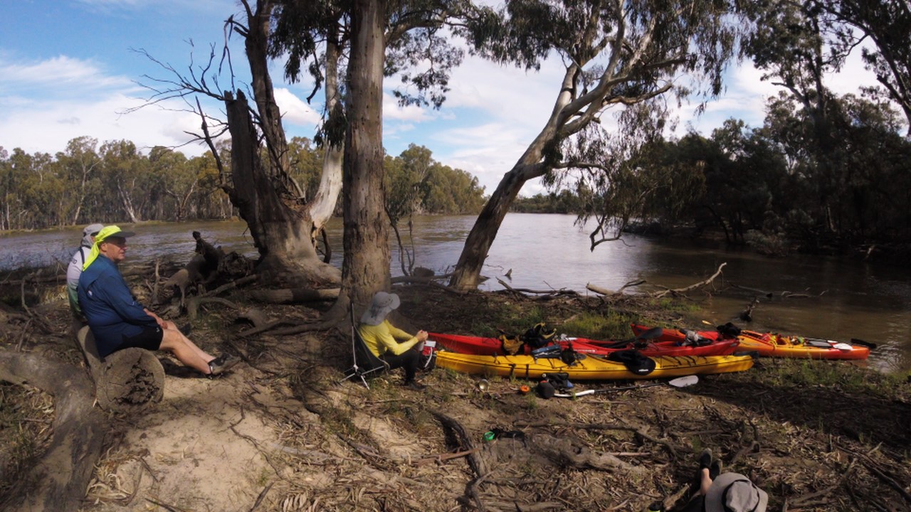
Setting camp
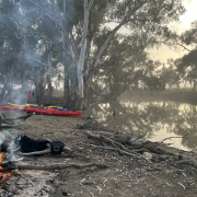
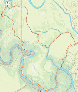
Our plan was to overnight opposite Long Point, which we reached around 5pm, so we selected a nice sandy beach and headed for shore. Not much room for tents so decided to continue north. Good decision as we would have had to share the beach with mozzies and an echidna that eagle eyed Matt spotted trying to escape our presence.
We were now north of Long Point and heading towards Nine Mile Point when we spotted what looked like a clearing behind a perfect beach, so in we went to explore! Discovered a perfect campsite area with plenty of room for several tents (noted for future trip!). Looking further we stumbled on a couple of old footings, signs of previous habitation, so continued exploring back into the clearing. We were blown away when we spotted an old shack nestled in the sand dune vegetation. Judging by the etching in the concrete footings (followed up with information from National Library), it was owned by George and Andy Ross, mulloway fishermen in the Coorong during the Great Depression years of the 1930’s. From a diary left in the shack it seems that it is gradually being restored by a group called the “Secret Shack Society”. Very important to retain these old buildings that depict early life on the Coorong.
The GPS showed that distance from Parnka Point was 37km, so not a bad day’s paddling with good assistance from our sails.
Still plenty of daylight so unpacked kayaks and set up camp, feeling very elated that we had discovered this little hideaway and a piece of SA history. Spent the evening talking about the highlights of the day and all the paddle options such as Car Camping at Parka Point or Long Point and exploring the section of the Coorong in more detail. Some of the dunes we passed were just stunning I will let the pictures speak for themselves. A very enjoyable evening, made even better with some cheese, focaccia bread, glass or two of red and some of Matt’s Green Ginger Wine. A very clear sky, so plenty of stars and satellites, much better than watching television.
Day Two: Monday 1 November
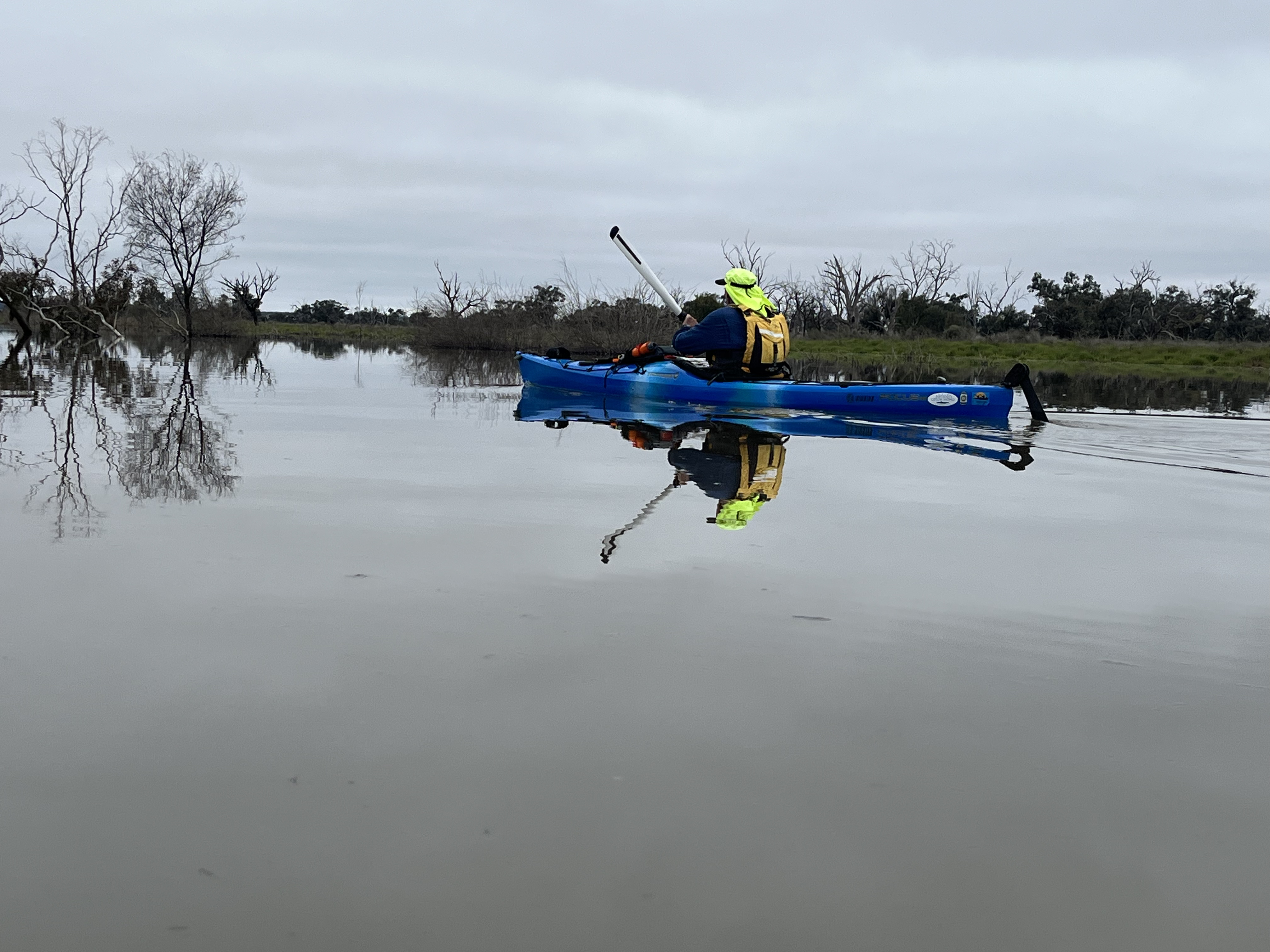
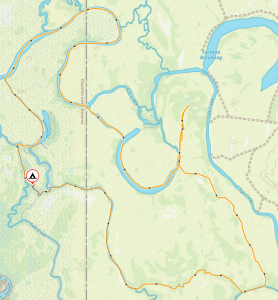
Woken up by sunrise just before 6am then got the day going with a nice cup of chai! No sign of wildlife around the campsite but plenty of fresh droppings around, so wallabies must have been grazing during the night. We did notice plenty of the small white snails glued to the tents and also on our PFDs. Also, Matt is now a bit more careful about putting his PFD on after discovering an interesting centipede who found a new home overnight. On the water about 9am, looking forward to another great day and wondering what we were going to see. The original plan was to make for Snake Pit, about 20km paddle, but opted for a shorter paddle to Lousy Jacks and enjoy the afternoon.

Coorong coast line
Managed to get some benefit from the sails with the 4 to 5kn NE winds – all good practice, especially with the Pacific Action sail. With the 28°C day and light breeze it was perfect for paddling the Coorong, the dunes were getting higher and more stunning as we approached Cattle Point. With the sails doing most of the work we were just mesmerised by the scenery – calm turquoise water, contrasted by green reeds from the freshwater soaks with a backdrop of golden sand dunes against the rich blue sky – wow! Landed at Cattle Point about 10.30am, while telling Matt about my last visit with Mike, Tresh and Peter McLeod – no 35kn winds this time. Just like last visit we were welcomed by a large flock of pelicans and smaller birds on the Point.
While Matt went climbing the dunes, I spent time recording this stunning location in a few photos and watching three fishermen on the point pulling in their nets, I assume for Coorong mullet. Unfortunately, they left before I had an opportunity to beg for dinner.
Matt returned after an interesting walk, all excited after discovering a large soak in between the dunes, dug down about 0.3m and found fresh water – good to remember if doing a solitary walk on the Coorong. Lousy Jacks was only around the point so back on water for leisurely paddle having a good close look at the shoreline around Cattle Point.
Soon had the tuart gums at Lousy Jacks in sight and made a beeline for the beach. We arrived before midday and just after fishermen had left – campfire was still warm and fish scales left around unfortunately. We selected our campsites either side of the tuart gums and set up camp. And then the mozzies arrived, not unexpected at Lousy Jacks, luckily we came prepared!
Setting camp
After getting settled, Matt decided on a walk across Younghusband Peninsula in search of cockles – about 1.6km across at this point. After making sure Matt had his phone, I settled into our lovely campsite enjoying the view while I read the “European Heritage of the Coorong” that Matt had brought along.
I breathed a sigh of relief when he returned safely. Looking very proud of himself with a small container with large Coorong cockles. I thought that was our dinner, but as we didn’t come prepared to cook cockles Matt tried to catch us a Coorong Mullet – we must have picked the wrong spot for fishing, although the pelicans seemed to be doing OK. Back to the dehydrated dinner again!
Another great evening under the stars and counting satellites, but turned in earlier on our second night as we knew the last day could be a challenging paddle, depending on the wind assistance.
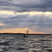
Up early, at least I was! Matt took a bit longer as he didn’t get much sleep. He was visited by a Bull Seal during the night calling out for a mate. He tried getting up shouting and shinning his torch but to no avail! Check out the pics, the seal can be seen near Matt’s kayak. As if that wasn’t enough, apparently, we also had a fishing boat shining spotlights looking for a spot to cook their midnight snack. I obviously slept well, didn’t hear a thing!
Day Three: Tuesday 2 November
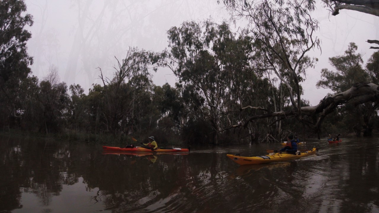
Back on water about 8.30am for our final day’s paddle to Goolwa, about 30km. Wind was forecast from NE to 18kn and again on our beam so would have to work hard with the sails. Needed to make the Barrage Lock by 4pm, so had a bit of flexibility depending on winds.
Real contrast on the water compared to last two days, overcast day, windier and gusty which made sailing a lot more challenging with the Pacific Action. Matt managed much better and I used the sail conservatively, not wanting to capsize.
Ended up getting more assistance from wind than expected, although we pretty well used the full width of the Coorong to get the best wind advantage. Bit of fun with the sandbars but no major problems.
We made good time and reached the Barrage Lock with 10 minutes to spare before it closed for lunch at 12.30pm, had to do a sprint on the final leg to get there! Short wait for a boat to come down from upstream, but wasn’t long before we cleared the Lock and made our way up towards Goolwa. Matt was on his phone arranging for his Dad to meet us at the Goolwa Wharf. It was about 1.30pm when we reached the small sandy beach just before the Wharf.
Over the three days we paddled 78km and managed to explore the northern lagoon of the Coorong in perfect days to see the Coorong at its best. Average speed was around 6km/hr with max run at 12km/hr. Not bad considering winds weren’t the most favourable. Hopefully with the Hume Dam currently being at capacity, we will have more water coming downstream with good opportunities for conducting a Salt Creek to Goolwa paddle in the new year.
Many thanks to Matt for keeping me company and organising the car shuttles, and particular thanks to Robert and Don for helping out. Enjoy the photos and keep an eye on the calendar for the next Coorong Trip.


")


 at ASC")