Posts

Wedge Island Kayaking Expedition – 23-25 January 2025

Day 0 – Arrival & Preparation

A number of participants travelled together to Pondalowie Bay, with several kayaks transported via the group trailer. Upon arrival at Pondalowie Campsite, the group set up for the night and held a detailed briefing to go over the trip logistics, safety measures, and anticipated conditions for the crossing. The excitement was high as discussions covered navigation, weather expectations, and contingency plans.

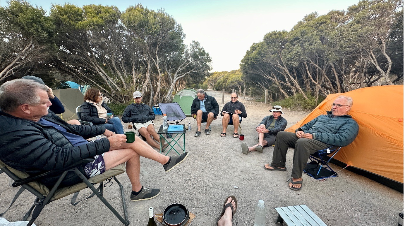
Group briefing & Pondalowie Bush Camp Site

However, the reminder that not all risks are water-based came early, as one participant had an unfortunate run-in with a large limestone rock in the dark. The resulting injury required a trip to Yorketown Hospital the next day, and further X-rays upon return to Adelaide confirmed a broken arm. Despite this setback, the group rallied and prepared for the adventure ahead.
A special thanks to Frances G. She acted as our emergency land contact, coordinating National Park vehicle access, and providing first aid support.

Day 1 – Departure & Island Exploration

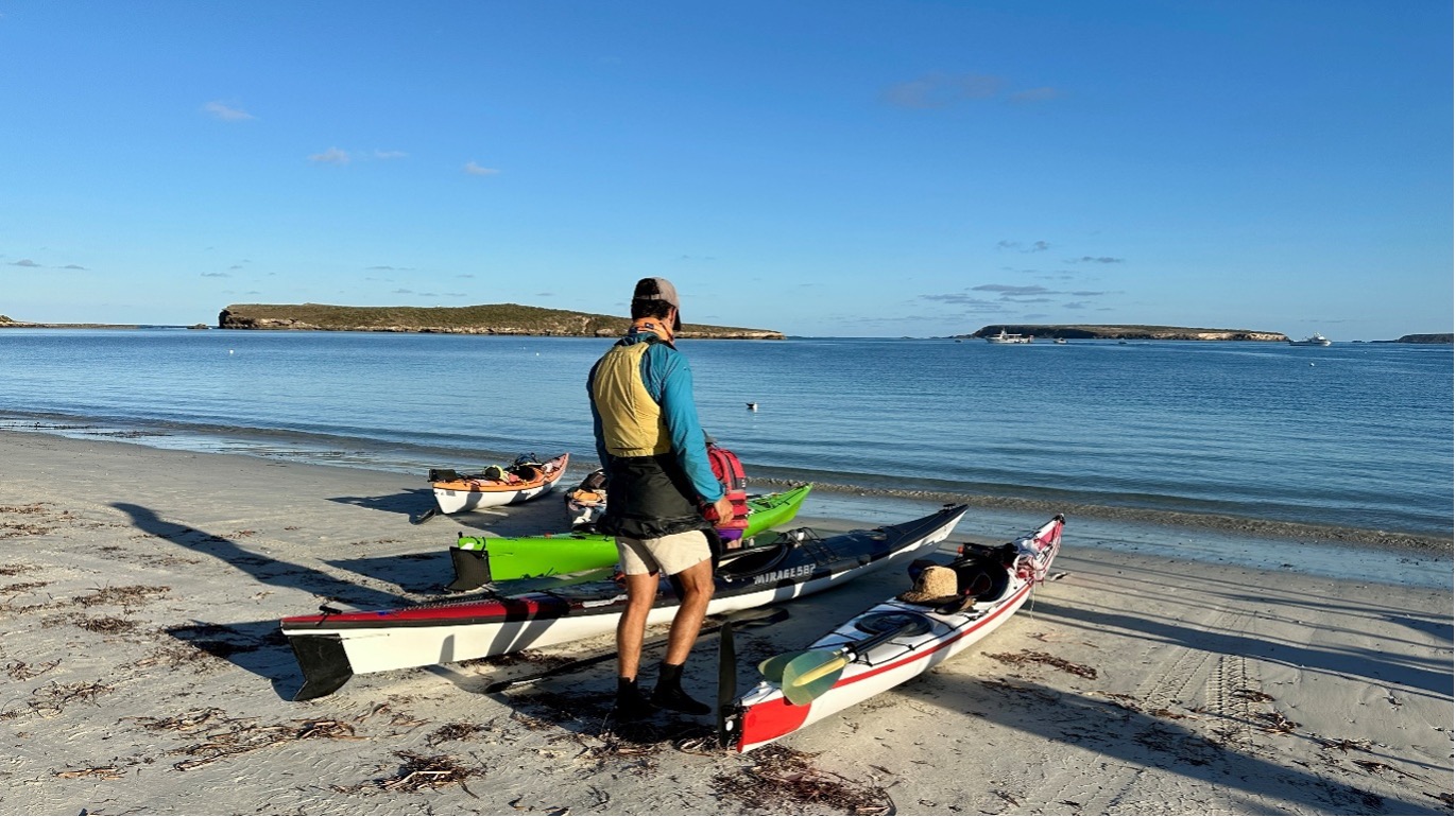
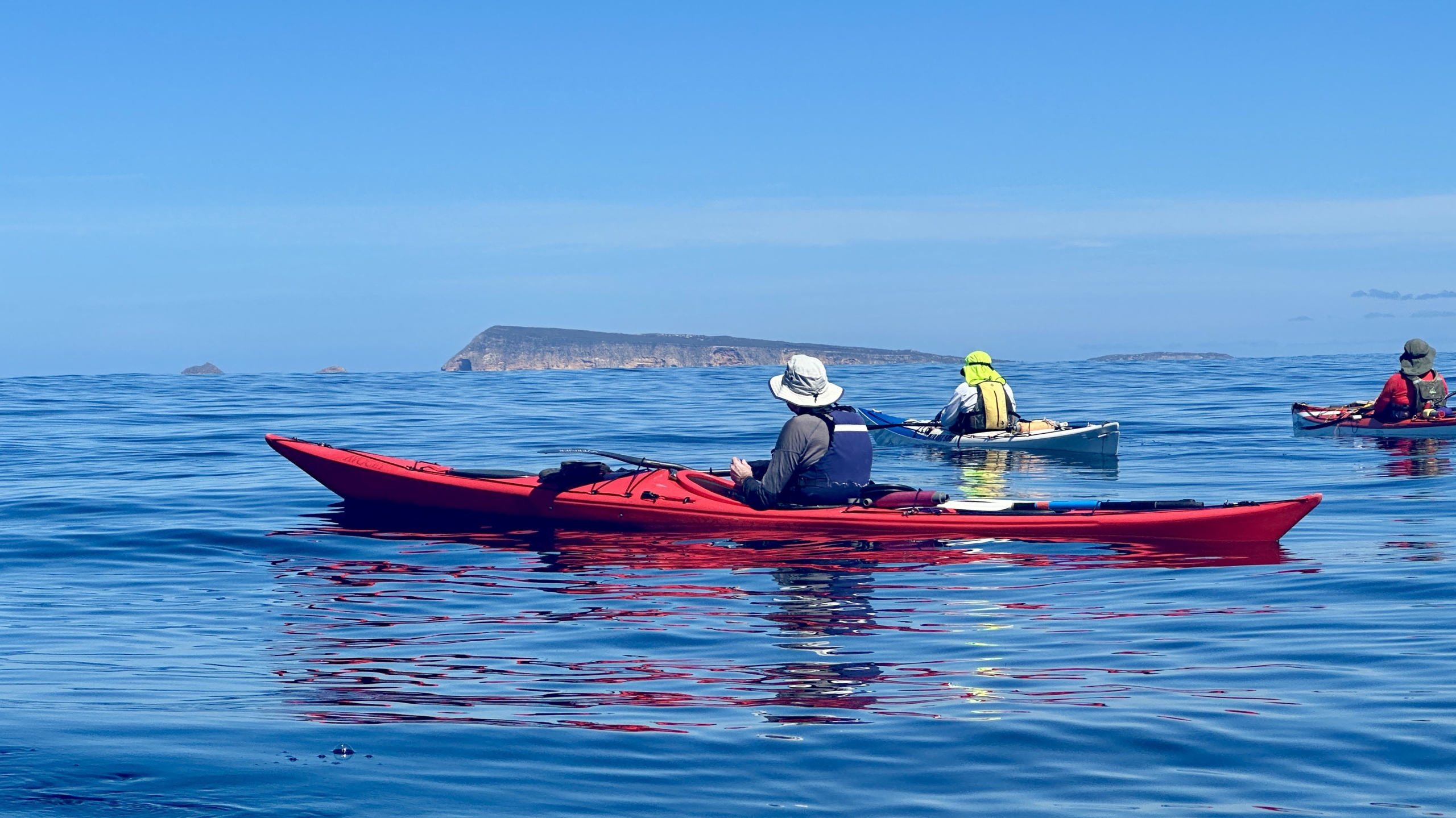
The group packed up early, drove to Pondalowie Beach for unloading, and conducted final launch discussions. With a slight outgoing tide and near-perfect conditions, the expedition set off smoothly.

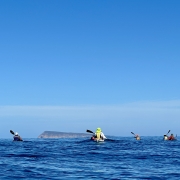
Although the wind made a few weak attempts at a sea breeze, it remained still throughout the day, creating an ideal paddling environment. On-water breaks provided opportunities to check GPS tracking, revealing some minor course deviations. About an hour from the planned route, the group opted to detour south towards the smaller islands at the southeast corner of Wedge Island.


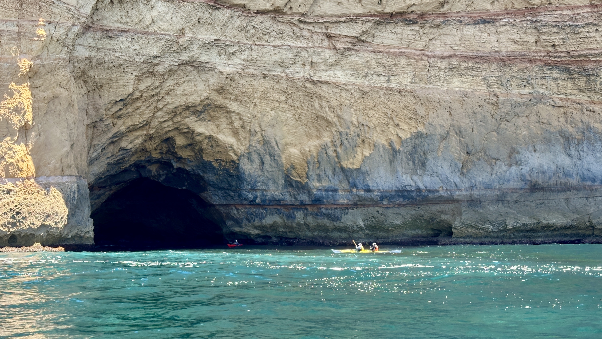
Upon approach, the awe-inspiring weathered cliff faces and cavernous sea caves immediately caught the attention of the paddlers. The underlying 1.2m swell created surges along the rock shelves, giving a dramatic effect to the crystal-clear deep waters below. Some members enthusiastically explored the caves, taking in the raw, untouched beauty of the island’s coastline.

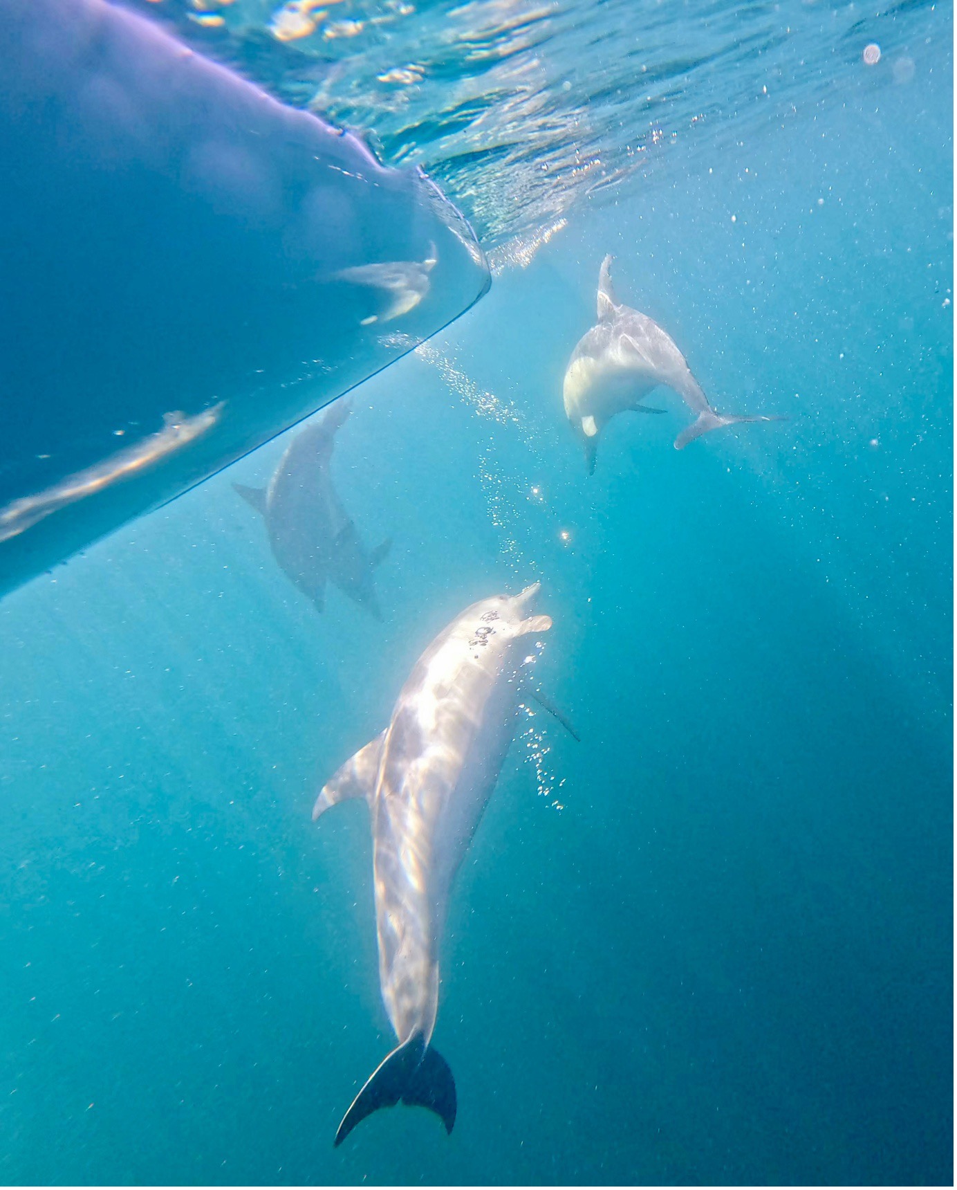
Wildlife sightings were plentiful. Pods of dolphins accompanied the group. A sea eagle soared overhead, and yellow-footed rock wallabies peered down curiously from the cliffs.
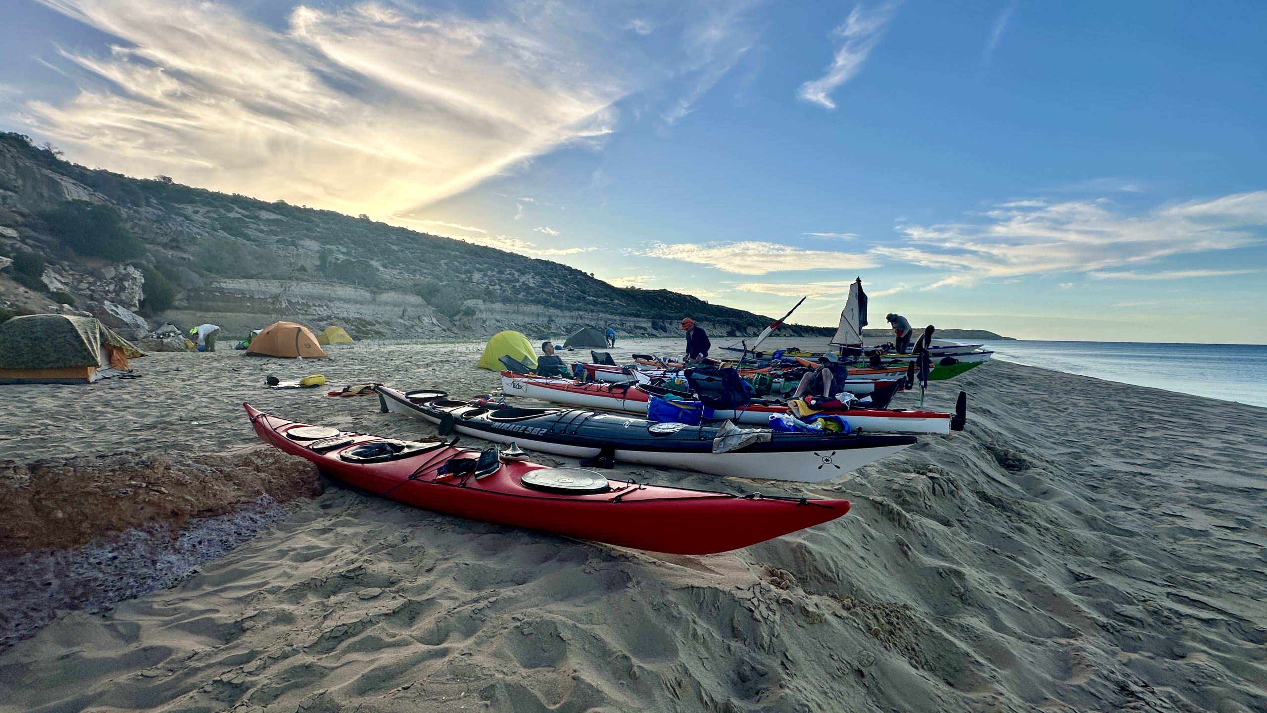
Continuing north along the coastline, the group landed inside the eastern headland on the main beach. As the afternoon heat set in, many took the opportunity to relax, chat, and even take a well-earned nap. Others explored the expansive beach on foot, soaking in the remote beauty of Wedge Island.


An unexpected sighting in the afternoon was a police helicopter and AMSA jet circling low over the eastern end of the island. Tuning into the VHF radio revealed that a small fishing boat had deployed an EPIRB. Authorities quickly confirmed that the crew was safe.
Limited mobile reception was discovered on a small rise behind the beach camp, allowing for a quick weather check and land contact update.


Day 2 – The Return Paddle

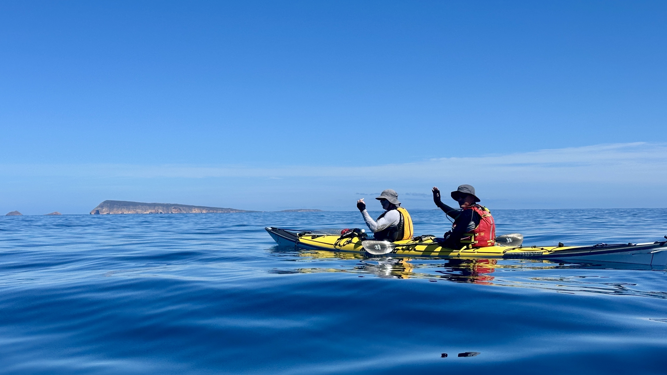
The forecast easterly breeze and small fetch arrived as expected in the morning. It created a shimmering reflection on the water as the sun rose behind the paddlers. For the first stretch of the crossing, Yorke Peninsula was not visible, requiring navigation by compass. The morning’s conditions were peaceful, with frequent visits from pods of dolphins, shearwaters, and storm petrels, providing incredible moments along the way.


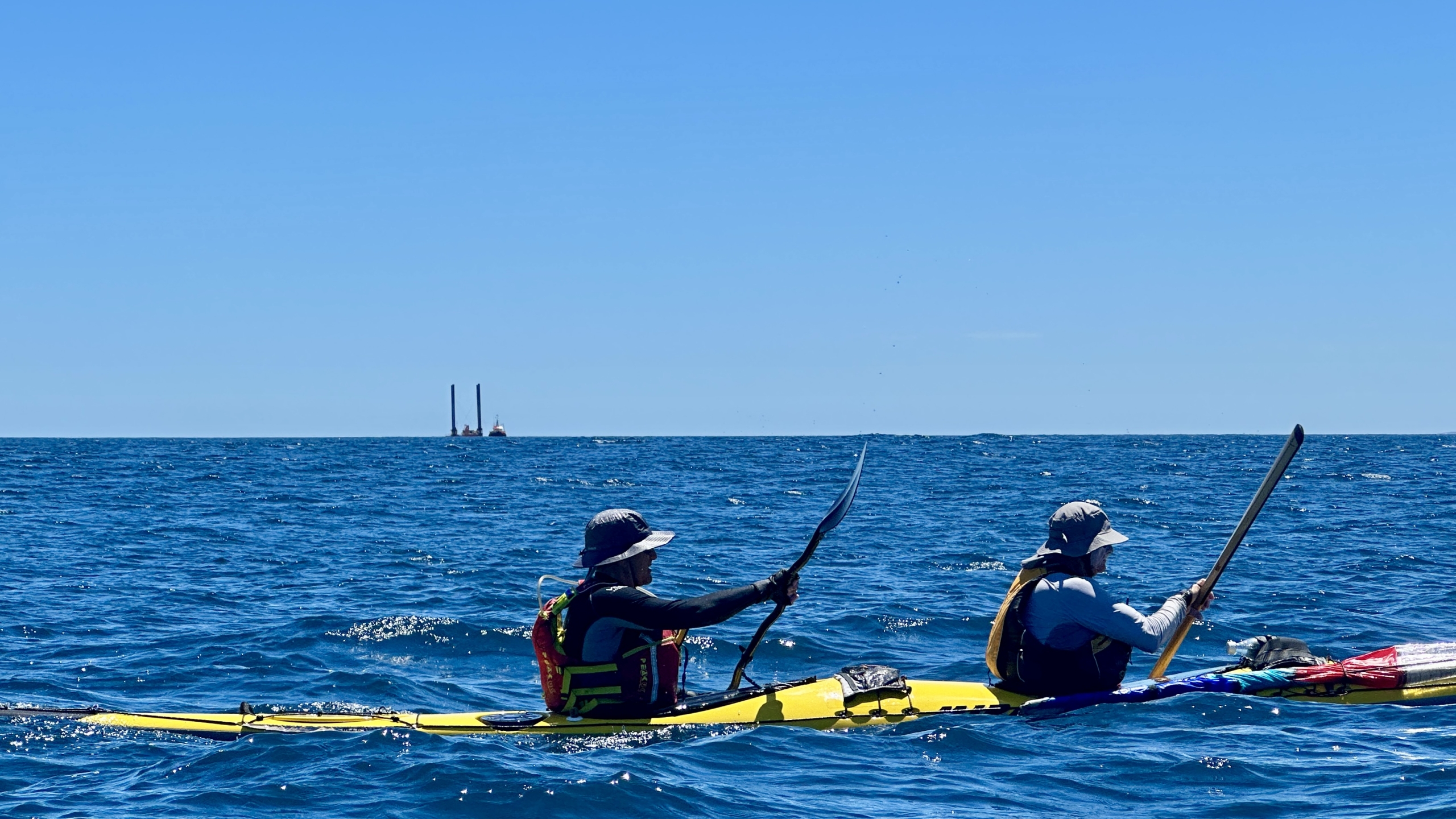
As the easterly winds eased, they gradually shifted southeast and freshened throughout the afternoon. Slowly, the coastline of Yorke Peninsula and the distinctive West Cape features emerged on the horizon. They offered fresh perspectives of the rugged landscape and nearby Althorpe Island. A unique sight on the return journey was a large industrial pylon rig being towed by a tugboat. From a distance, it was difficult to determine what it was, creating an unusual contrast against the open ocean backdrop.

After a solid and steady paddle, the group landed safely back at Pondalowie Boat Ramp, marking the successful completion of an unforgettable journey. Kayaks were loaded, and the team parted ways—some heading straight home, while others opted to extend their adventure.

Trip Highlights

  • Wildlife encounters: Multiple pods of dolphins, sealions, a sea eagle, yellow-footed rock wallabies, and three 1m tuna following one kayak, White-faced storm petrel, Shearwaters, Gannets.
  • Island exploration: The southeast cliffs and sea caves of Wedge Island provided breathtaking scenery and an adventurous detour.
  • Challenging but rewarding conditions: Navigation, distance, some tidal flows, self-sufficiency and weather made for a true expedition-style experience.
  • Unforgettable moments: From the glassy waters on the crossing to the spectacular cliffs.

The Wedge Island expedition proved to be a wonderful journey, combining adventure, endurance, and the raw beauty of South Australia’s remote coastline. A fantastic experience for all involved!

Karl Meyer

Overall statistics (Links point to GPX track files)

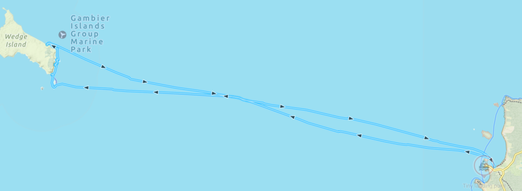
Pondalowie Bay – Wedge Island return: 70.9 Km


Innes National Park, November — 4th and 5th November 2023

I first visited Innes National Park-Dhilba Guuranda more that 40 years ago as a surfer, then scuba diver and now as a sea kayaker. Although the inland nature of the park is more manicured to pamper the modern camper the coastline is unchanged, wild, visually stunning, partly inaccessible from land and challenging to sea kayak. The rolling swells, ocean winds and currents are ever present factors to be considered in planning and when paddling.

As the weekend approached the weather and swell forecasts looked ideal for a sailing and sea kayaking adventure of great proportions. Winds up to 15 knots and low swell for this region. The plan was to camp at a favourite site called Shell Beach over Friday and Saturday nights and to paddle Saturday and Sunday.

Saturday

On Saturday morning all the group members had arrived at Shell Beach. Karl, Chris, Charlie and myself on Friday and Abelardo on Saturday.

Saturday’s paddle plan was to explore from Cable Bay around the very exposed Cape Spencer then northwards to Pondalowie Bay having a look at an amazing feature called The Gap and nearby Howling Cave Beach on the way. Given the forecast of ideal winds we decided that paddling all the way back to Shell Beach was also achievable. The total distance being a bit over 20 kilometres. Great plan.

On arrival at Cable Bay the wind was gusting over 20Knts from the south east and the promise of a sunny day was just that…a promise. It was heavily overcast and quite cold. Not deterred all paddlers were keen to give it a go and quickly prepared their craft and kit.

The launch was easy with no waves breaking on the beach. I had selected each launch and landing site carefully to minimise the chance of breaking waves.

Karl had paddled the day’s route several times and was elected to lead out through the small reefs and bombies. There was quite a bit of apprehension in the group calling for a cautious approach to this section and a tight group structure. A capsize could have occurred at any moment in the confused seas which reached their most challenging rounding Cape Spencer. The swell was coming from several directions and rebounding from the rocky shoreline. Charlie rated this section a BLACK ZONE on the new ACC rating system! We were all relieved to get around to the western side of the Cape and into less demanding conditions. It was a downwind run to The Gap and Howling Cave Beach but with the wind gusting over 20Knts it was decided not to hoist the sails just yet…we were travelling plenty fast enough!

The Gap

The Gap is an interesting coastal formation where erosion has carved a huge “amphitheatre” into the high cliff line. Begin in a more sheltered area we were able to explore inside the feature. Stunning high vertical sandstone/limestone cliffs all around!

Howling Cave Beach sounds like a place you just have to visit if you have an adventurous spirit. The small bay was very sheltered with only a tiny wave breaking on the beach, so we landed for an enjoyable lunch.

After lunch it was a fast paddle with sail up past Ethel Beach and West Cape to find another sheltered beach just inside West Cape to land and stretch the legs. From here we could look towards Pondalowie Heads and the numerous breakers between us and the next sheltered bay. We cautiously picked our way through these keeping an eye to seaward for “sneakers” at all times.

Crossing Pondalowie Bay to Royston Head was a real slog with side winds to 20Knt. It was such a relief to find a perfect and sheltered sandy beach on arrival. We landed for an extended rest and photo opportunity producing some awesome pics!

The final leg back to Shell Beach was something I had been dreading as it would be a slog straight into the wind. It turned out to be the best part of the day! The coast was littered with rock gardens covered with stunning growth. By staying in amongst the rocks we could avoid the wind and enjoy the challenge of manoeuvring through the gaps and riding the surging waves.

Upon reaching Shell Beach two big challenges awaited…getting the kayaks up the steep steps to the campground and retrieving the cars from the launch site. These were achieved with a minimum of fuss and a well-earned meal and wine finished off the day.

Sunday

Sunday morning brought sunshine but persistent strong ESE winds. We agreed that the original plan of another 20Km day was a bit optimistic and would not lead to a fun day’s paddling. With the winds further to the east there would also be no sailing. We opted to go search around Corny Point for some nice coastline to explore.

After another leisurely breakfast we headed to Berry Bay where a large number of school students were enjoying a surf lesson in the beautiful small waves and offshore winds. Quite ideal really apart from the steep and long set of stairs from the carpark to the beach. We’d done enough hoisting kayaks yesterday so needed another option. Karl had noticed and other beach with access on the way and went to check it out.

He arrived back with good news. Gravel Bay looked ideal with a 4WD track down to a sandy beach and no breakers. Our plan became to launch from Corny Point township, head west and downwind around Corny Point, south along Berry Bay to exit at Gravel Bay. All up about 9 Km which would lead to a reasonable landing time to begin the drive back to Adelaide. Perfect for how we were feeling.

Once at Corny Point township it was close enough to lunchtime to get some pies, sandwiches and iced coffee’s from the general store and then it was off to the beach boat ramp.

Launching

The beach launch was quite stunning with pure white sand, crystal blue sea and a huge sandbar that required some walking before paddling. Corny Point was one of the highlights (amongst many) for the trip.

Paddling down along spectacular Berry Bay with it’s pure white sands we encountered dolphins and seals. It wasn’t long before we had paddled and drifted down to Gravel Bay surrounded by rock gardens with plenty of growth clinging to the outcrops. This brought the end to paddling for the day. We piled into Chris’ minivan and back to the launch site to retrieve other vehicles, load up and began the trip back to Adelaide. A very satisfying weekend of adventurous sea kayaking and camping.

Report by Phil Doddridge, photos by Karl Meyer

Overall Statistics (Links point to GPX files)

Saturday 4/Nov Cable Bay – Shell Beach 24.5Km

Sunday 5/Nov Corny Point to Gravel Beach 9.77 Km